2020s Maps of L'Anse, L'Anse Township
Explore 2 historic maps of L'Anse from the 2020s. These maps offer a rare glimpse into what life looked like during the 2020s — showing old roads, neighborhoods, homes, and landmarks that have changed or disappeared over time.
Whether you're researching your family's past, planning a metal detecting trip, or studying how L'Anse's landscape evolved across the 2020s, these high-resolution maps are a powerful tool for exploring the history of this region.
- Focus on a specific era: All maps on this page are from the 2020s, giving you a focused view of this time period.
- See what’s changed: Compare century-old streets, trails, and buildings to today's modern landscape using overlays and satellite layers.
- Research with precision: Use these maps for genealogy, historical research, land use analysis, or educational projects.
- View, download, or print: Maps are fully viewable online in high resolution, and can be downloaded or printed for your own records.
Start exploring L'Anse's history through authentic maps from the 2020s. This is your window into the past.
L'Anse, L'Anse Township maps
(2)- 2023 Map of L'Anse, 2023 Print
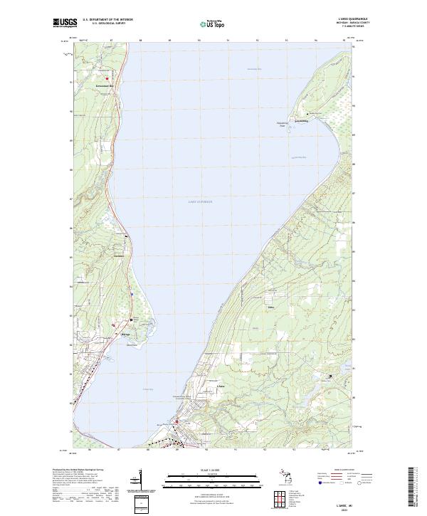 2023 L'Anse2023 Print · USGSThe shores of Baraga County come alive in this survey of the Keweenaw Bay area, capturing the modern layout of these historic Lake Superior settlements. Genealogists and local historians can locate several burial sites including Assinins Cem and Pinery Indian Cem, or trace the waterfront near Pequaming.
 - 2023 Map of Alberta, 2023 Print
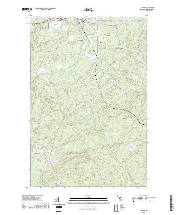 2023 Alberta2023 Print · USGSSettled along the south shore of L'Anse Bay, this area shows the rugged river systems and small settlements of the Upper Peninsula. Researchers can locate L'Anse Township Cem and trace the many cascades along the Falls River, including Power Dam Falls.
End of results
Showing maps 1-2 of 2
Top cities near L'Anse
Frequently asked questions
- What are the different types of historical maps available for L'Anse?
- What is the oldest map of L'Anse?
- Where can I purchase historical maps of L'Anse for my home or office?
- Where can I download high-res historical maps of L'Anse?
- Are there historical topographic maps available for L'Anse?
- Is there historical aerial imagery available for L'Anse?
- Where are historical maps of L'Anse sourced from?