Old Maps of L'Anse, L'Anse Township for Genealogy
Trace your family roots with 19 historic maps of L'Anse. These high-res maps reveal old neighborhoods, homesites, landmarks, and streets — helping you uncover where your ancestors lived and how the area evolved over time.
- Explore historic neighborhoods: Identify where your relatives may have lived in the 1800s or 1900s.
- Compare maps over time: Trace the changes in streets, buildings, and landmarks for multi-generational research.
- Perfect for genealogy & ancestry research: Used by family historians and researchers to map out lineage and migration.
These maps are an incredible resource for exploring your personal connection to L'Anse's past.
L'Anse, L'Anse Township maps
(19)- 1954 Map of Keweenaw Bay, 1956 Print
 1954 Keweenaw Bay1956 Print · USGSThe Keweenaw Peninsula in the mid-fifties shows a shoreline defined by maritime trade and timber history. Researchers can trace the rail lines of the Chicago and North Western and locate landmarks like Pequaming, the Aura Sch (Abandoned), and the Indian Cem.3 unique versions available
 - 1955 Map of Herman, 1956 Print
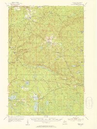 1955 Herman1956 Print · USGSUpper Peninsula timberlands and rail corridors are frozen in time here during the mid-1950s. Genealogists and historians can trace the remote settlement of Herman, locate the Herman Cem, and follow the Duluth South Shore and Atlantic railroad past Nestoria.3 unique versions available
 - 1958 Map of Iron River, 1968 Print
 1958 Iron River1968 Print · USGSThe Upper Peninsula in the late fifties is captured here as a landscape of timber, iron, and rail. Genealogists and historians can trace rail stops like Mass Station or explore the coastlines of Lake Gogebic and Keweenaw Bay.3 unique versions available
 - 1960 Map of Iron River
 1960 Iron River1960 Print · USGSThe Upper Peninsula’s western reaches are shown in the late fifties, featuring the industrial infrastructure of the Copper Country and the vast Ottawa National Forest. Researchers can trace the rail lines of the Milwaukee Road through settlements like Bruce Crossing and the White Pine Mine.
 - 1961 Map of Iron River
 1961 Iron River1961 Print · USGSThe Upper Peninsula and northern Wisconsin are shown here in the early 1960s, a landscape defined by the iron range and vast timberlands. Researchers can trace the legacy of mining and rail transport through Caspian, the Lac Du Flambeau Indian Reservation, and the Milwaukee Road.
 - 1967 Map of Iron River, 1968 Print
 1967 Iron River1968 Print · USGSThe Upper Peninsula and northern Wisconsin borderlands are shown here in the late sixties, a landscape of deep woods and iron-country rail lines. Genealogists and historians can trace the lakeside settlements of L'Anse and Ontonagon or follow the Soo Line through towns like Michigamme and Nestoria.
 - 1985 Map of L'Anse
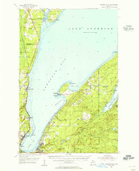
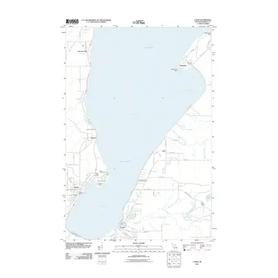
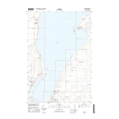
 1985 L'Anse1985 Print · USGSThe southern shores of Lake Superior's Keweenaw Bay come into focus in the mid-1980s, highlighting the industrial and tribal lands of Baraga County. Trace the development of L'Anse and Pequaming or find family landmarks like the Assinins mission and Zeba.
 - 1985 Map of Alberta, 1986 Print
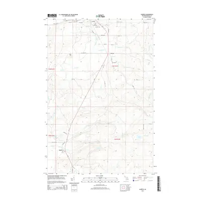
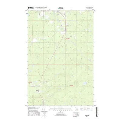
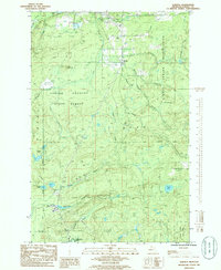 1985 Alberta1986 Print · USGSUpper Peninsula timberlands and waters dominate this mid-eighties survey of Baraga County. Researchers can trace local landmarks like the Alberta settlement, the L'Anse Indian Reservation boundary, and old transportation routes like the Old RR Grade.
 - 1991 Map of L'Anse
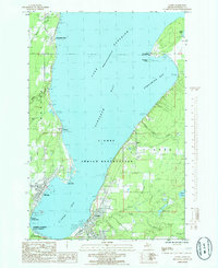
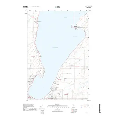
 1991 L'Anse1991 Print · USGSUpper Peninsula life in the early nineties centered on the waters of Keweenaw Bay and the timber-rich highlands of the Huron Mountains. Genealogists and researchers can trace the rail-and-road connections between L'Anse, Baraga, and smaller communities like Pequaming and Assinins.2 unique versions available
 - 2011 Map of Alberta, 2011 Print
 2011 Alberta2011 Print · USGSCovers L'Anse, including L'Anse Township, Baraga Township, and other nearby areas
 - 2011 Map of L'Anse, 2011 Print
 2011 L'Anse2011 Print · USGSCovers L'Anse, including Baraga, L'Anse Township, and other nearby areas
 - 2014 Map of L'Anse, 2014 Print
 2014 L'Anse2014 Print · USGSCovers L'Anse, including Baraga, L'Anse Township, and other nearby areas
 - 2014 Map of Alberta, 2014 Print
 2014 Alberta2014 Print · USGSCovers L'Anse, including L'Anse Township, Baraga Township, and other nearby areas
 - 2017 Map of L'Anse, 2017 Print
 2017 L'Anse2017 Print · USGSCovers L'Anse, including Baraga, L'Anse Township, and other nearby areas
 - 2017 Map of Alberta, 2017 Print
 2017 Alberta2017 Print · USGSCovers L'Anse, including L'Anse Township, Baraga Township, and other nearby areas
 - 2019 Map of Alberta, 2019 Print
 2019 Alberta2019 Print · USGSCovers L'Anse, including L'Anse Township, Baraga Township, and other nearby areas
 - 2019 Map of L'Anse, 2019 Print
 2019 L'Anse2019 Print · USGSCovers L'Anse, including Baraga, L'Anse Township, and other nearby areas
 - 2023 Map of L'Anse, 2023 Print
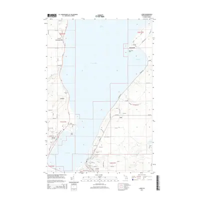
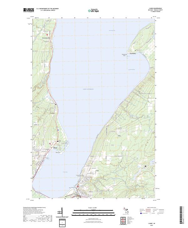 2023 L'Anse2023 Print · USGSThe shores of Baraga County come alive in this survey of the Keweenaw Bay area, capturing the modern layout of these historic Lake Superior settlements. Genealogists and local historians can locate several burial sites including Assinins Cem and Pinery Indian Cem, or trace the waterfront near Pequaming.
 - 2023 Map of Alberta, 2023 Print
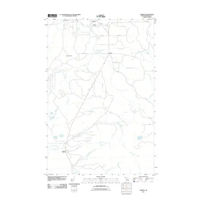
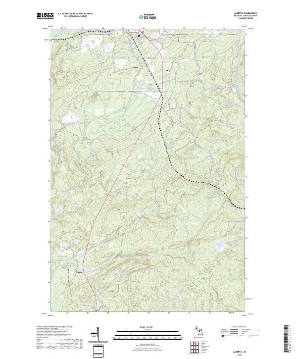 2023 Alberta2023 Print · USGSSettled along the south shore of L'Anse Bay, this area shows the rugged river systems and small settlements of the Upper Peninsula. Researchers can locate L'Anse Township Cem and trace the many cascades along the Falls River, including Power Dam Falls.
End of results
Showing maps 1-19 of 19
Top cities near L'Anse
Frequently asked questions
- What are the different types of historical maps available for L'Anse?
- What is the oldest map of L'Anse?
- Where can I purchase historical maps of L'Anse for my home or office?
- Where can I download high-res historical maps of L'Anse?
- Are there historical topographic maps available for L'Anse?
- Is there historical aerial imagery available for L'Anse?
- Where are historical maps of L'Anse sourced from?