2020s Maps of Barry County, Michigan
Explore 20 historic maps of Barry County from the 2020s. These maps offer a rare glimpse into what life looked like during the 2020s — showing old roads, neighborhoods, homes, and landmarks that have changed or disappeared over time.
Whether you're researching your family's past, planning a metal detecting trip, or studying how Barry County's landscape evolved across the 2020s, these high-resolution maps are a powerful tool for exploring the history of this region.
- Focus on a specific era: All maps on this page are from the 2020s, giving you a focused view of this time period.
- See what’s changed: Compare century-old streets, trails, and buildings to today's modern landscape using overlays and satellite layers.
- Research with precision: Use these maps for genealogy, historical research, land use analysis, or educational projects.
- View, download, or print: Maps are fully viewable online in high resolution, and can be downloaded or printed for your own records.
Start exploring Barry County's history through authentic maps from the 2020s. This is your window into the past.
Barry County, MI maps
(20)- 2023 Map of Cloverdale, 2023 Print
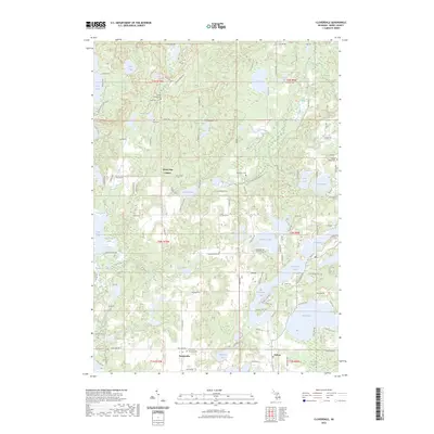 2023 Cloverdale2023 Print · USGSBarry County's lake country is captured here during the early twenty-first century, showing the enduring rural character of southern Michigan. Family historians can locate several burial grounds like McCallum Cem and Jesuit Cem or trace the CK&S Trl near Cloverdale Lake.
 - 2023 Map of Saubee Lake, 2023 Print
 2023 Saubee Lake2023 Print · USGSThe rural landscape between Woodland and Vermontville is shown here in the early twenty-first century, revealing a region defined by its glacial lakes and family-run farmsteads. Researchers can locate historic burial sites like Hosmer Cem and Patterson Cem among the wetlands of Saubee Lake.
 - 2023 Map of Bedford, 2023 Print
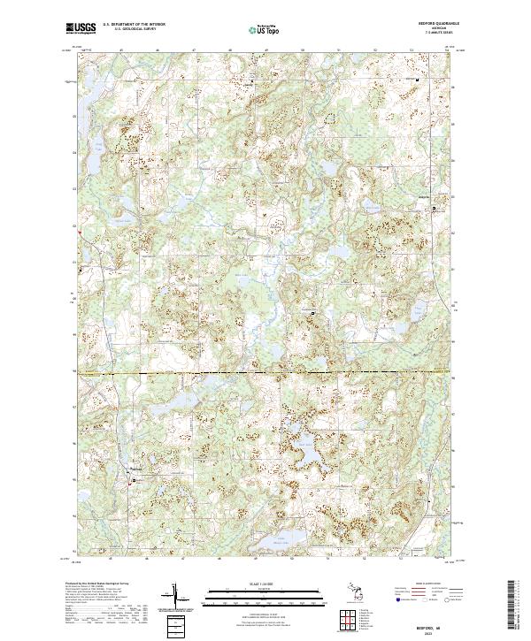 2023 Bedford2023 Print · USGSBarry and Calhoun Counties at the turn of the decade show a landscape of small rural settlements and glacial lakes. Family historians can trace local roots at Checkered Cem, Assyria Cem, and the waterside community of Bedford.
 - 2023 Map of Woodbury, 2023 Print
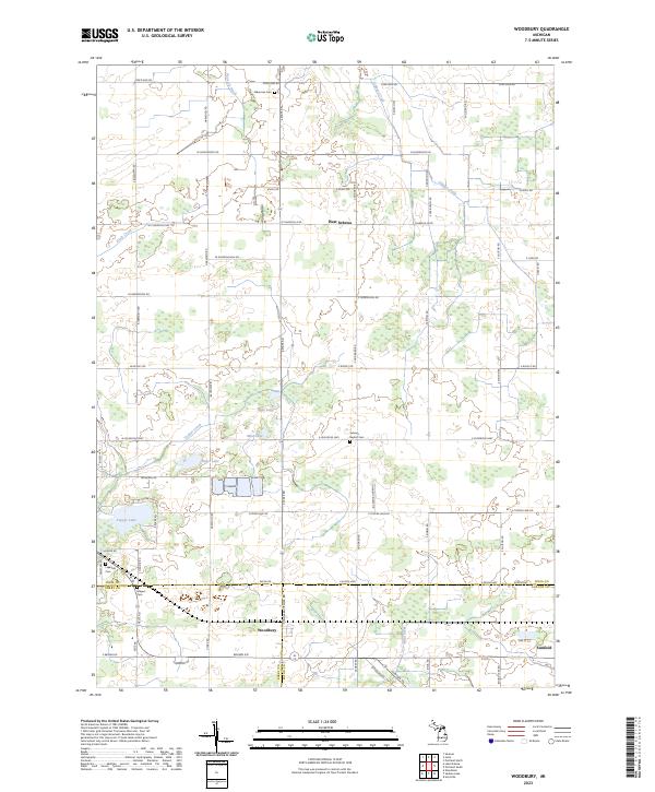 2023 Woodbury2023 Print · USGSThe rural borders of Ionia, Barry, and Eaton counties come into focus during this modern era of Michigan agriculture. Genealogists and local historians can trace family ties through the Sebewa Baptist Cem or explore the wetlands surrounding Tupper Lake and Woodbury.
 - 2023 Map of Lake Odessa, 2023 Print
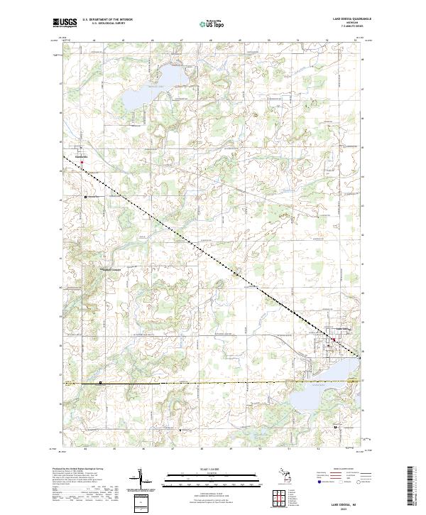 2023 Lake Odessa2023 Print · USGSIonia and Barry Counties meet in this modern survey of the agricultural and lakeside communities west of Lansing. Genealogists can locate family-named burial grounds like Dunkard Cem and Mauch Cem or trace the shoreline developments of Jordan Lake.
 - 2023 Map of Middleville, 2023 Print
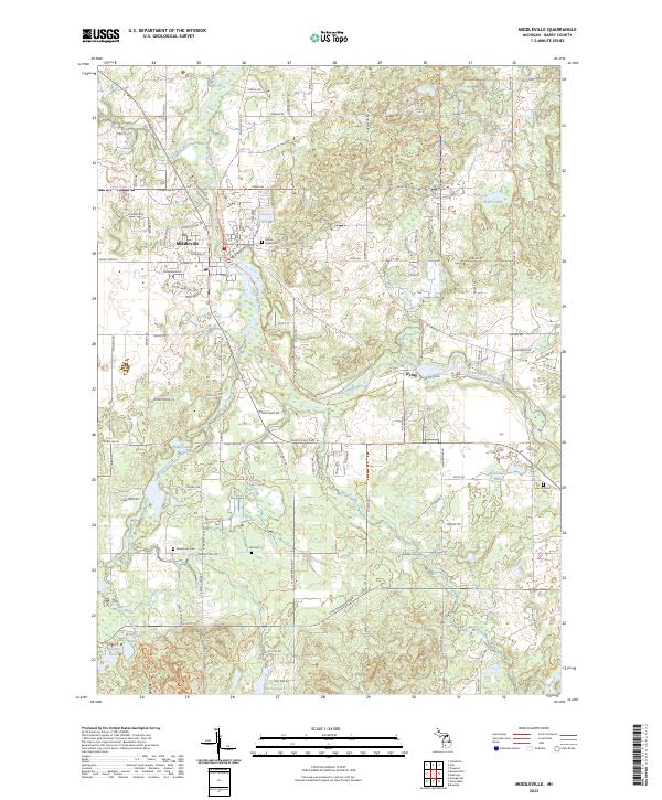 2023 Middleville2023 Print · USGSMiddleville and the surrounding Barry County countryside appear here in the early 2020s, centered on the winding Thornapple River. Genealogists can locate several local burial sites like Bowerman Cem and Rutland Cem or trace family land near the village of Irving.
 - 2023 Map of Hastings, 2023 Print
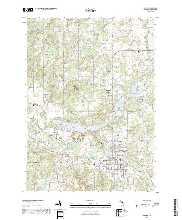 2023 Hastings2023 Print · USGSHastings and the surrounding Barry County landscape are shown in contemporary detail as the community continues to grow around the Thornapple River. Researchers can locate ancestral sites at Riverside Cem or Mount Calvary Cem and trace rural landmarks like Welcome Corner.
 - 2023 Map of Bellevue, 2023 Print
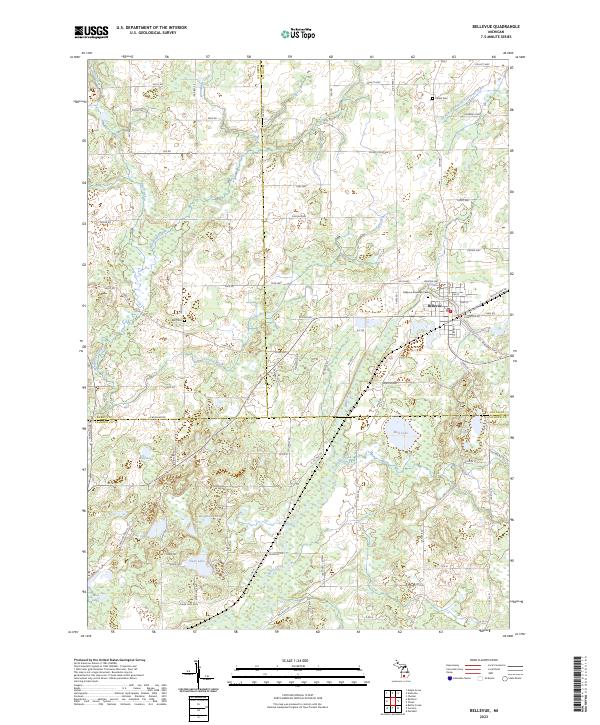 2023 Bellevue2023 Print · USGSSouthern Michigan farmland and lakeside communities are documented here during the early twenty-first century. Genealogists can trace family histories through sites like Bellevue Riverside Cem, Bell Cem, and the various homesteads scattered near Wolf Lake and Clear Lake.
 - 2023 Map of Woodland, 2023 Print
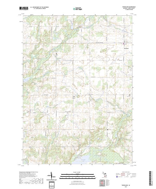 2023 Woodland2023 Print · USGSThe village of Woodland and the community of Coats Grove are the focal points of this Barry County landscape in the 2020s. Researchers can trace land tracts near the Farm Service Agency Interest of Michigan or locate family sites at Fuller Family Cem and Warner Cem.
 - 2023 Map of Caledonia, 2023 Print
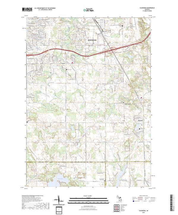 2023 Caledonia2023 Print · USGSThe southern suburbs of Grand Rapids and the surrounding townships are captured here in a moment of modern growth and historical preservation. Trace family lineages through several local burial grounds like Holy Corners Cem and Dutton Cem, or locate landmarks such as Davenport University and Emmons Lake.
 - 2023 Map of Banfield, 2023 Print
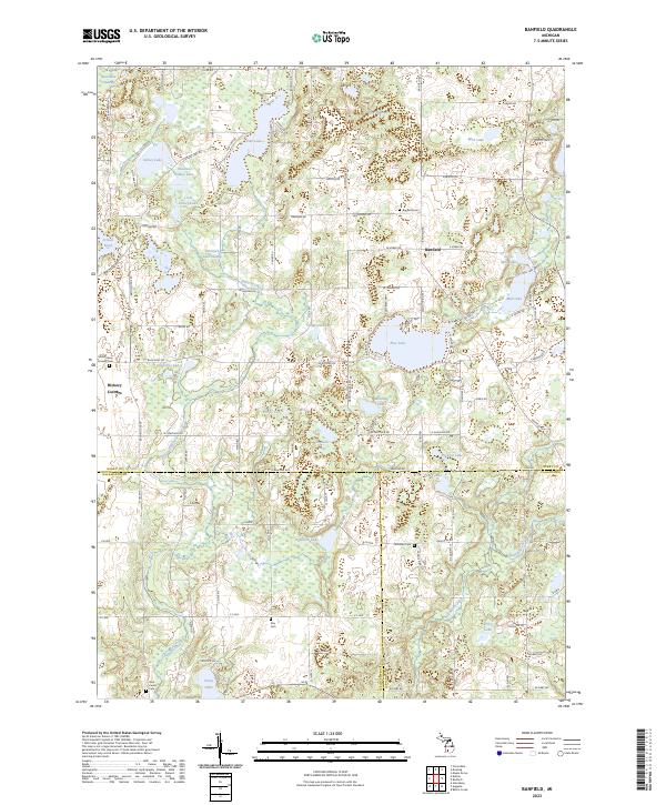 2023 Banfield2023 Print · USGSThe tri-county borderlands of Barry, Kalamazoo, and Calhoun counties are meticulously documented here in the early 2020s. Researchers can locate numerous family burial grounds including Day Cem and Hamilton Cem or trace the winding course of Augusta Creek through the swampy lowlands.
 - 2023 Map of Maple Grove, 2023 Print
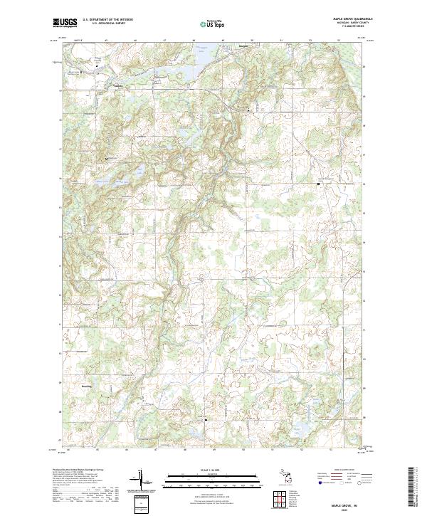 2023 Maple Grove2023 Print · USGSThe rural crossroads and glacial lakes of central Michigan are captured here in the early twenty-first century. Researchers can trace family history at the Barryville Cem and Union Cem or explore the banks of the Thornapple River.
 - 2023 Map of Alto, 2023 Print
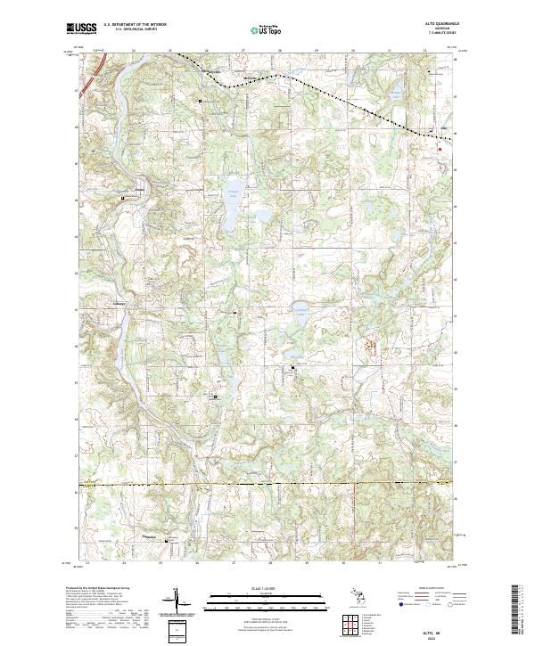 2023 Alto2023 Print · USGSSoutheast of Grand Rapids in the 2020s, this area showcases the enduring rural character of Kent County's lake-strewn landscape. Genealogists and local researchers can trace family roots through Whitneyville Cem, Saint Patrick's Cem, and the small community of Alaska along the Thornapple River.
 - 2023 Map of Freeport, 2023 Print
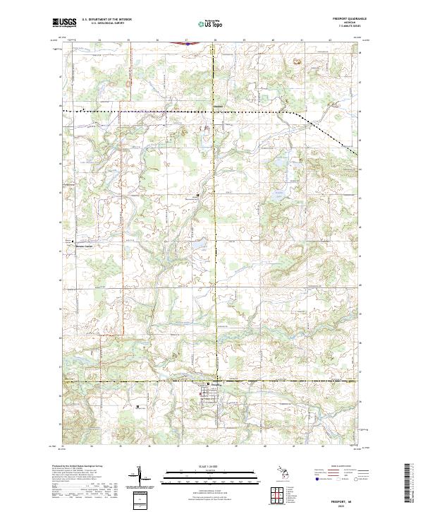 2023 Freeport2023 Print · USGSCrossing the borders of Kent, Ionia, and Barry counties in the early 2020s, this area maintains its deep agricultural and river-centered character. Local historians can trace family ties at the Freeport Cem or follow the North Country National Scenic Trl past landmarks like Lake Number Ten and the Coldwater River.
 - 2023 Map of Bowens Mill, 2023 Print
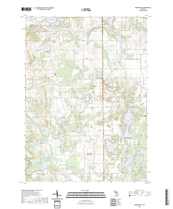 2023 Bowens Mill2023 Print · USGSAllegan and Barry counties at the dawn of the 2020s reveal a landscape of deep-rooted rural settlements and extensive lake systems. Researchers can trace family history through local landmarks like Bowens Mill, Saints Cyril and Methodius Catholic Cem, and Hooker Cem.
 - 2023 Map of Delton, 2023 Print
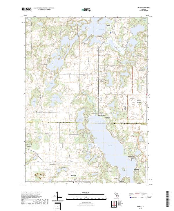 2023 Delton2023 Print · USGSGull Lake and the glacial terrain of southern Michigan are captured here in the early twenty-first century. Researchers can trace family history through local burial sites like North Hickory Cem and Yorkville Cem or locate the village of Delton.
 - 2023 Map of Kalamazoo NE, 2023 Print
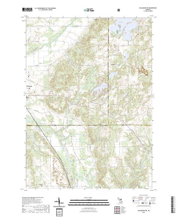 2023 Kalamazoo NE2023 Print · USGSNear the intersection of three counties in the early twenty-first century, this area shows a landscape shaped by river valleys and glacial lakes. Genealogists and local historians can locate Hillside Cem and Ives Cem or trace the early paths of Plainwell and Doster.
 - 2023 Map of Dowling, 2023 Print
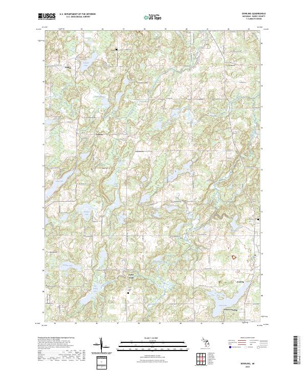 2023 Dowling2023 Print · USGSBarry County’s lake country is captured in this contemporary survey of the settlements and glacial waters of south-central Michigan. Researchers can locate family sites and old townships near Dowling, Cedar Creek Cem, and Podunk.
 - 2023 Map of Nashville, 2023 Print
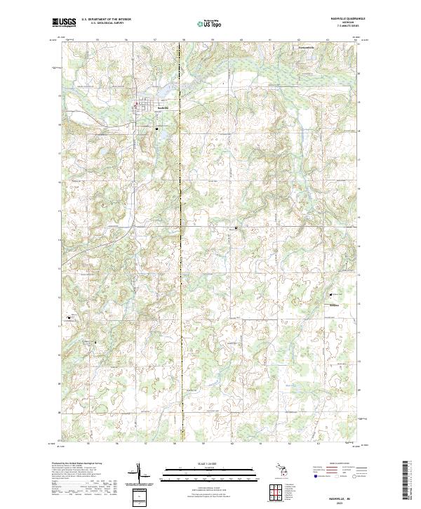 2023 Nashville2023 Print · USGSThe rural border of Barry and Eaton counties is captured here in the early 2020s, centered on the historic village of Nashville. Local researchers can locate numerous burial sites like Quaker Cem and trace the paths of Thornapple River and Wanadoga Creek.
 - 2023 Map of Orangeville, 2023 Print
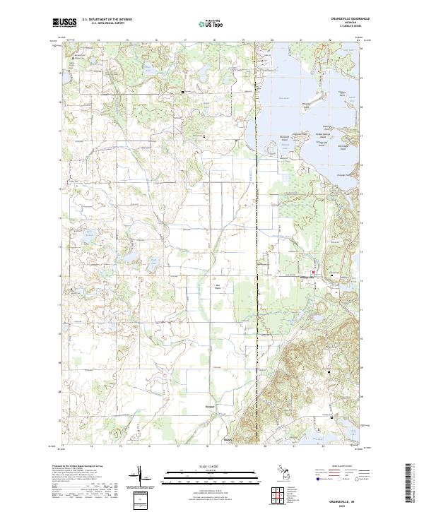 2023 Orangeville2023 Print · USGSOrangeville and the Gun River valley are shown in contemporary detail along the Allegan and Barry county line. Genealogists can locate numerous family burial sites like Selkirk Family Cem and the Bradley Indian Mission Cem.
End of results
Showing maps 1-20 of 20
Top cities of Barry County
Frequently asked questions
- What are the different types of historical maps available for Barry County?
- What is the oldest map of Barry County?
- Where can I purchase historical maps of Barry County for my home or office?
- Where can I download high-res historical maps of Barry County?
- Are there historical topographic maps available for Barry County?
- Is there historical aerial imagery available for Barry County?
- Where are historical maps of Barry County sourced from?