2020s Maps of Berrien Township, Michigan
Explore 2 historic maps of Berrien Township from the 2020s. These maps offer a rare glimpse into what life looked like during the 2020s — showing old roads, neighborhoods, homes, and landmarks that have changed or disappeared over time.
Whether you're researching your family's past, planning a metal detecting trip, or studying how Berrien Township's landscape evolved across the 2020s, these high-resolution maps are a powerful tool for exploring the history of this region.
- Focus on a specific era: All maps on this page are from the 2020s, giving you a focused view of this time period.
- See what’s changed: Compare century-old streets, trails, and buildings to today's modern landscape using overlays and satellite layers.
- Research with precision: Use these maps for genealogy, historical research, land use analysis, or educational projects.
- View, download, or print: Maps are fully viewable online in high resolution, and can be downloaded or printed for your own records.
Start exploring Berrien Township's history through authentic maps from the 2020s. This is your window into the past.
Berrien Township, MI maps
(2)- 2023 Map of Sumnerville, 2023 Print
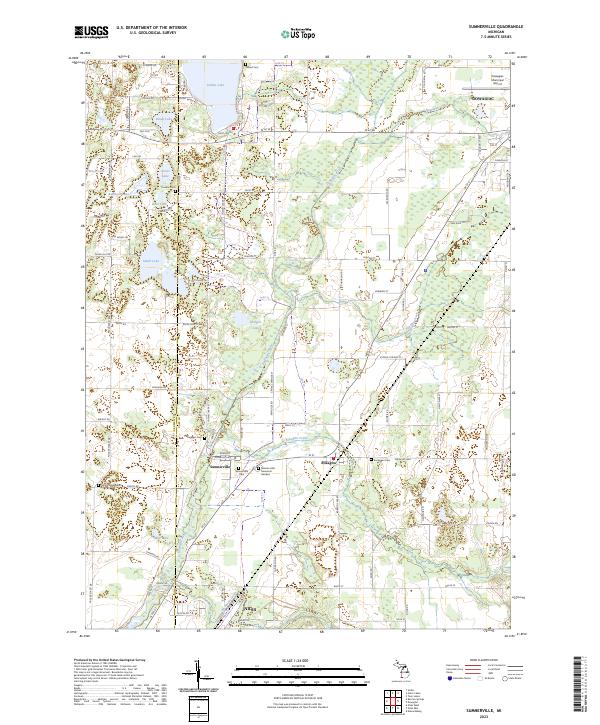 2023 Sumnerville2023 Print · USGSSouthwestern Michigan's rural landscapes between the Dowagiac and Niles area are captured here in the early twenty-first century. Researchers can trace family history at Mission Hills Memorial Gardens or explore the settlements of Sumnerville and Pokagon.
 - 2023 Map of Berrien Springs, 2023 Print
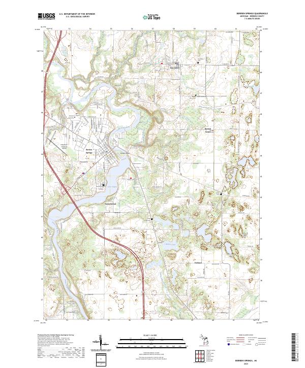 2023 Berrien Springs2023 Print · USGSThe Saint Joseph River valley in modern-day Berrien County shows a landscape defined by collegiate growth and rural crossroads. Researchers can trace family history through numerous sites like Rose Hill Cem, Union Cem, and the campus of Andrews University.
End of results
Showing maps 1-2 of 2
Top cities near Berrien Township
- South Bend historical maps
- Mishawaka historical maps
- Granger historical maps
- Niles historical maps
- Benton Harbor historical maps
- Saint Joseph historical maps
See more
Top neighborhoods of Berrien Township
Frequently asked questions
- What are the different types of historical maps available for Berrien Township?
- What is the oldest map of Berrien Township?
- Where can I purchase historical maps of Berrien Township for my home or office?
- Where can I download high-res historical maps of Berrien Township?
- Are there historical topographic maps available for Berrien Township?
- Is there historical aerial imagery available for Berrien Township?
- Where are historical maps of Berrien Township sourced from?