2020s Maps of Gilead Township, Michigan
Explore 2 historic maps of Gilead Township from the 2020s. These maps offer a rare glimpse into what life looked like during the 2020s — showing old roads, neighborhoods, homes, and landmarks that have changed or disappeared over time.
Whether you're researching your family's past, planning a metal detecting trip, or studying how Gilead Township's landscape evolved across the 2020s, these high-resolution maps are a powerful tool for exploring the history of this region.
- Focus on a specific era: All maps on this page are from the 2020s, giving you a focused view of this time period.
- See what’s changed: Compare century-old streets, trails, and buildings to today's modern landscape using overlays and satellite layers.
- Research with precision: Use these maps for genealogy, historical research, land use analysis, or educational projects.
- View, download, or print: Maps are fully viewable online in high resolution, and can be downloaded or printed for your own records.
Start exploring Gilead Township's history through authentic maps from the 2020s. This is your window into the past.
Gilead Township, MI maps
(2)- 2023 Map of Bronson South, 2023 Print
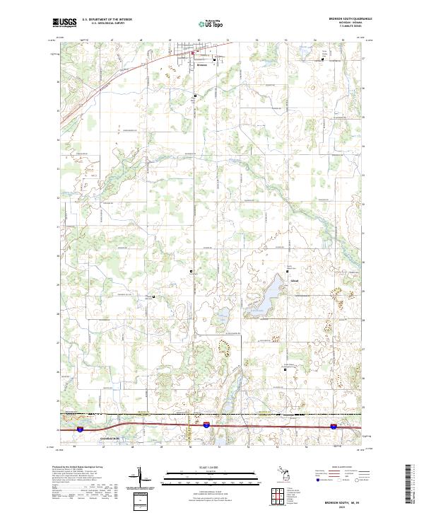 2023 Bronson South2023 Print · USGSBranch County, Michigan, meets the Indiana border in this modern survey of rural townships and glacial lakes. Family historians can locate numerous burial grounds including Snow Prairie Cem and South Gilead Hoopingarner Cem near the waters of Gilead Lake.
 - 2023 Map of Kinderhook, 2023 Print
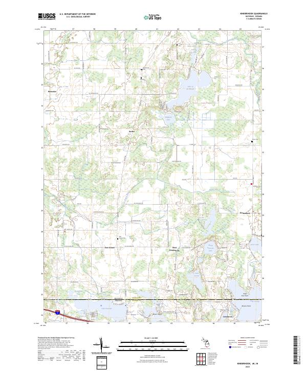 2023 Kinderhook2023 Print · USGSThe Michigan and Indiana borderlands are captured here in the early 2020s, showing a landscape defined by glacial lakes and rural townships. Genealogists can locate family burial sites at East Gilead Cem and Ammerman Cem or trace the settlements of Bethel and West Kinderhook.
End of results
Showing maps 1-2 of 2
Top cities near Gilead Township
- Coldwater historical maps
- Angola historical maps
- Jamestown historical maps
- Bronson historical maps
- Fremont historical maps
- Quincy historical maps
See more
Top neighborhoods of Gilead Township
Frequently asked questions
- What are the different types of historical maps available for Gilead Township?
- What is the oldest map of Gilead Township?
- Where can I purchase historical maps of Gilead Township for my home or office?
- Where can I download high-res historical maps of Gilead Township?
- Are there historical topographic maps available for Gilead Township?
- Is there historical aerial imagery available for Gilead Township?
- Where are historical maps of Gilead Township sourced from?