Old Maps of Branch County, Michigan
Explore 35 old maps of Branch County, spanning from 1918 to today. These high-resolution historic maps reveal how streets, neighborhoods, landmarks, and natural features evolved over time — perfect for genealogy, metal detecting, research, and local history exploration.
What you can do with these maps:
- See how Branch County changed over time: Compare historical maps to modern-day views to trace roads, homesites, rail lines & more.
- View detailed metadata: Each map includes creators, publishers, year, scale, and archive source.
- Overlay maps with satellite & LiDAR: Visualize the past alongside modern tools to explore terrain & human change.
- Trusted historical sources: Maps sourced from the USGS, Library of Congress, and other archives.
- Access maps your way: View online, download high-res files, or order prints for personal or research use.
Start exploring old maps of Branch County to uncover forgotten places, hidden landmarks, and the deep history beneath your feet.
Branch County, MI maps
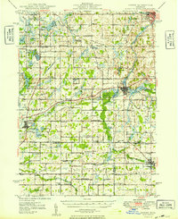
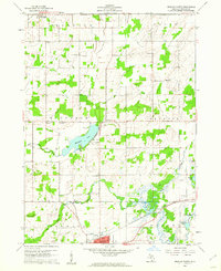
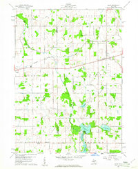
(35)- 1918 Map of Union City
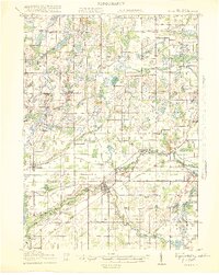 1918 Union City1918 Print · USGSCovers Branch County, including Battle Creek, Girard, and other nearby areas3 unique versions available
 - 1918 Map of Leonidas
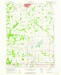
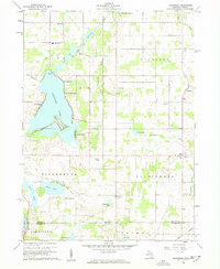
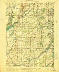 1918 Leonidas1918 Print · USGSCovers Branch County, including Battle Creek, Pavilion, and other nearby areas4 unique versions available
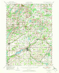
 - 1944 Map of Leonidas
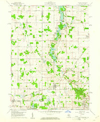
 1944 Leonidas1944 Print · USGSCovers Branch County, including Battle Creek, Pavilion, and other nearby areas
 - 1947 Map of Union City, 1972 Print
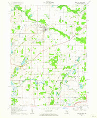
 1947 Union City1972 Print · USGSCovers Branch County, including Battle Creek, Girard, and other nearby areas2 unique versions available
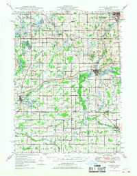
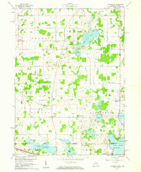
 - 1947 Map of Leonidas, 1976 Print
 1947 Leonidas1976 Print · USGSCovers Branch County, including Battle Creek, Pavilion, and other nearby areas
 - 1948 Map of Homer, 1968 Print
 1948 Homer1968 Print · USGSCovers Branch County, including Albion, Marshall, and other nearby areas2 unique versions available
 - 1949 Map of Homer
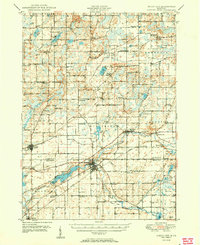
 1949 Homer1949 Print · USGSCovers Branch County, including Albion, Marshall, and other nearby areas2 unique versions available
 - 1950 Map of Leonidas
 1950 Leonidas1950 Print · USGSCovers Branch County, including Battle Creek, Pavilion, and other nearby areas2 unique versions available
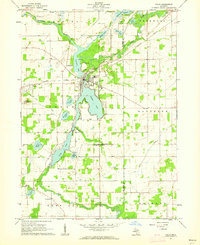
 - 1950 Map of Union City
 1950 Union City1950 Print · USGSCovers Branch County, including Battle Creek, Girard, and other nearby areas2 unique versions available
 - 1953 Map of Fort Wayne, 1963 Print
 1953 Fort Wayne1963 Print · USGSCovers Branch County, including Fort Wayne, Elkhart, and other nearby areas4 unique versions available
 - 1956 Map of Fort Wayne
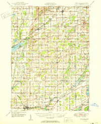
 1956 Fort Wayne1956 Print · USGSCovers Branch County, including Fort Wayne, Elkhart, and other nearby areas2 unique versions available
 - 1958 Map of Grand Rapids, 1973 Print
 1958 Grand Rapids1973 Print · USGSCovers Branch County, including Grand Rapids, Lansing, and other nearby areas2 unique versions available
 - 1960 Map of Coldwater West, 1961 Print
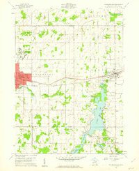
 1960 Coldwater West1961 Print · USGSCovers Branch County, including Coldwater, Batavia, and other nearby areas2 unique versions available
 - 1960 Map of Coldwater East, 1961 Print
 1960 Coldwater East1961 Print · USGSCovers Branch County, including Coldwater, Quincy, and other nearby areas2 unique versions available
 - 1960 Map of Bronson North, 1961 Print
 1960 Bronson North1961 Print · USGSCovers Branch County, including Bronson, Matteson, and other nearby areas
 - 1960 Map of Bronson South, 1961 Print
 1960 Bronson South1961 Print · USGSCovers Branch County, including Bronson, Gilead, and other nearby areas2 unique versions available
 - 1960 Map of Camden, 1961 Print
 1960 Camden1961 Print · USGSCovers Branch County, including Reading, Camden, and other nearby areas2 unique versions available
 - 1960 Map of Kinderhook, 1961 Print
 1960 Kinderhook1961 Print · USGSCovers Branch County, including Kinderhook, Bethel, and other nearby areas
 - 1960 Map of Allen, 1961 Print
 1960 Allen1961 Print · USGSCovers Branch County, including Quincy, Allen, and other nearby areas3 unique versions available
 - 1960 Map of California, 1962 Print
 1960 California1962 Print · USGSCovers Branch County, including Algansee, California, and other nearby areas2 unique versions available
 - 1961 Map of Grand Rapids
 1961 Grand Rapids1961 Print · USGSCovers Branch County, including Grand Rapids, Lansing, and other nearby areas
 - 1961 Map of Colon, 1962 Print
 1961 Colon1962 Print · USGSCovers Branch County, including Colon, Matteson Township, and other nearby areas2 unique versions available
 - 1961 Map of Burr Oak, 1962 Print
 1961 Burr Oak1962 Print · USGSCovers Branch County, including Fawn River, Burr Oak, and other nearby areas2 unique versions available
 - 1962 Map of Grand Rapids
 1962 Grand Rapids1962 Print · USGSCovers Branch County, including Grand Rapids, Lansing, and other nearby areas2 unique versions available
 - 1980 Map of Litchfield
 1980 Litchfield1980 Print · USGSCovers Branch County, including Litchfield, Butler, and other nearby areas
Showing maps 1-25 of 35
Top cities of Branch County
Frequently asked questions
- What are the different types of historical maps available for Branch County?
- What is the oldest map of Branch County?
- Where can I purchase historical maps of Branch County for my home or office?
- Where can I download high-res historical maps of Branch County?
- Are there historical topographic maps available for Branch County?
- Is there historical aerial imagery available for Branch County?
- Where are historical maps of Branch County sourced from?