2020s Maps of Porter Township, Michigan
Explore 4 historic maps of Porter Township from the 2020s. These maps offer a rare glimpse into what life looked like during the 2020s — showing old roads, neighborhoods, homes, and landmarks that have changed or disappeared over time.
Whether you're researching your family's past, planning a metal detecting trip, or studying how Porter Township's landscape evolved across the 2020s, these high-resolution maps are a powerful tool for exploring the history of this region.
- Focus on a specific era: All maps on this page are from the 2020s, giving you a focused view of this time period.
- See what’s changed: Compare century-old streets, trails, and buildings to today's modern landscape using overlays and satellite layers.
- Research with precision: Use these maps for genealogy, historical research, land use analysis, or educational projects.
- View, download, or print: Maps are fully viewable online in high resolution, and can be downloaded or printed for your own records.
Start exploring Porter Township's history through authentic maps from the 2020s. This is your window into the past.
Porter Township, MI maps
(4)- 2023 Map of Vandalia, 2023 Print
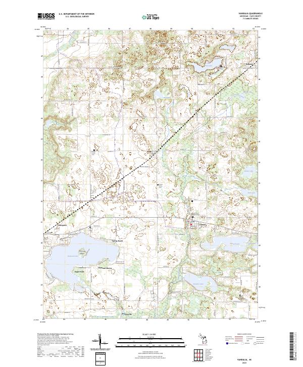 2023 Vandalia2023 Print · USGSCass County lake country is captured here in the 2020s, showing the intricate shorelines of Diamond Lake and Paradise Lake. Genealogists and researchers can trace the locations of historic burial grounds like Youngs Prairie Cem and Birch Lake Cem.
 - 2023 Map of Jones, 2023 Print
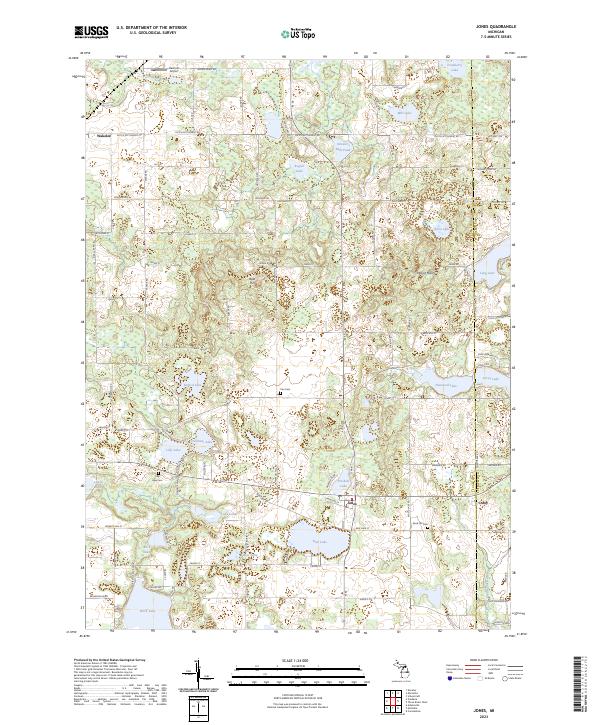 2023 Jones2023 Print · USGSCass County’s intricate network of lakes and wetlands is captured here at the dawn of the 2020s. Researchers can locate early burial sites like Poe Cem and trace the development around Jones, Bair Lake, and Streaters Mill Pond.
 - 2023 Map of Adamsville, 2023 Print
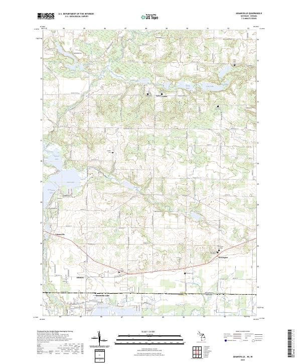 2023 Adamsville2023 Print · USGSSouthern Michigan at the Indiana border showcases a mosaic of glacial lakes and small farm settlements. Researchers can trace historical family plots at Chain Lake Cem or Mount Zion Cem, and explore old rural hubs like Adamsville and Kessington.
 - 2023 Map of Mottville, 2023 Print
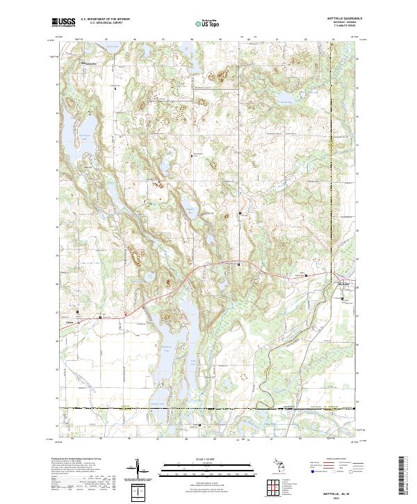 2023 Mottville2023 Print · USGSCrossing the state line into Indiana, this region centers on the Saint Joseph River and the settlement of Mottville. Genealogists can trace early families through numerous burial sites like White Pigeon Cem and Plum Grove Cem near Union.
End of results
Showing maps 1-4 of 4
Top cities near Porter Township
- Elkhart historical maps
- Goshen historical maps
- Three Rivers historical maps
- Fabius historical maps
- Middlebury historical maps
- Constantine historical maps
See more
Top neighborhoods of Porter Township
Frequently asked questions
- What are the different types of historical maps available for Porter Township?
- What is the oldest map of Porter Township?
- Where can I purchase historical maps of Porter Township for my home or office?
- Where can I download high-res historical maps of Porter Township?
- Are there historical topographic maps available for Porter Township?
- Is there historical aerial imagery available for Porter Township?
- Where are historical maps of Porter Township sourced from?