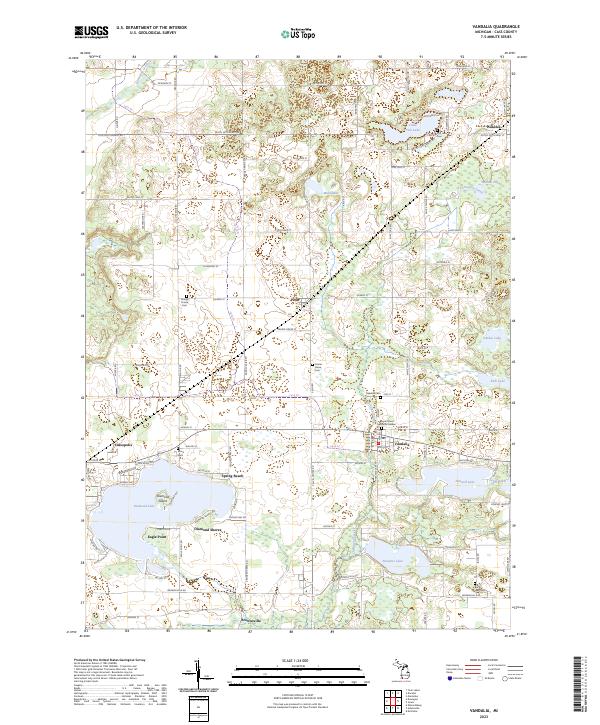
2023 Map of Vandalia
USGS Topo · Published 2023About this map
Diamond Lake and its prominent Diamond Island anchor this survey of Cass County, Michigan, where water and woodlot dominate the landscape. The village of Vandalia sits at a historic crossroads, surrounded by a dense network of smaller settlements such as Penn, Wakelee, and Brownsville. The area’s genealogical record is well-preserved through several rural burial grounds, including Youngs Prairie Cem and Oakdale Cem. This modern look at the region reveals a landscape defined by glacial lakes and the winding path of Christiana Creek, which connects Donnell Lake toward Paradise Lake in the south. Residential developments like Diamond Shores and Spring Beach highlight the shift toward recreational land use on the lakefronts, while the Bogue Street Memorial Garden in Vandalia serves as a contemporary point of local reflection.
Find a feature on this map
68 named features on this map. Tap any name to fly to it.
Don’t see what you’re looking for? This feature index may not catch every label — zoom into the map to look around manually.
Map Details
Editions of this 2023 Vandalia Map
This is the sole edition of this map. No revisions or reprints were ever made.
Other maps of this area

1927 · Hartford
USGS Topo · 1:62,500

1931 · Hartford
USGS Topo · 1:62,500

1944 · Marcellus
USGS Topo · 1:62,500

1945 · Cassopolis
USGS Topo · 1:62,500

1946 · Marcellus
USGS Topo · 1:62,500

1947 · Cassopolis
USGS Topo · 1:62,500

1948 · Vandalia
USGS Topo · 1:62,500

1949 · Vandalia
USGS Topo · 1:62,500

1953 · Fort Wayne
USGS Topo · 1:250,000

1953 · Chicago
USGS Topo · 1:250,000