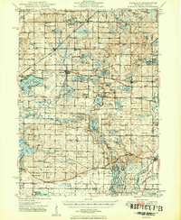
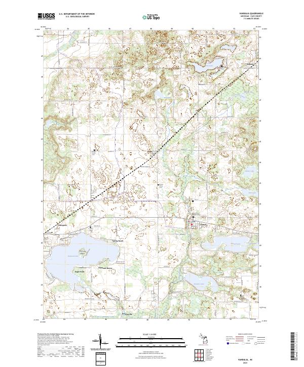
1949 Map of Vandalia
USGS Topo · Published 1949About this map
The Grand Trunk railroad corridor anchors this mid-century look at Cass County, connecting the villages of Penn and Wakelee while passing just north of Vandalia. This landscape is defined by its glacial kettle lakes and diverse summer camps, including Camp Tannadoonah and Camp Mi-Te-Na on the shores of Birch Lake. Evidence of early agricultural settlement is seen in the numerous small schoolhouses like Red Brick Sch and Swamp School, and the community centers at Calvin Center and Williamsville. In the southeast, the ST. Joseph River cuts through Mottville, where the road network converges at a critical crossing. The presence of Youngs Prairie and numerous cemeteries, such as Shavehead Cem and Sand Hill Cem, offers significant detail for researchers tracing local families and the evolution of rural Michigan's townships in the late 1940s.
Find a feature on this map
133 named features on this map. Tap any name to fly to it.
Don’t see what you’re looking for? This feature index may not catch every label — zoom into the map to look around manually.
Map Details
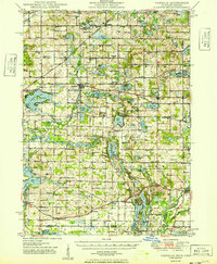
Editions of this 1949 Vandalia Map
2 editions found
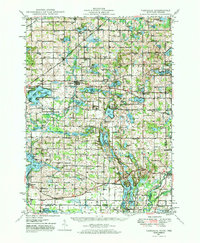
Historical Maps of Penn Through Time
8 maps found

Featured Locations
- Mottville, Mottville Township
- Penn, Penn Township
- Vandalia, Penn Township
- Allenton, Mason Township
- Cassopolis, LaGrange Township