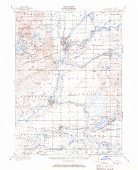
1914 Map of Three Rivers
USGS Topo · Published 1966About this map
The confluence of the St Joseph River, Rocky River, and Portage River anchors the industrial and transport hub of Three Rivers in this early twentieth-century study. The New York Central railroad lines radiate through the landscape, connecting the village of Centreville and the milling town of Constantine. This era reveals a high density of rural education and social infrastructure, evidenced by numerous district facilities like Peck Academy, Quail Trap School, and Brick Chapel School.
Find a feature on this map
101 named features on this map. Tap any name to fly to it.
Don’t see what you’re looking for? This feature index may not catch every label — zoom into the map to look around manually.
Map Details
Editions of this 1914 Three Rivers Map
This is the sole edition of this map. No revisions or reprints were ever made.
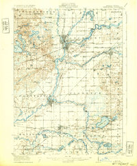
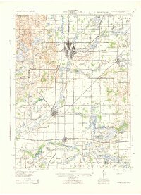
Historical Maps of Three Rivers Through Time
3 maps found
Featured Locations
- Three Rivers, MI
- Constantine, Constantine Township
- White Pigeon, White Pigeon Township
- Fabius, Fabius Township
- Centreville, Nottawa Township