
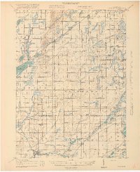
1918 Map of Leonidas
USGS Topo · Published 1918About this map
Leonidas and Mendon anchor the southern reaches of this 1917 survey, where the ST Joseph River and Nottawa Creek shape a landscape of rural townships and early industrial sites. The map reveals a dense network of country schools, such as School No 1 and Bedlam School, serving agricultural communities like Fulton and Factoryville. Transportation is defined by the Grand Rapids And Indiana RR and the Michigan Central RR, providing vital links for the region's economy. Notable landmarks like Kings Mill and the Nottawa Bridge highlight the era's reliance on water power and local river crossings. Genealogical researchers will find value in the specific placement of farm-adjacent landmarks including Mc Kain Corners, Beard Church, and the Dutton Cemetery, reflecting the social and physical structure of south-central Michigan during the early twentieth century.
Find a feature on this map
100 named features on this map. Tap any name to fly to it.
Don’t see what you’re looking for? This feature index may not catch every label — zoom into the map to look around manually.
Map Details
Editions of this 1918 Leonidas Map
3 editions found
Other maps of this area

1914 · Three Rivers
USGS Topo · 1:62,500

1916 · Three Rivers
USGS Topo · 1:62,500

1916 · Kalamazoo
USGS Topo · 1:62,500

1918 · Kalamazoo
USGS Topo · 1:62,500

1918 · Battle Creek
USGS Topo · 1:62,500

1918 · Union City
USGS Topo · 1:62,500

1918 · Galesburg
USGS Topo · 1:62,500

1922 · Schoolcraft
USGS Topo · 1:62,500

1943 · Battle Creek
USGS Topo · 1:62,500

1943 · Three Rivers
USGS Topo · 1:62,500