1980s Maps of Chandler Township, Michigan
Explore 5 historic maps of Chandler Township from the 1980s. These maps offer a rare glimpse into what life looked like during the 1980s — showing old roads, neighborhoods, homes, and landmarks that have changed or disappeared over time.
Whether you're researching your family's past, planning a metal detecting trip, or studying how Chandler Township's landscape evolved across the 1980s, these high-resolution maps are a powerful tool for exploring the history of this region.
- Focus on a specific era: All maps on this page are from the 1980s, giving you a focused view of this time period.
- See what’s changed: Compare century-old streets, trails, and buildings to today's modern landscape using overlays and satellite layers.
- Research with precision: Use these maps for genealogy, historical research, land use analysis, or educational projects.
- View, download, or print: Maps are fully viewable online in high resolution, and can be downloaded or printed for your own records.
Start exploring Chandler Township's history through authentic maps from the 1980s. This is your window into the past.
Chandler Township, MI maps
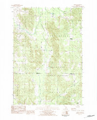
(5)- 1982 Map of Petoskey
 1982 Petoskey1982 Print · USGSNorthern Michigan in the early eighties shows a landscape of deep timber and vast inland lakes. Genealogists and historians can trace the rail corridors of the Michigan Central and Detroit and Mackinac between Petoskey, Gaylord, and Wolverine.
 - 1983 Map of Epsilon, 1984 Print
 1983 Epsilon1984 Print · USGSNorthern Michigan’s timber and rural farmsteads are documented here in the early eighties as the landscape transitioned between state-managed forests and local settlements. Researchers can locate family landmarks like Elmwood Cem or trace the early paths of Bear Creek and Minnehaha Creek.
 - 1986 Map of Thumb Lake
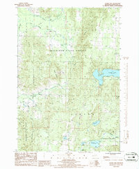 1986 Thumb Lake1986 Print · USGSCharlevoix County’s wooded uplands and glacial lakes are captured here in the mid-1980s, showcasing a landscape shaped by both recreation and state forest management. You can trace an Old RR Grade through the hills or locate family landmarks like the Cem and Thumb Lake.
 - 1986 Map of Wildwood
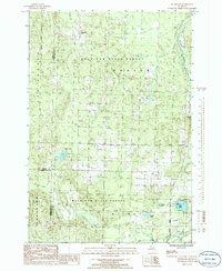 1986 Wildwood1986 Print · USGSNorthern Michigan’s timber and recreation lands are captured here during the mid-1980s. Genealogists and outdoorsmen can trace the settlement of Wildwood, find the CAMPGROUND at Weber Lake, or locate family sites near the Sturgeon River and Barhite Lake.
 - 1986 Map of Vanderbilt
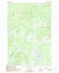 1986 Vanderbilt1986 Print · USGSThe village of Vanderbilt and the surrounding timberlands of the Mackinaw State Forest are captured here in the mid-1980s. Genealogists and local historians can trace the Old Railroad Grade, locate the village Cem, and explore the shores of Thumb Lake.
End of results
Showing maps 1-5 of 5
Top cities near Chandler Township
- Petoskey historical maps
- Gaylord historical maps
- Boyne City historical maps
- Indian River historical maps
- Elmira historical maps
- Harbor Springs historical maps
See more
Frequently asked questions
- What are the different types of historical maps available for Chandler Township?
- What is the oldest map of Chandler Township?
- Where can I purchase historical maps of Chandler Township for my home or office?
- Where can I download high-res historical maps of Chandler Township?
- Are there historical topographic maps available for Chandler Township?
- Is there historical aerial imagery available for Chandler Township?
- Where are historical maps of Chandler Township sourced from?