2020s Maps of East Jordan, Michigan
Explore 2 historic maps of East Jordan from the 2020s. These maps offer a rare glimpse into what life looked like during the 2020s — showing old roads, neighborhoods, homes, and landmarks that have changed or disappeared over time.
Whether you're researching your family's past, planning a metal detecting trip, or studying how East Jordan's landscape evolved across the 2020s, these high-resolution maps are a powerful tool for exploring the history of this region.
- Focus on a specific era: All maps on this page are from the 2020s, giving you a focused view of this time period.
- See what’s changed: Compare century-old streets, trails, and buildings to today's modern landscape using overlays and satellite layers.
- Research with precision: Use these maps for genealogy, historical research, land use analysis, or educational projects.
- View, download, or print: Maps are fully viewable online in high resolution, and can be downloaded or printed for your own records.
Start exploring East Jordan's history through authentic maps from the 2020s. This is your window into the past.
East Jordan, MI maps
(2)- 2023 Map of Boyne City, 2023 Print
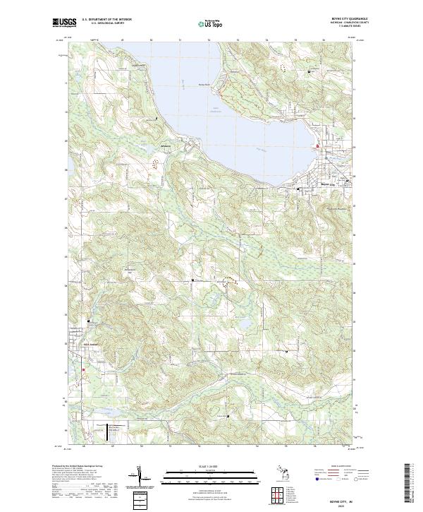 2023 Boyne City2023 Print · USGSThe tip of the south arm of Lake Charlevoix comes into focus during the early twenty-first century, showing the established communities of Boyne City and East Jordan. Genealogists can locate several burial grounds including Maple Lawn Cem, Evangeline Cem, and Saint Joseph Calvary Cem.
 - 2023 Map of Ellsworth, 2023 Print
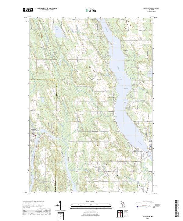 2023 Ellsworth2023 Print · USGSThe Lake Charlevoix region in the early 2020s is a landscape of interconnected waterways and lakeside villages. Genealogists and local historians can trace the foundations of Ellsworth and East Jordan, alongside historic burial sites like Lakeside Cem and Jones Cem.
End of results
Showing maps 1-2 of 2
Top cities near East Jordan
- Petoskey historical maps
- Boyne City historical maps
- Charlevoix historical maps
- Bellaire historical maps
- Central Lake historical maps
- Chestonia historical maps
See more
Frequently asked questions
- What are the different types of historical maps available for East Jordan?
- What is the oldest map of East Jordan?
- Where can I purchase historical maps of East Jordan for my home or office?
- Where can I download high-res historical maps of East Jordan?
- Are there historical topographic maps available for East Jordan?
- Is there historical aerial imagery available for East Jordan?
- Where are historical maps of East Jordan sourced from?