2020s Maps of Drummond Township, Michigan
Explore 9 historic maps of Drummond Township from the 2020s. These maps offer a rare glimpse into what life looked like during the 2020s — showing old roads, neighborhoods, homes, and landmarks that have changed or disappeared over time.
Whether you're researching your family's past, planning a metal detecting trip, or studying how Drummond Township's landscape evolved across the 2020s, these high-resolution maps are a powerful tool for exploring the history of this region.
- Focus on a specific era: All maps on this page are from the 2020s, giving you a focused view of this time period.
- See what’s changed: Compare century-old streets, trails, and buildings to today's modern landscape using overlays and satellite layers.
- Research with precision: Use these maps for genealogy, historical research, land use analysis, or educational projects.
- View, download, or print: Maps are fully viewable online in high resolution, and can be downloaded or printed for your own records.
Start exploring Drummond Township's history through authentic maps from the 2020s. This is your window into the past.
Drummond Township, MI maps
(9)- 2023 Map of Meade Island, 2023 Print
 2023 Meade Island2023 Print · USGSDrummond Island in the early twenty-first century reveals a rugged coastal landscape shaped by Lake Huron and inland lakes. Researchers can trace family history at the Finnish Cem or explore the jagged shoreline near Scammon Cove and Canoe Point.
 - 2023 Map of Whitney Bay, 2023 Print
 2023 Whitney Bay2023 Print · USGSDrummond Island and the surrounding waters of Chippewa County are captured here in the early twenty-first century. Genealogists and local historians can trace family-named routes like S Fairbanks Point Rd or locate coastal landmarks such as Cream City Point and Island Harbor.
 - 2023 Map of De Tour Village, 2023 Print
 2023 De Tour Village2023 Print · USGSDe Tour Village and the eastern tip of Michigan's Upper Peninsula are shown in high detail during the early 2020s. Researchers can locate the Drummond Island Ferry landing, trace family roots at Riverside Cem, or explore the shoreline of Caribou Lake.
 - 2023 Map of Marble Head OE E, 2023 Print
 2023 Marble Head OE E2023 Print · USGSDrummond Island's easternmost point is documented in this modern survey, where the Michigan wilderness meets the international border. Researchers can trace the rugged shoreline from Marble Head down to the secluded Pilot Cove and along the False Detour Channel.
 - 2023 Map of Marble Head, 2023 Print
 2023 Marble Head2023 Print · USGSThe eastern reaches of Drummond Island are documented in this contemporary study, showing the area's complex coastal geometry and island interior. Researchers can trace the roads around Johnswood or explore maritime features like Scammon Point and the False Detour Channel.
 - 2023 Map of Drummond, 2023 Print
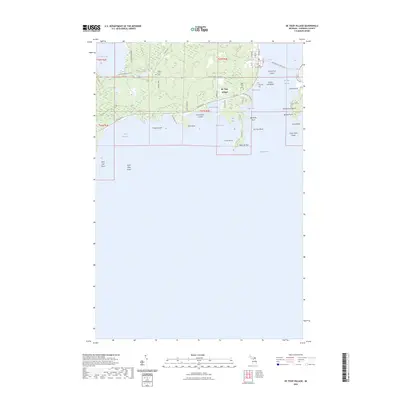
 2023 Drummond2023 Print · USGSDrummond Island at the northern edge of Lake Huron shows a unique borderland landscape defined by maritime activity and remote island life. Genealogists and historians can trace local family roots at Drummond Cem, Matthews Family Cem, and the grounds of Saint Florence Catholic Church.
 - 2023 Map of Drummond SE, 2023 Print
 2023 Drummond SE2023 Print · USGSDrummond Island’s southeastern shore remains a rugged frontier of limestone plains and international waters in this recent survey. Researchers can trace the coastal geography of Glen Cove Beach, Raynolds Bay, and the inland Stevens Lake.
 - 2023 Map of Lime Island, 2023 Print
 2023 Lime Island2023 Print · USGSThe northern tip of Lake Huron meets the St. Marys River in this modern study of the Chippewa County shoreline and its islands. Genealogists and maritime historians can trace the streets of De Tour Village or locate Sacred Heart Cem and Lime Island.
 - 2023 Map of Burnt Island, 2023 Print
 2023 Burnt Island2023 Print · USGSThe northern shores of Drummond Island meet the Canadian border in this recent survey of the Chippewa County archipelago. Maritime researchers can trace the coastal roads and naming of features like Wreck Island, the Drummond Island Airport, and Potagannissing Bay.
End of results
Showing maps 1-9 of 9
Top cities near Drummond Township
Top neighborhoods of Drummond Township
Frequently asked questions
- What are the different types of historical maps available for Drummond Township?
- What is the oldest map of Drummond Township?
- Where can I purchase historical maps of Drummond Township for my home or office?
- Where can I download high-res historical maps of Drummond Township?
- Are there historical topographic maps available for Drummond Township?
- Is there historical aerial imagery available for Drummond Township?
- Where are historical maps of Drummond Township sourced from?