Old Maps of Drummond Township, Michigan for Academic Research
Study the evolution of Drummond Township with 61 high-resolution historic maps. Whether you're teaching, researching, or modeling changes in land use, these maps provide essential visual documentation of urban, environmental, and geographic change.
- Analyze long-term change: Track patterns in development, transportation, and natural features.
- Ideal for environmental or urban studies: Support academic projects with primary historical map data.
- Use in the classroom or lab: Educators and researchers rely on these maps to bring historical context to life.
These maps are a powerful tool for teaching, research, and visualizing how Drummond Township has changed over the decades.
Drummond Township, MI maps
(61)- 1954 Map of Alpena, 1978 Print
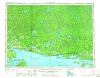
 1954 Alpena1978 Print · USGSThe northern waters of Lake Huron meet the Ontario islands during the mid-1950s, a time of active coastal shipping and timber management. Genealogists and historians can trace the Detroit and Mackinac rail line through Alpena or locate rural landmarks like St. Catharine Ch and Forty Mile Point.2 unique versions available
 - 1957 Map of Alpena
 1957 Alpena1957 Print · USGSNortheast Michigan and the islands of the North Channel are captured in the mid-1950s, showing the vital maritime and rail connections of the region. Researchers can trace the path of the Detroit and Mackinac RR or locate small settlements like Meldrum Bay and Lachine.
 - 1958 Map of Alpena
 1958 Alpena1958 Print · USGSThe northern reaches of Lake Huron and the Ontario islands are mapped here in the late fifties. You can trace the Detroit and Mackinac RR through Rogers City or locate remote outposts like Meldrum Bay and St. Vital church.
 - 1961 Map of Blind River, 1966 Print
 1961 Blind River1966 Print · USGSThe North Channel and Ontario shoreline are captured here in the early sixties, showing the vital link between coastal ports and the rugged interior. Trace the Canadian Pacific rail line through Thessalon and Massey, or locate landings on Drummond Island.3 unique versions available
 - 1964 Map of De Tour Village, 1965 Print
 1964 De Tour Village1965 Print · USGSDe Tour Village and the Saint Marys River shoreline are captured here in the mid-1960s, showing the town's critical role in Great Lakes navigation. Genealogists and maritime historians can locate De Tour Lighthouse, Bob Hill Cem, and the old quarry near the water's edge.2 unique versions available
 - 1964 Map of Marble Head, 1965 Print
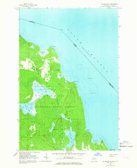
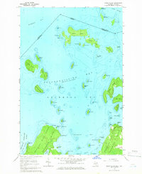
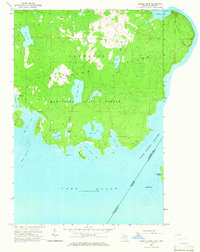 1964 Marble Head1965 Print · USGSDrummond Island and its easternmost point at Marble Head are captured here during the mid-1960s, a period defined by forestry and remote coastal living. Researchers can trace the layout of Johnswood, follow trails through Munuscong State Forest, and locate landmarks like Shelter Island and the Gravel Pit.3 unique versions available
 - 1964 Map of Drummond, 1965 Print
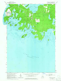
 1964 Drummond1965 Print · USGSDrummond Island and the surrounding archipelago are captured at the international boundary in the mid-1960s. Researchers can locate the Drummond post office, the Indian Cem, and the Maxton Lookout Tower overlooking the bay.3 unique versions available
 - 1964 Map of Whitney Bay, 1965 Print
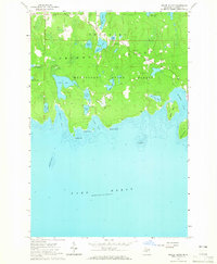
 1964 Whitney Bay1965 Print · USGSDrummond Island's rugged southern shore appears here in the mid-sixties, a landscape of state forest and historic military outposts. Researchers can trace the grounds of Old Fort Drummond, find a hidden Cem, or locate the expansive Quarry near Kempainen Lake.3 unique versions available
 - 1964 Map of Lime Island, 1966 Print
 1964 Lime Island1966 Print · USGSThe maritime borderlands between Michigan and Ontario come into focus in the mid-1960s. Researchers can trace the shoreline of De Tour Village and find local landmarks like Sacred Heart Cem and Lime Island.2 unique versions available
 - 1964 Map of Meade Island, 1966 Print
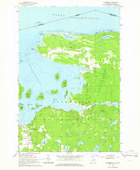
 1964 Meade Island1966 Print · USGSThe northern reaches of Lake Huron and the forests of Drummond Island are captured here in the mid-1960s. Genealogists and local historians can locate the Finnish Cem and the settlement of Lincoln or trace the shoreline from Canoe Point to Scammon Point.2 unique versions available
 - 1964 Map of Drummond SE, 1966 Print
 1964 Drummond SE1966 Print · USGSDrummond Island’s southeastern wilderness is captured here in the mid-1960s, showing the intersection of Michigan and Ontario in the North Channel. Researchers can trace the winding Potagannissing River through the Munuscong State Forest and across the Maxton Plains.3 unique versions available
 - 1964 Map of Burnt Island, 1966 Print
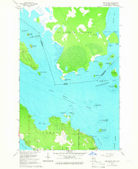
 1964 Burnt Island1966 Print · USGSDrummond Island and its surrounding archipelago are captured in the mid-sixties, showing the intricate waterways of the North Channel. Maritime researchers can trace the shoreline of Potagannissing Bay and find coastal features like the Quarry and Wreck Island.3 unique versions available
 - 1968 Map of Blind River
 1968 Blind River1968 Print · USGSThe North Channel coast and the North Woods of Ontario and Michigan are captured here in the late sixties. Genealogists and local historians can trace the Canadian Pacific rail line through Bruce Station, Thessalon, and Blind River.
 - 1969 Map of Alpena
 1969 Alpena1969 Print · USGSThe Lake Huron coastline and the Manitoulin islands come alive in this mid-century survey of the Michigan-Ontario border. Genealogists and historians can trace the Detroit and Mackinac rail line through settlements like Lachine and Cathro, or locate the numerous island reservations including Obigewong Indian Reservation No 21.
 - 1984 Map of Drummond, 1985 Print
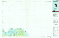 1984 Drummond1985 Print · USGSUpper Peninsula maritime life and the island geography of Chippewa County are captured here in the mid-eighties. Trace the roads through Maxton, locate the Quarry near the shore, or explore the inlets of Potagannissing Bay and Sturgeon Bay.2 unique versions available
 - 1984 Map of De Tour Village, 1985 Print
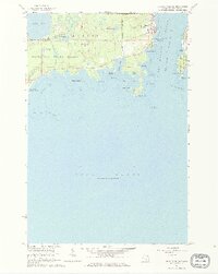
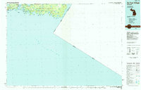 1984 De Tour Village1985 Print · USGSThe eastern Upper Peninsula and Drummond Island are captured in the mid-1980s before modern development altered these remote shorelines. Genealogists and historians can trace the isolated settlements of De Tour Village and Johnswood or locate the historic De Tour Lighthouse.2 unique versions available
 - 2011 Map of Drummond SE, 2011 Print
 2011 Drummond SE2011 Print · USGSCovers Drummond Township, including Huron Shores, Chippewa County, and other nearby areas
 - 2011 Map of Lime Island, 2011 Print
 2011 Lime Island2011 Print · USGSCovers Drummond Township, including Jocelyn Township, Detour Township, and other nearby areas
 - 2011 Map of Drummond, 2011 Print
 2011 Drummond2011 Print · USGSCovers Drummond Township, including Huron Shores, Drummond, and other nearby areas
 - 2011 Map of Burnt Island, 2011 Print
 2011 Burnt Island2011 Print · USGSCovers Drummond Township, including Jocelyn Township, Hilton Township, and other nearby areas
 - 2011 Map of Meade Island, 2011 Print
 2011 Meade Island2011 Print · USGSCovers Drummond Township, including Lincoln, Chippewa County, and other nearby areas
 - 2011 Map of Marble Head OE E, 2011 Print
 2011 Marble Head OE E2011 Print · USGSCovers Drummond Township, including Huron Shores, Cockburn Island Township, and other nearby areas
 - 2011 Map of Marble Head, 2011 Print
 2011 Marble Head2011 Print · USGSCovers Drummond Township, including Cockburn Island Township, Unorganized West Manitoulin, and other nearby areas
 - 2011 Map of De Tour Village, 2011 Print
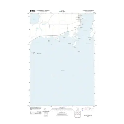 2011 De Tour Village2011 Print · USGSCovers Drummond Township, including De Tour Village, Detour Township, and other nearby areas
 - 2011 Map of Whitney Bay, 2011 Print
 2011 Whitney Bay2011 Print · USGSCovers Drummond Township, including Chippewa County, United States, and other nearby areas
Showing maps 1-25 of 61
Top cities near Drummond Township
Top neighborhoods of Drummond Township
Frequently asked questions
- What are the different types of historical maps available for Drummond Township?
- What is the oldest map of Drummond Township?
- Where can I purchase historical maps of Drummond Township for my home or office?
- Where can I download high-res historical maps of Drummond Township?
- Are there historical topographic maps available for Drummond Township?
- Is there historical aerial imagery available for Drummond Township?
- Where are historical maps of Drummond Township sourced from?