
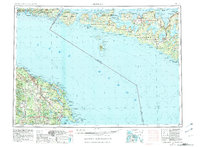
1954 Map of Alpena
USGS Topo · Published 1978About this map
Lake Huron and the North Channel define this mid-century maritime corridor, spanning the international boundary between Michigan and Ontario. On the western shore, Rogers City and Alpena serve as the primary hubs of commerce, connected by the Detroit and Mackinac railroad line that skirts the coast of Presque Isle County. This area is characterized by an extensive network of protected woodlands, including the Black Lake State Forest and Alpena State Forest, where numerous lookout towers stand watch over the timberlands.
Find a feature on this map
115 named features on this map. Tap any name to fly to it.
Don’t see what you’re looking for? This feature index may not catch every label — zoom into the map to look around manually.
Map Details
Editions of this 1954 Alpena Map
2 editions found
Other maps of this area

1954 · Traverse City
USGS Topo · 1:250,000

1954 · Tawas City
USGS Topo · 1:250,000

1954 · Sault Sainte Marie
USGS Topo · 1:250,000

1955 · Atlanta
USGS Topo · 1:62,500

1955 · Comins
USGS Topo · 1:62,500

1955 · Hillman
USGS Topo · 1:62,500

1955 · Cheboygan
USGS Topo · 1:250,000

1956 · Sault Sainte Marie
USGS Topo · 1:250,000

1957 · Alpena
USGS Topo · 1:250,000

1957 · Sault Sainte Marie
USGS Topo · 1:250,000