Old Maps of Fayette, Fairbanks Township for Metal Detecting
Plan your next treasure hunt with 12 historic maps of Fayette. Find old homesites, ghost towns, trails, and gathering spots that may be lost to time — perfect for identifying promising metal detecting locations.
- Locate forgotten sites: Uncover places like long-lost settlements, abandoned rail lines, or gathering spots.
- Plan better hunts: Use map overlays combined with LiDAR or satellite views to narrow in on historically rich areas.
- Made for detectorists: Thousands of hobbyists use these maps to discover relics, coins, and hidden history.
Use these historic maps to boost your research and find new opportunities beneath the surface of Fayette.
Fayette, Fairbanks Township maps
(12)- 1932 Map of Burnt Bluff NW
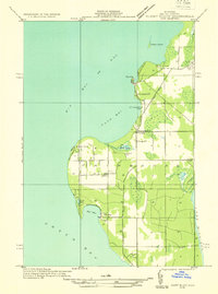 1932 Burnt Bluff NW1932 Print · USGSThe Garden Peninsula’s coastline is captured here in the early thirties as a landscape of isolated harbors and rural schoolhouses. Researchers can locate vanished landmarks like the Burnt Bluff Sch, St Josephs Ch, and the coastal settlement at Sac Bay.
 - 1954 Map of Escanaba, 1967 Print
 1954 Escanaba1967 Print · USGSThe Upper Peninsula and Door County shorelines meet here in the mid-fifties, showing the vital maritime and timber networks of the Great Lakes. Researchers can trace historic rail lines, old fire lookouts like the Stonington Fire Tower, and island settlements such as Washington Island.2 unique versions available
 - 1957 Map of Escanaba
 1957 Escanaba1957 Print · USGSThe Upper Peninsula and Door County shorelines meet in the mid-fifties, capturing a landscape of timber, iron, and maritime trade. Genealogists and local historians can trace the Chicago & North Western RR through settlements like Hermansville or locate St Vitals Church and the Potawatome Indian Reservation.
 - 1958 Map of Escanaba
 1958 Escanaba1958 Print · USGSNorthern Lake Michigan maritime commerce and timberlands are captured here in the mid-fifties. Genealogists and historians can trace rail networks like the Escanaba and Lake Superior or locate island settlements such as Detroit Harbor and Fish Creek.
 - 1958 Map of Fairport, 1959 Print
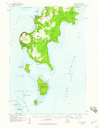 1958 Fairport1959 Print · USGSThe Garden Peninsula and its outlying islands are captured here in the late fifties, showing a landscape defined by Great Lakes maritime life. Genealogists and researchers can locate St Peters Cem, the remote Poverty Island light, and the school at Mud Lake Sch.2 unique versions available
 - 1983 Map of Manistique
 1983 Manistique1983 Print · USGSThe northern shores of Lake Michigan and the Garden Peninsula appear here in the early eighties. Historians can trace the Soo Line rail corridor and explore coastal settlements like Nahma, Fayette, and the harbor town of Manistique.
 - 1985 Map of Fayette
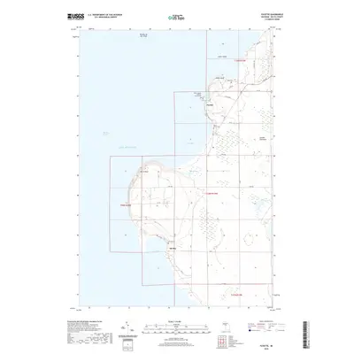
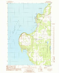 1985 Fayette1985 Print · USGSThe Garden Peninsula in the mid-1980s reveals a rugged shoreline of bluffs and harbors along Lake Michigan. Genealogists and historians can trace the foundations of Fayette (Site) or locate family plots at Hinks Cem and St Peters Cem.
 - 2011 Map of Fayette, 2011 Print
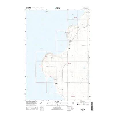
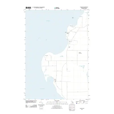 2011 Fayette2011 Print · USGSCovers Fayette, including Fairbanks Township, Sac Bay, and other nearby areas
 - 2014 Map of Fayette, 2014 Print
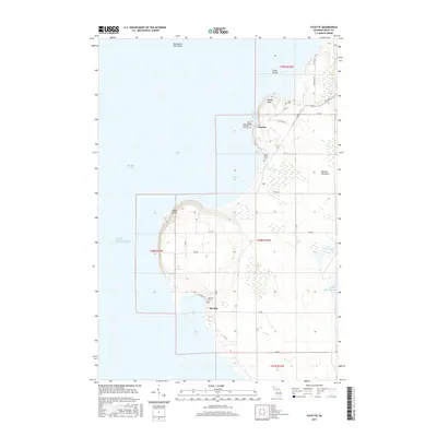
 2014 Fayette2014 Print · USGSCovers Fayette, including Fairbanks Township, Sac Bay, and other nearby areas
 - 2017 Map of Fayette, 2017 Print
 2017 Fayette2017 Print · USGSCovers Fayette, including Fairbanks Township, Sac Bay, and other nearby areas
 - 2019 Map of Fayette, 2019 Print
 2019 Fayette2019 Print · USGSCovers Fayette, including Fairbanks Township, Sac Bay, and other nearby areas
 - 2023 Map of Fayette, 2023 Print
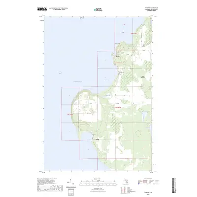 2023 Fayette2023 Print · USGSThe western shore of the Garden Peninsula in the early twenty-first century reveals a landscape defined by dramatic bluffs and historic maritime settlements. Researchers can locate family heritage sites at Saint Peters Cem and Sac Bay Cem or trace the preserved townsite at Fayette.
End of results
Showing maps 1-12 of 12
Top cities near Fayette
Frequently asked questions
- What are the different types of historical maps available for Fayette?
- What is the oldest map of Fayette?
- Where can I purchase historical maps of Fayette for my home or office?
- Where can I download high-res historical maps of Fayette?
- Are there historical topographic maps available for Fayette?
- Is there historical aerial imagery available for Fayette?
- Where are historical maps of Fayette sourced from?