Old Maps of Bear Creek Township, Michigan for Genealogy
Trace your family roots with 31 historic maps of Bear Creek Township. These high-res maps reveal old neighborhoods, homesites, landmarks, and streets — helping you uncover where your ancestors lived and how the area evolved over time.
- Explore historic neighborhoods: Identify where your relatives may have lived in the 1800s or 1900s.
- Compare maps over time: Trace the changes in streets, buildings, and landmarks for multi-generational research.
- Perfect for genealogy & ancestry research: Used by family historians and researchers to map out lineage and migration.
These maps are an incredible resource for exploring your personal connection to Bear Creek Township's past.
Bear Creek Township, MI maps
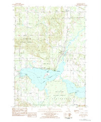
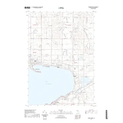
(31)- 1955 Map of Cheboygan, 1964 Print
 1955 Cheboygan1964 Print · USGSNorthern Michigan in the mid-fifties is a landscape of dense timber and deep water, showing the region just as the road network began to modernize. Trace family roots in lakeside towns like St Ignace and Petoskey, or follow the historic tracks of the Pennsylvania RR and New York Central RR.5 unique versions available
 - 1958 Map of Cheboygan
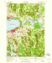
 1958 Cheboygan1958 Print · USGSThe tip of Michigan's Lower Peninsula and the surrounding Great Lakes islands are shown here in the late fifties, during the peak of the rail-and-ferry era. Trace the paths of the Pennsylvania RR and explore lakeside settlements like St James, Petoskey, and Indian River.2 unique versions available
 - 1958 Map of Petoskey, 1959 Print
 1958 Petoskey1959 Print · USGSCoastal Emmet County in the late fifties is captured here through its growing resort towns and inland forest tracts. Researchers can trace the legacy of local families through landmarks like Patons Corner, Morford Sch, and Curtis Cem.4 unique versions available
 - 1975 Map of Petoskey NW, 1976 Print
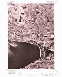 1975 Petoskey NW1976 Print · USGSLittle Traverse Bay and its coastal settlements are captured from the air in the mid-1970s, showing the intersection of resort life and rural land use. Trace the established shorelines of Harbor Springs, Petoskey, and the storied grounds of Bay View.
 - 1975 Map of Petoskey SW, 1976 Print
 1975 Petoskey SW1976 Print · USGSNorthern Michigan's coastline and interior lakes are captured in high detail during the mid-seventies. Trace the 1975 development of Petoskey along Little Traverse Bay and the shoreline of Walloon Lake.
 - 1975 Map of Petoskey NE, 1976 Print
 1975 Petoskey NE1976 Print · USGSEmmet County's lake country is seen through aerial photography in the mid-seventies, showing the transition from woodland to waterfront settlement. Researchers can trace the exact footprint of shoreline communities like Alanson, Oden, and Conway along Crooked Lake.
 - 1982 Map of Petoskey
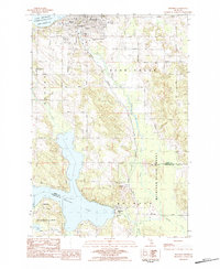
 1982 Petoskey1982 Print · USGSNorthern Michigan in the early eighties shows a landscape of deep timber and vast inland lakes. Genealogists and historians can trace the rail corridors of the Michigan Central and Detroit and Mackinac between Petoskey, Gaylord, and Wolverine.
 - 1983 Map of Alanson, 1984 Print
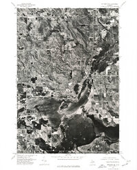
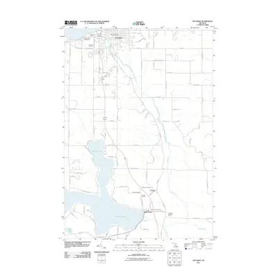
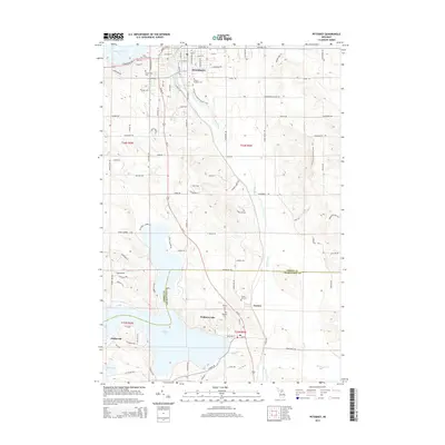
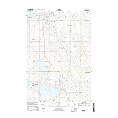
 1983 Alanson1984 Print · USGSNorthern Michigan lake country is documented here in the early eighties, centered on the Inland Waterway. Researchers can trace lakeside developments like Ponshewaing, the Sacramentine Monastery, and the Michigan Northern rail line.
 - 1983 Map of Epsilon, 1984 Print
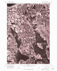
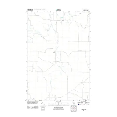
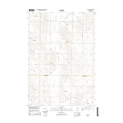
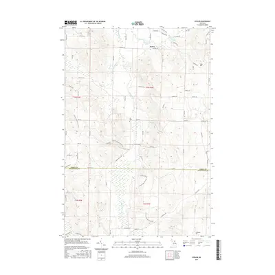
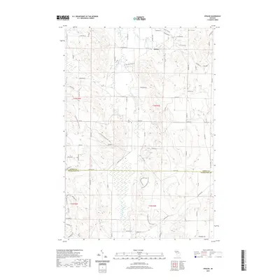
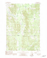 1983 Epsilon1984 Print · USGSNorthern Michigan’s timber and rural farmsteads are documented here in the early eighties as the landscape transitioned between state-managed forests and local settlements. Researchers can locate family landmarks like Elmwood Cem or trace the early paths of Bear Creek and Minnehaha Creek.
 - 1983 Map of Petoskey, 1984 Print
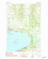
 1983 Petoskey1984 Print · USGSThe Lake Michigan shoreline and the deep inlets of Walloon Lake define this region in the early eighties. Researchers can trace the development of Petoskey alongside rural landmarks like Dunkard Cem, Wildwood, and Little Traverse Hosp.
 - 1983 Map of Harbor Springs, 1984 Print
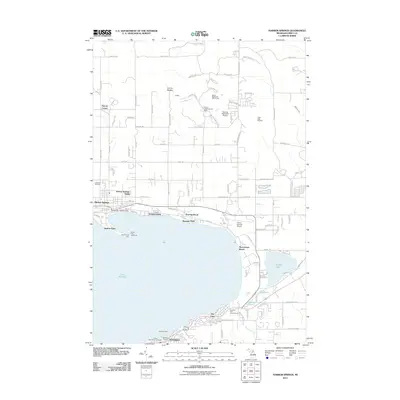
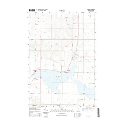
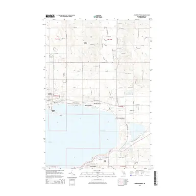
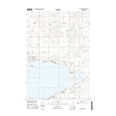
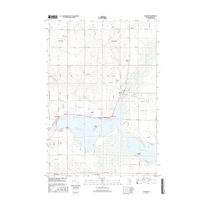
 1983 Harbor Springs1984 Print · USGSLittle Traverse Bay and its coastal resorts are frozen in time just before the mid-eighties, showing the growth of Harbor Springs and its neighboring ski hills. Researchers can locate local landmarks like Lakeview Cem, the Shay Sch, and the winding Northern Hiawatha Trail.
 - 2011 Map of Alanson, 2011 Print
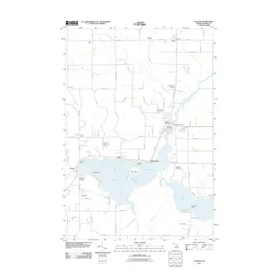 2011 Alanson2011 Print · USGSCovers Bear Creek Township, including Alanson, Littlefield Township, and other nearby areas
 - 2011 Map of Epsilon, 2011 Print
 2011 Epsilon2011 Print · USGSCovers Bear Creek Township, including Chandler Township, Melrose Township, and other nearby areas
 - 2011 Map of Harbor Springs, 2011 Print
 2011 Harbor Springs2011 Print · USGSCovers Bear Creek Township, including Petoskey, Harbor Springs, and other nearby areas
 - 2011 Map of Petoskey, 2011 Print
 2011 Petoskey2011 Print · USGSCovers Bear Creek Township, including Petoskey, Melrose Township, and other nearby areas
 - 2014 Map of Alanson, 2014 Print
 2014 Alanson2014 Print · USGSCovers Bear Creek Township, including Alanson, Littlefield Township, and other nearby areas
 - 2014 Map of Epsilon, 2014 Print
 2014 Epsilon2014 Print · USGSCovers Bear Creek Township, including Chandler Township, Melrose Township, and other nearby areas
 - 2014 Map of Harbor Springs, 2014 Print
 2014 Harbor Springs2014 Print · USGSCovers Bear Creek Township, including Petoskey, Harbor Springs, and other nearby areas
 - 2014 Map of Petoskey, 2014 Print
 2014 Petoskey2014 Print · USGSCovers Bear Creek Township, including Petoskey, Melrose Township, and other nearby areas
 - 2017 Map of Harbor Springs, 2017 Print
 2017 Harbor Springs2017 Print · USGSCovers Bear Creek Township, including Petoskey, Harbor Springs, and other nearby areas
 - 2017 Map of Epsilon, 2017 Print
 2017 Epsilon2017 Print · USGSCovers Bear Creek Township, including Chandler Township, Melrose Township, and other nearby areas
 - 2017 Map of Petoskey, 2017 Print
 2017 Petoskey2017 Print · USGSCovers Bear Creek Township, including Petoskey, Melrose Township, and other nearby areas
 - 2017 Map of Alanson, 2017 Print
 2017 Alanson2017 Print · USGSCovers Bear Creek Township, including Alanson, Littlefield Township, and other nearby areas
 - 2019 Map of Harbor Springs, 2019 Print
 2019 Harbor Springs2019 Print · USGSCovers Bear Creek Township, including Petoskey, Harbor Springs, and other nearby areas
 - 2019 Map of Epsilon, 2019 Print
 2019 Epsilon2019 Print · USGSCovers Bear Creek Township, including Chandler Township, Melrose Township, and other nearby areas
Showing maps 1-25 of 31
Top cities near Bear Creek Township
- Petoskey historical maps
- Boyne City historical maps
- East Jordan historical maps
- Harbor Springs historical maps
- Alanson historical maps
- Pellston historical maps
See more
Top neighborhoods of Bear Creek Township
Frequently asked questions
- What are the different types of historical maps available for Bear Creek Township?
- What is the oldest map of Bear Creek Township?
- Where can I purchase historical maps of Bear Creek Township for my home or office?
- Where can I download high-res historical maps of Bear Creek Township?
- Are there historical topographic maps available for Bear Creek Township?
- Is there historical aerial imagery available for Bear Creek Township?
- Where are historical maps of Bear Creek Township sourced from?