1940s Maps of Genesee County, Michigan
Explore 6 historic maps of Genesee County from the 1940s. These maps offer a rare glimpse into what life looked like during the 1940s — showing old roads, neighborhoods, homes, and landmarks that have changed or disappeared over time.
Whether you're researching your family's past, planning a metal detecting trip, or studying how Genesee County's landscape evolved across the 1940s, these high-resolution maps are a powerful tool for exploring the history of this region.
- Focus on a specific era: All maps on this page are from the 1940s, giving you a focused view of this time period.
- See what’s changed: Compare century-old streets, trails, and buildings to today's modern landscape using overlays and satellite layers.
- Research with precision: Use these maps for genealogy, historical research, land use analysis, or educational projects.
- View, download, or print: Maps are fully viewable online in high resolution, and can be downloaded or printed for your own records.
Start exploring Genesee County's history through authentic maps from the 1940s. This is your window into the past.
Genesee County, MI maps
(6)- 1943 Map of Holly
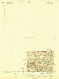
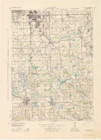 1943 Holly1943 Print · USGSThe Shiawassee River valley and its surrounding lake country are shown here in the early 1940s as a thriving network of rail towns and rural schools. Genealogists and local historians can trace family locations near Fenton, Holly, and the small settlement at Groveland Mills.
 - 1943 Map of Burt
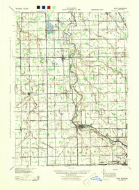 1943 Burt1943 Print · USGSThe rural borders of Saginaw and Genesee counties come alive in the 1940s as the Flint River winds past growing farm towns. Genealogists and historians can trace dozens of family-named schoolhouses and crossroads, from St Michaels Ch to the rail hubs of Burt and Montrose.
 - 1943 Map of Durand
 1943 Durand1943 Print · USGSMid-century Shiawassee and Genesee Counties are mapped here during a period of agricultural stability and rail expansion. Genealogists can trace family farm locations near Crapo Farm or locate rural schools like Doane Sch and Church Sch.
 - 1943 Map of Flint, 1944 Print
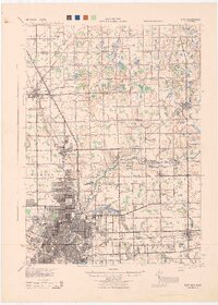 1943 Flint1944 Print · USGSGenesee County and the city of Flint appear in transition during the mid-forties, balancing a booming urban core with a sprawling network of rural township schools. Genealogists and local historians can trace hundreds of property sites near Kearsley Res or locate early academic landmarks like Wildcat Sch and Hopkins Sch.
 - 1945 Map of Hadley
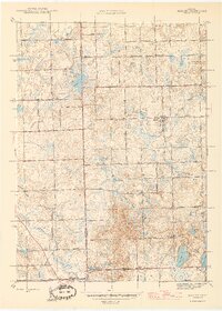 1945 Hadley1945 Print · USGSLapeer County at the end of the war reveals a quiet landscape of agricultural homesteads and numerous small lakes. Genealogists can trace family roots at Green Corners Cem or locate rural landmarks like Kipp Sch and the Sawmill near Sawmill Lake.2 unique versions available
 - 1945 Map of Davisburg
 1945 Davisburg1945 Print · USGSOakland County's rural character remains evident in the mid-1940s, just before the post-war housing boom. Genealogists can trace early landmarks like Austin Corners, Brondige Sch, and the Bigelow Cem.3 unique versions available
End of results
Showing maps 1-6 of 6
Top cities of Genesee County
- Flint historical maps
- Burton historical maps
- Fenton historical maps
- Flushing historical maps
- Grand Blanc historical maps
- Swartz Creek historical maps
See more
Frequently asked questions
- What are the different types of historical maps available for Genesee County?
- What is the oldest map of Genesee County?
- Where can I purchase historical maps of Genesee County for my home or office?
- Where can I download high-res historical maps of Genesee County?
- Are there historical topographic maps available for Genesee County?
- Is there historical aerial imagery available for Genesee County?
- Where are historical maps of Genesee County sourced from?