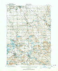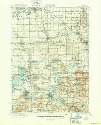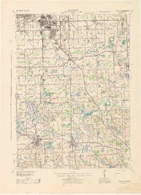
1943 Map of Holly
USGS Topo · Published 1943About this map
The Shiawassee River winds through the southern reaches of this landscape, anchoring the bustling rail hubs of Fenton and Holly during the early 1940s. This territory is defined by a dense network of country schools, such as Van Slyke Sch and Patterson Sch, which served the rural families of Grand Blanc and Springfield. The Grand Trunk Railway and Pere Marquette Railway provide the primary industrial arteries, connecting northern Flint with smaller southern outposts like Davisburg. Significant water features including Lake Ponemah, Silver Lake, and Long Lake reveal the region's complex glacial topography. Local commerce and community life are marked by landmarks like Groveland Mills and Grange Hall, while smaller named settlements such as Newark and Gibsonville appear alongside family-named landmarks like Wolcott Cem and Log Cabin Point.
Find a feature on this map
147 named features on this map. Tap any name to fly to it.
Don’t see what you’re looking for? This feature index may not catch every label — zoom into the map to look around manually.
Map Details
Editions of this 1943 Holly Map
This is the sole edition of this map. No revisions or reprints were ever made.