1920 Map of Holly
USGS Topo · Published 1964About this map
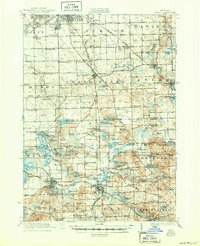
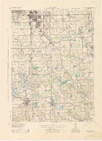
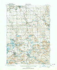
Industrial and agricultural life in Genesee and Oakland counties centers around the Shiawassee River and a network of early 20th-century transportation. The United Electric Railway parallels the Detroit and Pontiac Road, reflecting the era of interurban travel that connected smaller settlements like Grand Blanc and Goodrich to the growing city of Flint. Further south, the Grand Trunk Railway and Pere Marquette Railway converge at Holly, a vital rail junction surrounded by glacial lakes including Long Lake and Squaw Lake.
Find a feature on this map
160 named features on this map. Tap any name to fly to it.
Don’t see what you’re looking for? This feature index may not catch every label — zoom into the map to look around manually.
Map Details
Editions of this 1920 Holly Map
This is the sole edition of this map. No revisions or reprints were ever made.