
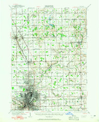
1920 Map of Flint
USGS Topo · Published 1920About this map
The Flint metropolitan area and its surrounding townships emerge here as a dense industrial and agricultural network just after World War I. The city grid is tightly defined, centered on the Flint River and supported by massive infrastructure like the city Waterworks. Transportation is dominated by the Pere Marquette and Grand Trunk railroads, which facilitated the region's rapid transition into a manufacturing powerhouse. Outside the urban core, the landscape is punctuated by a remarkably high density of one-room schoolhouses, such as Beecher School and Rotear School, reflecting the settled rural character of Mt Morris and Genesee townships. Large burial grounds like Gracelawn Cemetery and Glenwood Cemetery mark the community's established history, while smaller settlements like Otisville and Clio serve as outlying local hubs.
Find a feature on this map
74 named features on this map. Tap any name to fly to it.
Don’t see what you’re looking for? This feature index may not catch every label — zoom into the map to look around manually.
Map Details
Editions of this 1920 Flint Map
2 editions found
Other maps of this area

1919 · Saginaw
USGS Topo · 1:62,500

1919 · Burt
USGS Topo · 1:62,500

1920 · Holly
USGS Topo · 1:62,500

1921 · Burt
USGS Topo · 1:62,500

1922 · Holly
USGS Topo · 1:62,500

1922 · Durand
USGS Topo · 1:62,500

1922 · Flint
USGS Topo · 1:62,500

1941 · Saginaw
USGS Topo · 1:62,500

1943 · Holly
USGS Topo · 1:62,500

1943 · Burt
USGS Topo · 1:62,500