Loading...
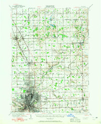
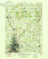
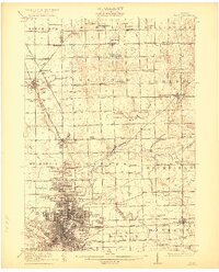
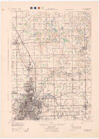
Loading map...1920 Map of Flint
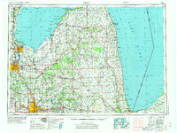
USGS Topo · Published 1965About this map
The industrial hub of Flint and its surrounding townships are documented here during a period of significant growth and rural organization. This survey, conducted at the close of the 1910s, highlights the dense street grid of the city, extending north toward Gracelawn Cemetery and south past the Waterworks. The Flint River meanders through the landscape, flanked by the Grand Trunk RR and Pere Marquette RR, which facilitated the region's manufacturing and transit.
Find a feature on this map
85 named features on this map. Tap any name to fly to it.
Don’t see what you’re looking for? This feature index may not catch every label — zoom into the map to look around manually.
Map Details
Date Portrayed1920
Date Published1965
PublisherU.S. Geological Survey
Map TypeTopographic
Scale1:62,500
Physical Dimensions17 x 20.9 inches
Editions of this 1920 Flint Map
2 editions found
Historical Maps of Flint Through Time
7 maps found


Featured Locations
Source Details
SourceU.S. Geological Survey
CopyrightPublic Domain