2020s Maps of Flint, Michigan
Explore 4 historic maps of Flint from the 2020s. These maps offer a rare glimpse into what life looked like during the 2020s — showing old roads, neighborhoods, homes, and landmarks that have changed or disappeared over time.
Whether you're researching your family's past, planning a metal detecting trip, or studying how Flint's landscape evolved across the 2020s, these high-resolution maps are a powerful tool for exploring the history of this region.
- Focus on a specific era: All maps on this page are from the 2020s, giving you a focused view of this time period.
- See what’s changed: Compare century-old streets, trails, and buildings to today's modern landscape using overlays and satellite layers.
- Research with precision: Use these maps for genealogy, historical research, land use analysis, or educational projects.
- View, download, or print: Maps are fully viewable online in high resolution, and can be downloaded or printed for your own records.
Start exploring Flint's history through authentic maps from the 2020s. This is your window into the past.
Flint, MI maps
(4)- 2023 Map of Davison, 2023 Print
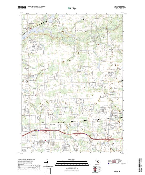 2023 Davison2023 Print · USGSThe Genesee County suburbs of Flint are captured here as they transition from rural townships to established residential centers. Genealogists and historians can trace the developments around Davison and Burton, or locate family sites at Richfield Union Cem and Tanner Cem.
 - 2023 Map of Flint North, 2023 Print
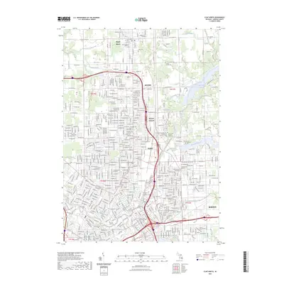 2023 Flint North2023 Print · USGSFlint and its northern suburbs are captured here at a time of urban density and educational growth. Researchers can trace family sites near Old Calvary Catholic Cem or explore the rail and river geography around McGrew Junction and Kearsley Reservoir.
 - 2023 Map of Swartz Creek, 2023 Print
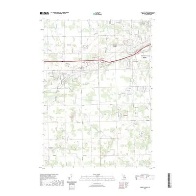 2023 Swartz Creek2023 Print · USGSSwartz Creek and the western outskirts of Flint are shown here as a landscape of suburban growth and vital aviation hubs. Researchers can trace ancestral roots at the Chippewa Nation Indian Cem or Dart Family Cem while exploring watercourses like Kimball Drain.
 - 2023 Map of Flint South, 2023 Print
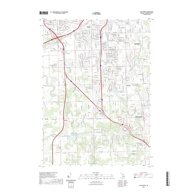 2023 Flint South2023 Print · USGSThe southern suburbs of Flint and the Grand Blanc area are captured in high detail during this era of modern residential and infrastructure development. Researchers can trace family history through numerous burial sites like Crestwood Memorial Cemetery or locate smaller communities such as Whigville and Rankin.
End of results
Showing maps 1-4 of 4
Top cities near Flint
- Burton historical maps
- Springfield Charter Township historical maps
- Fenton historical maps
- Flushing historical maps
- Grand Blanc historical maps
- Atlas historical maps
See more
Top neighborhoods of Flint
- McGrew Junction historical maps
- Brownell Holmes historical maps
- Civic Park historical maps
- East Village Neighborhood historical maps
- Carriage Town historical maps
Frequently asked questions
- What are the different types of historical maps available for Flint?
- What is the oldest map of Flint?
- Where can I purchase historical maps of Flint for my home or office?
- Where can I download high-res historical maps of Flint?
- Are there historical topographic maps available for Flint?
- Is there historical aerial imagery available for Flint?
- Where are historical maps of Flint sourced from?