Old Maps of Chassell Township, Michigan for Hiking & Exploration
Hike through history with 41 historic maps of Chassell Township. Explore old trails, ghost towns, and forgotten backroads — perfect for outdoor adventurers and local explorers.
- Rediscover forgotten places: Map out old mining camps, roads, and footpaths that no longer exist on modern maps.
- Layer with modern tools: Combine with LiDAR or satellite views to plan hikes through historical terrain.
- Made for exploration: Popular among hikers, overlanders, and local history lovers.
Use these maps to find adventure and explore the hidden past of Chassell Township.
Chassell Township, MI maps
(41)- 1915 Map of Houghton
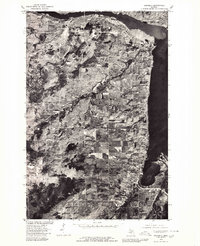
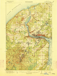 1915 Houghton1915 Print · USGSThe Keweenaw copper boom is in full swing on this map of the Upper Peninsula at the height of its industrial power. Genealogists can trace family roots through company towns like Atlantic Mine, South Range, and Baltic while following the path of the Copper Range RR.4 unique versions available
 - 1946 Map of Chassell, 1966 Print
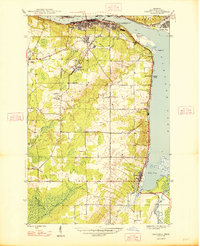
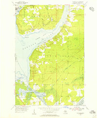
 1946 Chassell1966 Print · USGSThe Copper Country of Michigan's Upper Peninsula comes to life in this mid-century survey of the port towns and mining districts along the Keweenaw. Genealogists and industrial historians can trace the Isle Royale Mine, the campus of the Michigan College of Mining and Technology, and small-town roots in Dodgeville or Atlantic Mine.2 unique versions available
 - 1948 Map of Chassell
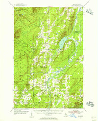
 1948 Chassell1948 Print · USGSThe copper mining heart of the Keweenaw Peninsula is shown here during its mid-century industrial peak. Researchers can trace the rail lines of the Copper Range and locate old mining operations like the Isle Royale Mine and Old Superior Mine.2 unique versions available
 - 1954 Map of Keweenaw Bay, 1956 Print
 1954 Keweenaw Bay1956 Print · USGSThe Keweenaw Peninsula in the mid-fifties shows a shoreline defined by maritime trade and timber history. Researchers can trace the rail lines of the Chicago and North Western and locate landmarks like Pequaming, the Aura Sch (Abandoned), and the Indian Cem.3 unique versions available
 - 1954 Map of Point Mills, 1956 Print
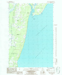
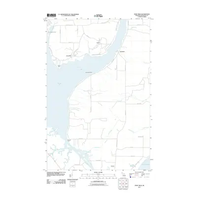
 1954 Point Mills1956 Print · USGSThe Keweenaw Peninsula’s copper country is captured here in the mid-fifties, showing the vital rail and water networks of the era. Genealogists and historians can trace the foundations of local life through the Jacobsville Cem, Sarazin Sch, and the settlements at Dollar Bay and Lahti.3 unique versions available
 - 1954 Map of Pelkie, 1956 Print
 1954 Pelkie1956 Print · USGSThe Baraga County backcountry and Finnish farming settlements of the mid-1950s are preserved here in striking detail. Researchers can trace family roots through sites like Elo Cem and Pelkie Cem or locate old community landmarks like Limestone Mountain.3 unique versions available
 - 1954 Map of Houghton, 1959 Print
 1954 Houghton1959 Print · USGSThe Keweenaw Peninsula copper mining district is shown here at mid-century, centering on the twin cities of Hancock and Houghton. Genealogists and industrial historians can trace the rail lines of the Duluth South Shore and Atlantic Railroad to legacy sites like Champion Mine, Mill Mine Junction, and Pewabic.2 unique versions available
 - 1958 Map of Hancock, 1967 Print
 1958 Hancock1967 Print · USGSThe Keweenaw Peninsula and Isle Royale are seen here during the mid-twentieth century as mining and maritime hubs. Trace the dense town layouts of Hancock and Calumet, or locate remote coastal markers like the Eagle Harbor Lighthouse and Rock of Ages Light.2 unique versions available
 - 1958 Map of Iron River, 1968 Print
 1958 Iron River1968 Print · USGSThe Upper Peninsula in the late fifties is captured here as a landscape of timber, iron, and rail. Genealogists and historians can trace rail stops like Mass Station or explore the coastlines of Lake Gogebic and Keweenaw Bay.3 unique versions available
 - 1960 Map of Iron River
 1960 Iron River1960 Print · USGSThe Upper Peninsula’s western reaches are shown in the late fifties, featuring the industrial infrastructure of the Copper Country and the vast Ottawa National Forest. Researchers can trace the rail lines of the Milwaukee Road through settlements like Bruce Crossing and the White Pine Mine.
 - 1960 Map of Hancock
 1960 Hancock1960 Print · USGSThe Keweenaw Peninsula and Isle Royale are captured in detail during the late 1950s. Researchers can trace copper-mining era settlements like Calumet and Laurium, or locate remote maritime landmarks such as the Isle Royale Lighthouse.
 - 1961 Map of Iron River
 1961 Iron River1961 Print · USGSThe Upper Peninsula and northern Wisconsin are shown here in the early 1960s, a landscape defined by the iron range and vast timberlands. Researchers can trace the legacy of mining and rail transport through Caspian, the Lac Du Flambeau Indian Reservation, and the Milwaukee Road.
 - 1961 Map of Hancock
 1961 Hancock1961 Print · USGSThe Keweenaw Peninsula and Isle Royale are shown here at the start of the 1960s, featuring the region's historic copper mining and maritime infrastructure. Genealogists and researchers can trace local families through settlements like Atlantic Mine and Painesdale, or locate remote landmarks including Rock of Ages Light and Eagle Harbor.
 - 1966 Map of Hancock, 1987 Print
 1966 Hancock1987 Print · USGSThe Keweenaw Peninsula and Isle Royale are captured in the mid-1960s during a pivotal era for Michigan’s Copper Country. Trace the industrial footprint of the SOO LINE through Calumet or locate historic maritime landmarks like Fort Wilkins and Rock of Ages Light.
 - 1967 Map of Iron River, 1968 Print
 1967 Iron River1968 Print · USGSThe Upper Peninsula and northern Wisconsin borderlands are shown here in the late sixties, a landscape of deep woods and iron-country rail lines. Genealogists and historians can trace the lakeside settlements of L'Anse and Ontonagon or follow the Soo Line through towns like Michigamme and Nestoria.
 - 1978 Map of Point Mills, 1980 Print
 1978 Point Mills1980 Print · USGSHoughton County's industrial shoreline and timbered tracts are revealed in this 1970s aerial survey. Trace the footprints of late-century development around Dollar Bay, Senter, and the meeting of the Sturgeon River with the lake.
 - 1978 Map of Chassell, 1980 Print
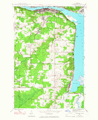
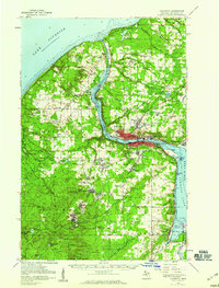
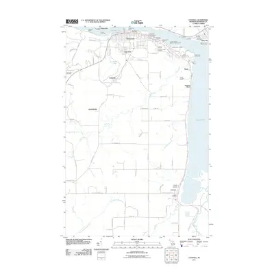
 1978 Chassell1980 Print · USGSHoughton County at the close of the 1970s shows the enduring footprint of the Copper Country's mining and maritime industry. Trace the layout of settlements like Atlantic Mine and Chassell or the waterfront developments along Portage Lake.
 - 1984 Map of Portage Entry, 1986 Print
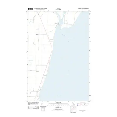
 1984 Portage Entry1986 Print · USGSKeweenaw Bay and the strategic canal entrance at Jacobsville are captured in this mid-eighties survey. Genealogists and local historians can trace the foundations of Jacobsville and Klingville, locate the Portage Entry Lighthouse, and find the historic Crebassa Latitude Post.
 - 1985 Map of Otter Lake
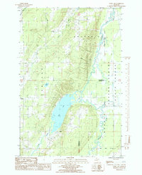 1985 Otter Lake1985 Print · USGSThe Copper Country wilderness comes into focus in the mid-1980s, showing a landscape defined by the winding Sturgeon River and the forested border of Baraga County. Researchers can trace the rural communities of Tapiola and Askel or follow the old industrial grades through the Copper State Forest.
 - 1985 Map of Hancock
 1985 Hancock1985 Print · USGSThe Keweenaw Peninsula in the mid-1980s reveals a landscape shaped by copper and the Great Lakes. You can trace the industrial legacy of the region through the Quincy Mine, the Old RR Grade, and old cemeteries like Forest Hill Cem.3 unique versions available
 - 1991 Map of L'Anse
 1991 L'Anse1991 Print · USGSUpper Peninsula life in the early nineties centered on the waters of Keweenaw Bay and the timber-rich highlands of the Huron Mountains. Genealogists and researchers can trace the rail-and-road connections between L'Anse, Baraga, and smaller communities like Pequaming and Assinins.2 unique versions available
 - 2011 Map of Otter Lake, 2011 Print
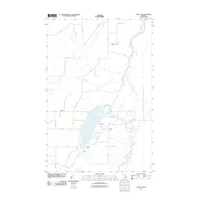 2011 Otter Lake2011 Print · USGSCovers Chassell Township, including Baraga Township, Portage Township, and other nearby areas
 - 2011 Map of Chassell, 2011 Print
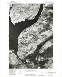
 2011 Chassell2011 Print · USGSCovers Chassell Township, including Houghton, Hancock, and other nearby areas
 - 2011 Map of Portage Entry, 2011 Print
 2011 Portage Entry2011 Print · USGSCovers Chassell Township, including Baraga Township, Torch Lake Township, and other nearby areas
 - 2011 Map of Point Mills, 2011 Print
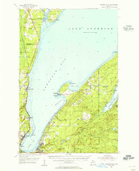
 2011 Point Mills2011 Print · USGSCovers Chassell Township, including Senter, Torch Lake Township, and other nearby areas
Showing maps 1-25 of 41
Top cities near Chassell Township
- Houghton historical maps
- Hancock historical maps
- L'Anse historical maps
- Chassell historical maps
- Baraga historical maps
- Lake Linden historical maps
See more
Top neighborhoods of Chassell Township
Frequently asked questions
- What are the different types of historical maps available for Chassell Township?
- What is the oldest map of Chassell Township?
- Where can I purchase historical maps of Chassell Township for my home or office?
- Where can I download high-res historical maps of Chassell Township?
- Are there historical topographic maps available for Chassell Township?
- Is there historical aerial imagery available for Chassell Township?
- Where are historical maps of Chassell Township sourced from?