Loading...
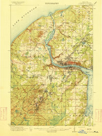
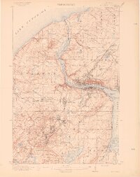
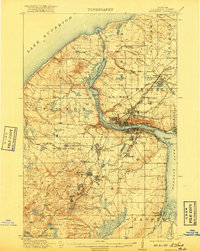
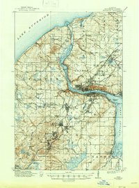
Loading map...1915 Map of Houghton
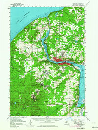
USGS Topo · Published 1915About this map
Copper mining operations define the landscape of the Keweenaw Peninsula during this era of industrial peak. The twin cities of Houghton and Hancock anchor the region, connected by the intensive activity along Portage Lake and the Portage Lake Ship Canal. To the south and north, a dense network of specialized railroads, including the Copper Range RR and the Mineral Range RR, services numerous company towns and mine sites such as Atlantic Mine, Trimountain, and Painesdale.
Find a feature on this map
80 named features on this map. Tap any name to fly to it.
Don’t see what you’re looking for? This feature index may not catch every label — zoom into the map to look around manually.
Map Details
Date Portrayed1915
Date Published1915
PublisherU.S. Geological Survey
Map TypeTopographic
Scale1:62,500
Physical Dimensions14.8 x 19.8 inches
Editions of this 1915 Houghton Map
4 editions found
Historical Maps of Houghton Through Time
Featured Locations
- Hancock, MI
- Houghton, MI
- South Range, Adams Township
- Chassell, Chassell Township
- Hurontown, Portage Township
Source Details
SourceU.S. Geological Survey
CopyrightPublic Domain