
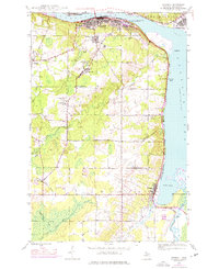
1946 Map of Chassell
USGS Topo · Published 1966About this map
Houghton and Hancock anchor the northern edge of this copper country survey, where the industry's footprint is visible through the Isle Royale Mine and Old Superior Mine. The landscape is defined by the heavy infrastructure of the Duluth South Shore and Atlantic and Copper Range railroads, which hug the shores of Portage Lake and Pike Bay.
Find a feature on this map
32 named features on this map. Tap any name to fly to it.
Don’t see what you’re looking for? This feature index may not catch every label — zoom into the map to look around manually.
Map Details
Editions of this 1946 Chassell Map
2 editions found
Other maps of this area

1915 · Houghton
USGS Topo · 1:62,500

1946 · Hancock
USGS Topo · 1:24,000

1946 · South Range
USGS Topo · 1:24,000

1946 · Laurium
USGS Topo · 1:24,000

1948 · South Range
USGS Topo · 1:24,000

1948 · Laurium
USGS Topo · 1:24,000

1948 · Hancock
USGS Topo · 1:24,000

1948 · Chassell
USGS Topo · 1:24,000

1954 · Oskar
USGS Topo · 1:24,000

1954 · Keweenaw Bay
USGS Topo · 1:62,500