
1946 Map of South Range
USGS Topo · Published 1966About this map
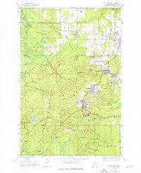
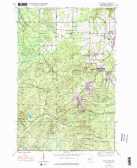
Mining operations and company towns dominate the Copper Country landscape in this post-war record of Houghton County. The Copper Range railroad network threads together industrial hubs like Atlantic Mine, Painesdale, and Trimountain, revealing the infrastructure of the Keweenaw Peninsula's mineral economy. Beyond the clustered settlements of South Range and Baltic, the terrain is defined by rugged topography and a series of water bodies including Lake Perrault and Elevenmile Lake. The presence of the Globe Mine and Champion Mine alongside landmarks such as the Trimountain Fire Tower and Mountain View Cem provides a detailed look at the interface between the region’s intensive industrial legacy and its natural environment, from the Salmon Trout River to the drainage of the Little Otter River.
Find a feature on this map
26 named features on this map. Tap any name to fly to it.
Don’t see what you’re looking for? This feature index may not catch every label — zoom into the map to look around manually.
Map Details
Editions of this 1946 South Range Map
3 editions found
Other maps of this area

1915 · Houghton
USGS Topo · 1:62,500

1946 · Hancock
USGS Topo · 1:24,000

1946 · Chassell
USGS Topo · 1:24,000

1948 · South Range
USGS Topo · 1:24,000

1948 · Hancock
USGS Topo · 1:24,000

1948 · Chassell
USGS Topo · 1:24,000

1954 · Graveraet River
USGS Topo · 1:24,000

1954 · Oskar
USGS Topo · 1:24,000

1954 · Beacon Hill
USGS Topo · 1:24,000

1954 · Pelkie
USGS Topo · 1:62,500