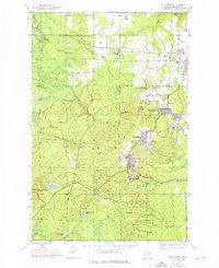
1946 Map of South Range
USGS Topo · Published 1976About this map
South Range and the surrounding Copper Country settlements are captured here in a transition period between their industrial peak and modern revitalization. The landscape is defined by the legacy of the Copper Range Railroad, seen through the Old Railroad Grade and active paths that once served the heavy mining operations at Champion Mine and Globe Mine. Dense settlement clusters at Painesdale and Trimountain reflect the organized company-town planning typical of the Keweenaw Peninsula, while the Mountain View Cem serves as a silent record of the families who settled this upland terrain.
Find a feature on this map
29 named features on this map. Tap any name to fly to it.
Don’t see what you’re looking for? This feature index may not catch every label — zoom into the map to look around manually.
Map Details
Editions of this 1946 South Range Map
3 editions found
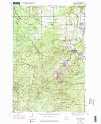
Other maps of this area

1915 · Houghton
USGS Topo · 1:62,500

1946 · Hancock
USGS Topo · 1:24,000

1946 · Chassell
USGS Topo · 1:24,000

1946 · South Range
USGS Topo · 1:24,000

1948 · South Range
USGS Topo · 1:24,000

1948 · Hancock
USGS Topo · 1:24,000

1948 · Chassell
USGS Topo · 1:24,000

1954 · Graveraet River
USGS Topo · 1:24,000

1954 · Oskar
USGS Topo · 1:24,000

1954 · Beacon Hill
USGS Topo · 1:24,000