
1946 Map of Laurium
USGS Topo · Published 1974About this map
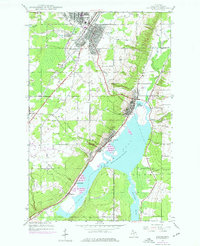
Industrial Copper Country infrastructure centers on the shores of Torch Lake in this mid-century survey. The landscape is defined by the heavy presence of the Mineral Range Railroad and the Copper Range Railroad, which connected the massive stamping facilities at Quincy Mill to the mining hubs of Calumet, Osceola, and Laurium. The shoreline settlements of Lake Linden, Hubbell, and Mason reveal a densely packed residential and industrial interface along the waterfront, served by local institutions like the Osceola Sch and Calvary Cem.
Find a feature on this map
28 named features on this map. Tap any name to fly to it.
Don’t see what you’re looking for? This feature index may not catch every label — zoom into the map to look around manually.
Map Details
Editions of this 1946 Laurium Map
2 editions found
Other maps of this area

1915 · Houghton
USGS Topo · 1:62,500

1941 · Ahmeek
USGS Topo · 1:31,680

1941 · Mohawk
USGS Topo · 1:31,680

1946 · Hancock
USGS Topo · 1:24,000

1946 · Chassell
USGS Topo · 1:24,000

1946 · Mohawk
USGS Topo · 1:24,000

1946 · Muggun Creek
USGS Topo · 1:24,000

1946 · Ahmeek
USGS Topo · 1:24,000

1947 · Ahmeek
USGS Topo · 1:24,000
1948 · Muggun Creek
USGS Topo · 1:24,000