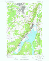
1946 Map of Laurium
USGS Topo · Published 1976About this map
Torch Lake and its industrial shoreline define this section of Michigan's Copper Country, reflecting a landscape shaped by mineral extraction and transportation. The settlements of Laurium and Calumet stand as major population centers, while the western shore of the lake is marked by significant mining infrastructure like the Quincy Mill. The transit network is dense with history, featuring the Soo Line Railroad and the Hecla and Calumet lines that once moved ore and timber through the region.
Find a feature on this map
30 named features on this map. Tap any name to fly to it.
Don’t see what you’re looking for? This feature index may not catch every label — zoom into the map to look around manually.
Map Details
Editions of this 1946 Laurium Map
2 editions found
Other maps of this area

1915 · Houghton
USGS Topo · 1:62,500

1941 · Ahmeek
USGS Topo · 1:31,680

1941 · Mohawk
USGS Topo · 1:31,680

1946 · Hancock
USGS Topo · 1:24,000

1946 · Chassell
USGS Topo · 1:24,000

1946 · Mohawk
USGS Topo · 1:24,000

1946 · Muggun Creek
USGS Topo · 1:24,000

1946 · Ahmeek
USGS Topo · 1:24,000

1946 · Laurium
USGS Topo · 1:24,000

1947 · Ahmeek
USGS Topo · 1:24,000