
Loading...
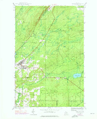
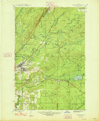
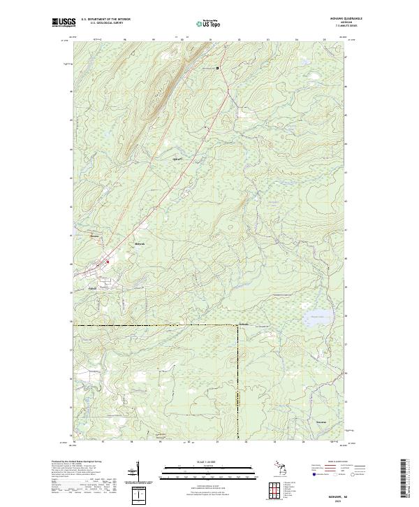
Loading map...1941 Map of Mohawk
USGS Topo · Published 1941About this map
Copper mining operations and railroad networks define this landscape on the Keweenaw Peninsula during the late 1930s. The settlement of Mohawk serves as a primary hub, situated near the Gratiot Mine and the waters of Seneca Lake. The industrial footprint of the era is clearly visible through the branching lines of the Keweenaw Central Railroad and the Copper Range Railroad, which facilitated the movement of ore through the townships of Allouez and Calumet.
Find a feature on this map
30 named features on this map. Tap any name to fly to it.
Don’t see what you’re looking for? This feature index may not catch every label — zoom into the map to look around manually.
Map Details
Date Portrayed1941
Date Published1941
PublisherU.S. Geological Survey
Map TypeTopographic
Scale1:31,680
Physical Dimensions15.3 x 20 inches
Editions of this 1941 Mohawk Map
This is the sole edition of this map. No revisions or reprints were ever made.
Historical Maps of Houghton Township Through Time
9 maps found
Featured Locations
- Schoolcraft Township, MI
- Calumet Township, MI
- Houghton Township, MI
- Allouez Township, MI
- Seneca, Allouez Township
Source Details
SourceU.S. Geological Survey
CopyrightPublic Domain