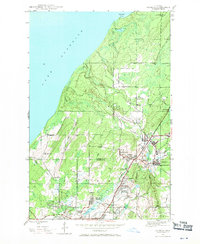
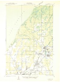
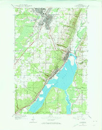
1946 Map of Ahmeek
USGS Topo · Published 1971About this map
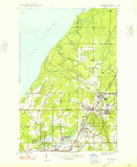
The copper-rich landscape of the Keweenaw Peninsula unfolds here in the mid-1940s, centered on the mining communities of Ahmeek and Allouez. The industrial character of the region is defined by the Calumet and Hecla Range and the Copper Range RR, which connected deep shaft operations like the Ahmeek Mine and Seneca Mine to processing centers. Beyond the industrial grid, the map shows the transition from organized settlements like Copper City and Centennial Heights to the wild shoreline at Sevenmile Point along Lake Superior. Local institutional life is marked by the Lake Shore Sch and several prominent burial grounds, including Lakeview Cem, serving the dense cluster of mining locations. The map illustrates the specific layout of company-built housing and infrastructure that characterized this portion of the Copper Country before the major decline of the local mining industry.
Find a feature on this map
36 named features on this map. Tap any name to fly to it.
Don’t see what you’re looking for? This feature index may not catch every label — zoom into the map to look around manually.
Map Details
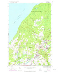
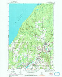
Editions of this 1946 Ahmeek Map
3 editions found
Other maps of this area
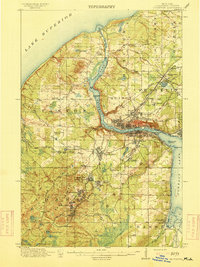
1915 · Houghton
USGS Topo · 1:62,500
1941 · Ahmeek
USGS Topo · 1:31,680

1941 · Mohawk
USGS Topo · 1:31,680
1946 · Phoenix
USGS Topo · 1:24,000
1946 · Hancock
USGS Topo · 1:24,000
1946 · Mohawk
USGS Topo · 1:24,000

1946 · Muggun Creek
USGS Topo · 1:24,000
1946 · Laurium
USGS Topo · 1:24,000

1947 · Phoenix
USGS Topo · 1:24,000
1947 · Ahmeek
USGS Topo · 1:24,000
Featured Places
- Allouez, Allouez Township
- Calumet, Calumet Township
- Copper City, Calumet Township
- Ahmeek, Allouez Township
- Schoolcraft Township, MI