
1946 Map of Muggun Creek
USGS Topo · Published 1967About this map
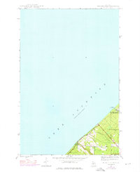
Lake Superior dominates this mid-century topographic study, which captures the immediate shoreline interface of Michigan's Copper Country. The terrain transitions from the deep waters of the lake to the elevated plateau of the Keweenaw Peninsula, marked by the boundary between Keweenaw Co and Houghton Co. Infrastructure along this northern coast is centered on municipal utility sites, including the Tamarack Waterworks and Calumet Waterworks, which were vital for the industrial and residential needs of the nearby mining districts.
Find a feature on this map
8 named features on this map. Tap any name to fly to it.
Don’t see what you’re looking for? This feature index may not catch every label — zoom into the map to look around manually.
Map Details
Editions of this 1946 Muggun Creek Map
2 editions found
Other maps of this area

1915 · Houghton
USGS Topo · 1:62,500

1941 · Ahmeek
USGS Topo · 1:31,680

1946 · Hancock
USGS Topo · 1:24,000

1946 · Ahmeek
USGS Topo · 1:24,000

1946 · Laurium
USGS Topo · 1:24,000

1947 · Ahmeek
USGS Topo · 1:24,000
1948 · Muggun Creek
USGS Topo · 1:24,000

1948 · Laurium
USGS Topo · 1:24,000

1948 · Hancock
USGS Topo · 1:24,000

1954 · Oskar
USGS Topo · 1:24,000