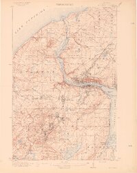
1915 Map of Houghton
USGS Topo · Published 1915About this map
Hancock and Houghton anchor this industrial landscape along the banks of Portage Lake, serving as the urban core of Michigan’s Copper Country during its early 20th-century peak. The terrain is defined by the heavy footprint of the mining industry, with the Franklin Mine and Rhode Island Mine dotting the ridges of the Osceola and Calumet districts. A complex web of rail infrastructure, including the Copper Range RR and the Quincy and Torch Lake RR, weaves through the hills to connect extraction sites with processing facilities and shipping points like Dollar Bay.
Find a feature on this map
70 named features on this map. Tap any name to fly to it.
Don’t see what you’re looking for? This feature index may not catch every label — zoom into the map to look around manually.
Map Details
Editions of this 1915 Houghton Map
4 editions found
Other maps of this area

1915 · Houghton
USGS Topo · 1:62,500

1941 · Ahmeek
USGS Topo · 1:31,680

1946 · Hancock
USGS Topo · 1:24,000

1946 · Chassell
USGS Topo · 1:24,000

1946 · South Range
USGS Topo · 1:24,000

1946 · Muggun Creek
USGS Topo · 1:24,000

1946 · Ahmeek
USGS Topo · 1:24,000

1946 · Laurium
USGS Topo · 1:24,000

1947 · Ahmeek
USGS Topo · 1:24,000

1948 · South Range
USGS Topo · 1:24,000