2020s Maps of Torch Lake Township, Michigan
Explore 7 historic maps of Torch Lake Township from the 2020s. These maps offer a rare glimpse into what life looked like during the 2020s — showing old roads, neighborhoods, homes, and landmarks that have changed or disappeared over time.
Whether you're researching your family's past, planning a metal detecting trip, or studying how Torch Lake Township's landscape evolved across the 2020s, these high-resolution maps are a powerful tool for exploring the history of this region.
- Focus on a specific era: All maps on this page are from the 2020s, giving you a focused view of this time period.
- See what’s changed: Compare century-old streets, trails, and buildings to today's modern landscape using overlays and satellite layers.
- Research with precision: Use these maps for genealogy, historical research, land use analysis, or educational projects.
- View, download, or print: Maps are fully viewable online in high resolution, and can be downloaded or printed for your own records.
Start exploring Torch Lake Township's history through authentic maps from the 2020s. This is your window into the past.
Torch Lake Township, MI maps
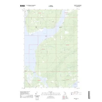
(7)- 2023 Map of Gay, 2023 Print
 2023 Gay2023 Print · USGSThe Keweenaw Peninsula coastline comes into focus in this recent survey of the Michigan lakefront. Researchers can trace the roads and waterways around Gay and Snowshoe, including Traverse Point and the winding course of the Tobacco River.
 - 2023 Map of Rice Lake, 2023 Print
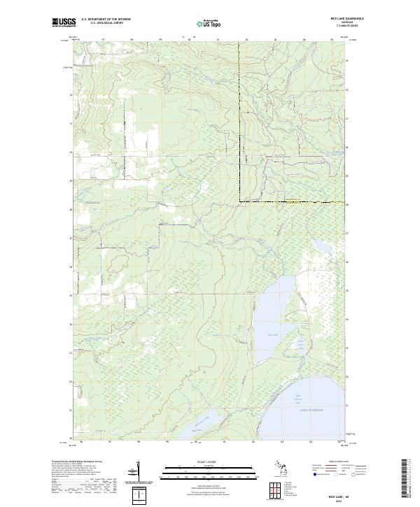 2023 Rice Lake2023 Print · USGSThe Keweenaw Peninsula shoreline meets the deep waters of Lake Superior in this modern survey of the Michigan coast. Researchers can trace the drainage of the Traverse River into Little Traverse Bay and locate landmarks like Rice Lake and Mud Lake.
 - 2023 Map of Traverse Island, 2023 Print
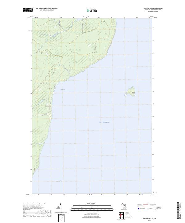 2023 Traverse Island2023 Print · USGSThe eastern shores of the Keweenaw Peninsula are captured in this modern survey, highlighting the remote coastal landscape and offshore features. Researchers can locate the settlement of Rabbit Bay and trace waterways like Ye Chance Creek and Traverse Island.
 - 2023 Map of Chassell, 2023 Print
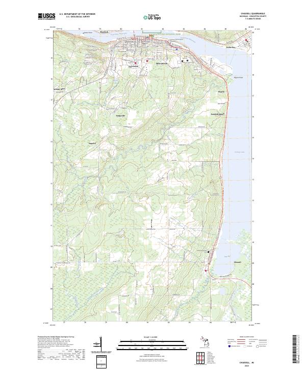 2023 Chassell2023 Print · USGSThe Copper Country is captured in this modern survey of the Houghton and Hancock area during the early 2020s. Researchers can locate family roots at Forest Hill Cem or trace the industrial history of Atlantic Mine and the shoreline at Dollar Bay.
 - 2023 Map of Portage Entry, 2023 Print
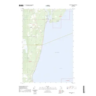 2023 Portage Entry2023 Print · USGSThe Keweenaw Peninsula meets the lake at this modern survey of the Portage River's mouth and the surrounding wetlands. Genealogists and local historians can trace family-named areas like Korhonen and Helberg alongside the coastal settlements of Jacobsville and White City.
 - 2023 Map of Point Mills, 2023 Print
 2023 Point Mills2023 Print · USGSThe Keweenaw Peninsula's eastern shore comes to life in this contemporary study of the waterways connecting Portage Lake to Lake Superior. Trace local family roots near Dollar Bay, Point Mills, and the historic Jacobsville Cem.
 - 2023 Map of Laurium, 2023 Print
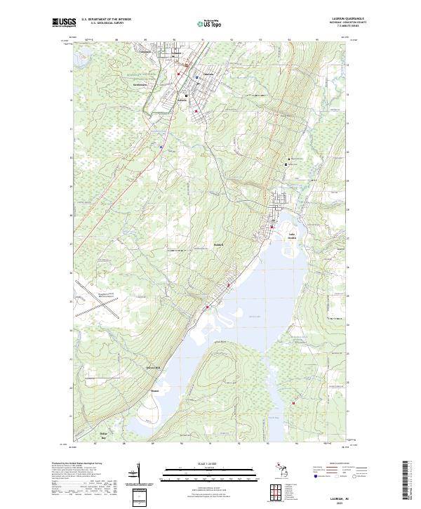 2023 Laurium2023 Print · USGSUpper Peninsula copper mining country is mapped in detail during the early 2020s, showing the enduring footprints of industrial centers. Researchers can trace historic neighborhoods from Calumet and Laurium down to the milling sites at Quincy Mill and Torch Lake.
End of results
Showing maps 1-7 of 7
Top cities near Torch Lake Township
- Houghton historical maps
- Hancock historical maps
- Laurium historical maps
- Osceola historical maps
- Chassell historical maps
- Allouez historical maps
See more
Top neighborhoods of Torch Lake Township
- Dreamland historical maps
- White City historical maps
- Senter historical maps
- Chickensville Location historical maps
- Jacobsville historical maps
- Point Mills historical maps
See more
Frequently asked questions
- What are the different types of historical maps available for Torch Lake Township?
- What is the oldest map of Torch Lake Township?
- Where can I purchase historical maps of Torch Lake Township for my home or office?
- Where can I download high-res historical maps of Torch Lake Township?
- Are there historical topographic maps available for Torch Lake Township?
- Is there historical aerial imagery available for Torch Lake Township?
- Where are historical maps of Torch Lake Township sourced from?