Old Maps of Caseville, Michigan for Genealogy
Trace your family roots with 9 historic maps of Caseville. These high-res maps reveal old neighborhoods, homesites, landmarks, and streets — helping you uncover where your ancestors lived and how the area evolved over time.
- Explore historic neighborhoods: Identify where your relatives may have lived in the 1800s or 1900s.
- Compare maps over time: Trace the changes in streets, buildings, and landmarks for multi-generational research.
- Perfect for genealogy & ancestry research: Used by family historians and researchers to map out lineage and migration.
These maps are an incredible resource for exploring your personal connection to Caseville's past.
Caseville, MI maps
(9)- 1954 Map of Flint, 1968 Print
 1954 Flint1968 Print · USGSThe industrial corridor and fertile Thumb region of Michigan come alive in this mid-century survey. Genealogists and historians can trace the rail networks of the Grand Trunk, locate established settlements like Bad Axe and Sandusky, or explore the 1950s shoreline along Saginaw Bay.4 unique versions available
 - 1958 Map of Flint
 1958 Flint1958 Print · USGSThe Michigan Thumb and the Saginaw Valley are captured here during the height of the post-war industrial era. Researchers can trace the complex rail networks of the Grand Trunk Western or locate mid-century landmarks like Lakeport State Park and the port at Bay City.2 unique versions available
 - 1970 Map of Caseville, 1972 Print
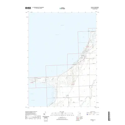
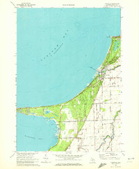 1970 Caseville1972 Print · USGSThe Lake Huron shoreline at Caseville is meticulously documented here during the early 1970s. Trace the coastal growth from Oak Point down to Wildfowl Bay, locating local landmarks like Caseville Cem and St Johns Ch.
 - 1984 Map of Bay City, 1985 Print
 1984 Bay City1985 Print · USGSSaginaw Bay and the surrounding Michigan thumb region are captured in the mid-1980s, showing a landscape defined by industrial riverfronts and expanding lakeside parks. Researchers can trace family roots through landmarks like Floral Gardens Cem or follow the Chesapeake and Ohio rail lines through towns like Bad Axe and Pigeon.
 - 2011 Map of Caseville, 2011 Print
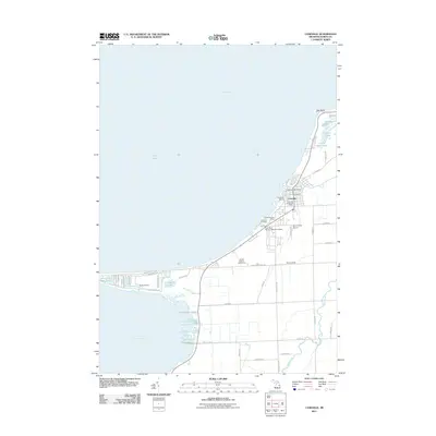 2011 Caseville2011 Print · USGSCovers Caseville, including McKinley Township, Caseville Township, and other nearby areas
 - 2014 Map of Caseville, 2014 Print
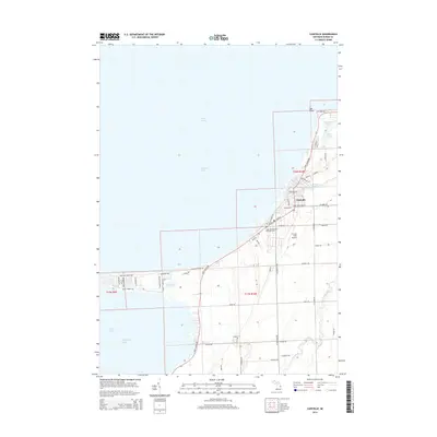 2014 Caseville2014 Print · USGSCovers Caseville, including McKinley Township, Caseville Township, and other nearby areas
 - 2017 Map of Caseville, 2017 Print
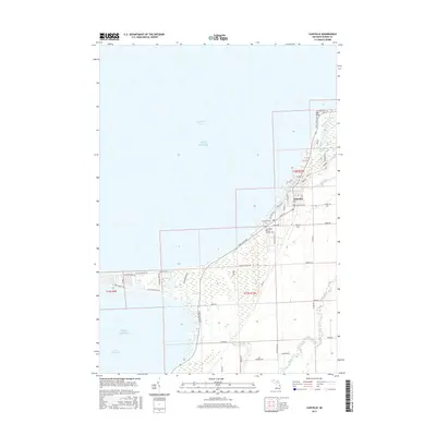 2017 Caseville2017 Print · USGSCovers Caseville, including McKinley Township, Caseville Township, and other nearby areas
 - 2019 Map of Caseville, 2019 Print
 2019 Caseville2019 Print · USGSCovers Caseville, including McKinley Township, Caseville Township, and other nearby areas
 - 2023 Map of Caseville, 2023 Print
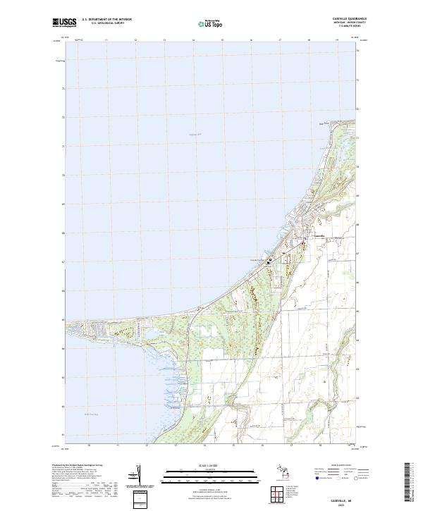 2023 Caseville2023 Print · USGSThe Lake Huron shoreline comes into focus in this recent survey of the area where the Pigeon River empties into Saginaw Bay. Genealogists and local historians can trace the community layout of Caseville, including the locations of Caseville Township Cem and Saint Roch Cem.
End of results
Showing maps 1-9 of 9
Top cities near Caseville
- Sebewaing historical maps
- Pigeon historical maps
- Elkton historical maps
- Bay Port historical maps
- Owendale historical maps
Frequently asked questions
- What are the different types of historical maps available for Caseville?
- What is the oldest map of Caseville?
- Where can I purchase historical maps of Caseville for my home or office?
- Where can I download high-res historical maps of Caseville?
- Are there historical topographic maps available for Caseville?
- Is there historical aerial imagery available for Caseville?
- Where are historical maps of Caseville sourced from?