2020s Maps of Sheridan Township, Michigan
Explore 4 historic maps of Sheridan Township from the 2020s. These maps offer a rare glimpse into what life looked like during the 2020s — showing old roads, neighborhoods, homes, and landmarks that have changed or disappeared over time.
Whether you're researching your family's past, planning a metal detecting trip, or studying how Sheridan Township's landscape evolved across the 2020s, these high-resolution maps are a powerful tool for exploring the history of this region.
- Focus on a specific era: All maps on this page are from the 2020s, giving you a focused view of this time period.
- See what’s changed: Compare century-old streets, trails, and buildings to today's modern landscape using overlays and satellite layers.
- Research with precision: Use these maps for genealogy, historical research, land use analysis, or educational projects.
- View, download, or print: Maps are fully viewable online in high resolution, and can be downloaded or printed for your own records.
Start exploring Sheridan Township's history through authentic maps from the 2020s. This is your window into the past.
Sheridan Township, MI maps
(4)- 2023 Map of New Greenleaf, 2023 Print
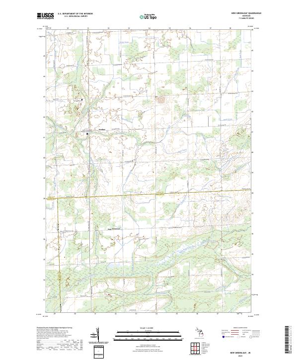 2023 New Greenleaf2023 Print · USGSAgricultural life in the Michigan Thumb is captured here at the triple-county boundary of Huron, Sanilac, and Tuscola. Family historians can trace local landmarks like Saint Columbkille Roman Catholic Cem and settlements at Ivanhoe and New Greenleaf.
 - 2023 Map of Bad Axe West, 2023 Print
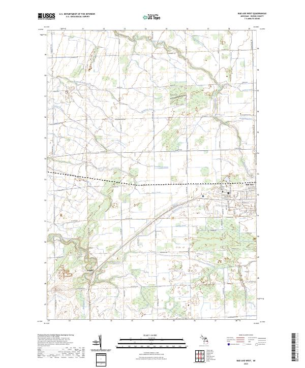 2023 Bad Axe West2023 Print · USGSAgricultural land in the Michigan Thumb is defined by its drainage network and section-line roads in this modern survey. Researchers can locate the Colfax Township Cem, the settlement of Popple, and the path of the Pinnebog River.
 - 2023 Map of Bad Axe East, 2023 Print
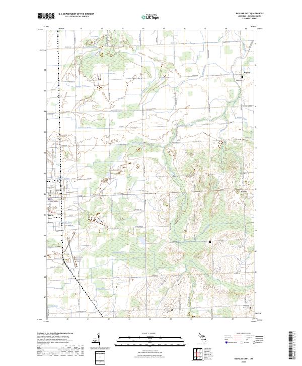 2023 Bad Axe East2023 Print · USGSThe eastern surroundings of Bad Axe and the agricultural heart of Huron County are captured here in the early twenty-first century. Genealogists can locate several rural burial sites, including Saint Joseph Cem, Verona Cem, and Most Holy Trinity Cem.
 - 2023 Map of Ubly, 2023 Print
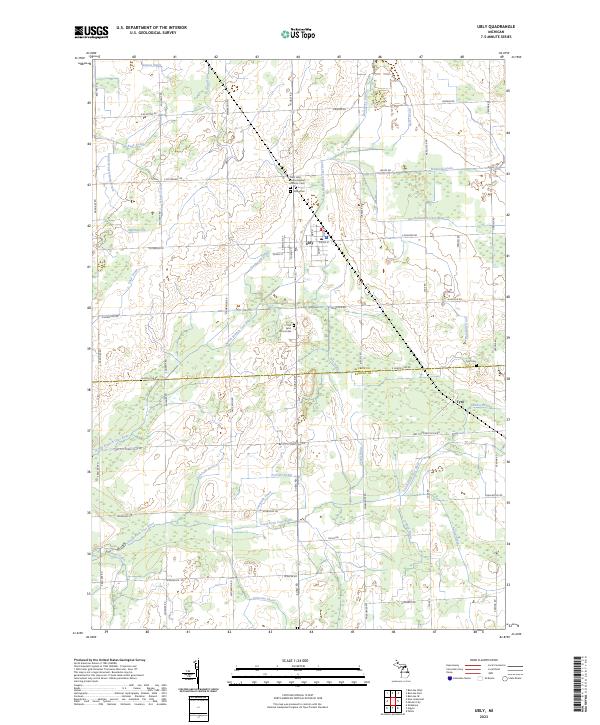 2023 Ubly2023 Print · USGSUbly and the surrounding farm country of Huron County are captured in this contemporary survey. Historians and genealogists can trace the rural landscape through family-named landmarks like Osentoski Branch and resting places such as Valley Cem and Tyre Cem.
End of results
Showing maps 1-4 of 4
Top cities near Sheridan Township
- Bad Axe historical maps
- Cass City historical maps
- Pigeon historical maps
- Verona historical maps
- Elmwood historical maps
- Caseville historical maps
See more
Top neighborhoods of Sheridan Township
Frequently asked questions
- What are the different types of historical maps available for Sheridan Township?
- What is the oldest map of Sheridan Township?
- Where can I purchase historical maps of Sheridan Township for my home or office?
- Where can I download high-res historical maps of Sheridan Township?
- Are there historical topographic maps available for Sheridan Township?
- Is there historical aerial imagery available for Sheridan Township?
- Where are historical maps of Sheridan Township sourced from?