Old Maps of Hazel, Iron River Township for Academic Research
Study the evolution of Hazel with 14 high-resolution historic maps. Whether you're teaching, researching, or modeling changes in land use, these maps provide essential visual documentation of urban, environmental, and geographic change.
- Analyze long-term change: Track patterns in development, transportation, and natural features.
- Ideal for environmental or urban studies: Support academic projects with primary historical map data.
- Use in the classroom or lab: Educators and researchers rely on these maps to bring historical context to life.
These maps are a powerful tool for teaching, research, and visualizing how Hazel has changed over the decades.
Hazel, Iron River Township maps
(14)- 1898 Map of Iron River, 1899 Print
 1898 Iron River1899 Print · USGSUpper Peninsula mining and timber frontiers emerge in the 1890s as railroads begin connecting remote outposts. Researchers can trace early rail lines through Iron River and Stambaugh or locate former stations and camps at Hazle, Atkinson, and Saunders.2 unique versions available
 - 1945 Map of Gibbs City
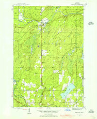 1945 Gibbs City1945 Print · USGSIron County, Michigan, is depicted here at the end of the Second World War as a landscape of timber, rail, and small forest settlements. Genealogists and historians can locate the Finnish Lutheran Ch, trace the Chicago and Northwestern line, and find sites like Camp Gibbs.2 unique versions available
 - 1946 Map of Gibbs City
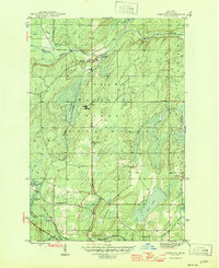 1946 Gibbs City1946 Print · USGSIron County’s timber and rail landscape is captured here in the mid-1940s, centered on the confluence of the Paint River. Genealogists and historians can trace the Chicago and Northwestern tracks through Hazel and locate the Finnish Lutheran Ch near the banks of the South Branch Iron River.2 unique versions available
 - 1958 Map of Iron River, 1968 Print
 1958 Iron River1968 Print · USGSThe Upper Peninsula in the late fifties is captured here as a landscape of timber, iron, and rail. Genealogists and historians can trace rail stops like Mass Station or explore the coastlines of Lake Gogebic and Keweenaw Bay.3 unique versions available
 - 1960 Map of Iron River
 1960 Iron River1960 Print · USGSThe Upper Peninsula’s western reaches are shown in the late fifties, featuring the industrial infrastructure of the Copper Country and the vast Ottawa National Forest. Researchers can trace the rail lines of the Milwaukee Road through settlements like Bruce Crossing and the White Pine Mine.
 - 1961 Map of Iron River
 1961 Iron River1961 Print · USGSThe Upper Peninsula and northern Wisconsin are shown here in the early 1960s, a landscape defined by the iron range and vast timberlands. Researchers can trace the legacy of mining and rail transport through Caspian, the Lac Du Flambeau Indian Reservation, and the Milwaukee Road.
 - 1967 Map of Iron River, 1968 Print
 1967 Iron River1968 Print · USGSThe Upper Peninsula and northern Wisconsin borderlands are shown here in the late sixties, a landscape of deep woods and iron-country rail lines. Genealogists and historians can trace the lakeside settlements of L'Anse and Ontonagon or follow the Soo Line through towns like Michigamme and Nestoria.
 - 1989 Map of Iron River, 1990 Print
 1989 Iron River1990 Print · USGSUpper Peninsula mining and timber lands are documented here in the late 1980s, showcasing the region's industrial and natural interface. Researchers can trace the iron heritage through the Monongahela Mine and local junctions like Kelso Junction and Amasa.
 - 1999 Map of Gibbs City, 2004 Print
 1999 Gibbs City2004 Print · USGSIron County at the turn of the millennium shows a landscape defined by timber history and Northwoods recreation. Genealogists and historians can locate the Finnish Lutheran Ch, the Old Atkinson Dam Site, and the historic site of Gibbs City.
 - 2011 Map of Gibbs City, 2011 Print
 2011 Gibbs City2011 Print · USGSCovers Hazel, including Bates Township, Gibbs City, and other nearby areas
 - 2014 Map of Gibbs City, 2014 Print
 2014 Gibbs City2014 Print · USGSCovers Hazel, including Bates Township, Gibbs City, and other nearby areas
 - 2017 Map of Gibbs City, 2017 Print
 2017 Gibbs City2017 Print · USGSCovers Hazel, including Bates Township, Gibbs City, and other nearby areas
 - 2019 Map of Gibbs City, 2019 Print
 2019 Gibbs City2019 Print · USGSCovers Hazel, including Bates Township, Gibbs City, and other nearby areas
 - 2023 Map of Gibbs City, 2023 Print
 2023 Gibbs City2023 Print · USGSUpper Peninsula timberlands and river systems are documented in detail here during the early twenty-first century. Researchers can trace the network of forest trails and water bodies surrounding Gibbs City and Hazel, including Iron Lake and the Paint Wild and Scenic River.
End of results
Showing maps 1-14 of 14
Top cities near Hazel
- Iron River historical maps
- Phelps historical maps
- Stambaugh historical maps
- Caspian historical maps
- Florence historical maps
- Hiles historical maps
See more
Frequently asked questions
- What are the different types of historical maps available for Hazel?
- What is the oldest map of Hazel?
- Where can I purchase historical maps of Hazel for my home or office?
- Where can I download high-res historical maps of Hazel?
- Are there historical topographic maps available for Hazel?
- Is there historical aerial imagery available for Hazel?
- Where are historical maps of Hazel sourced from?