Old Maps of Pemberthy Crossing, Bear Lake Township for Hiking & Exploration
Hike through history with 11 historic maps of Pemberthy Crossing. Explore old trails, ghost towns, and forgotten backroads — perfect for outdoor adventurers and local explorers.
- Rediscover forgotten places: Map out old mining camps, roads, and footpaths that no longer exist on modern maps.
- Layer with modern tools: Combine with LiDAR or satellite views to plan hikes through historical terrain.
- Made for exploration: Popular among hikers, overlanders, and local history lovers.
Use these maps to find adventure and explore the hidden past of Pemberthy Crossing.
Pemberthy Crossing, Bear Lake Township maps
(11)- 1949 Map of Black Creek, 1953 Print
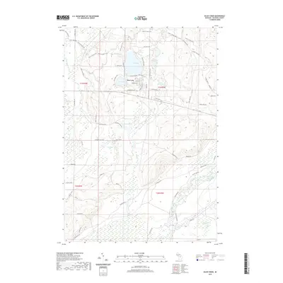
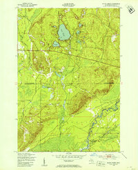 1949 Black Creek1953 Print · USGSUpper Michigan's interior is seen here just after the war, where state forest lands and military training grounds meet. Researchers can trace the path of the Manistee River and locate specific sites like Camp Grayling or the series of Upper Black Lakes.4 unique versions available
 - 1949 Map of Fletcher, 1955 Print
 1949 Fletcher1955 Print · USGSUpper Michigan's glacial interior is revealed here just after the war, showing the early infrastructure of the Camp Grayling area. Genealogists and historians can trace the New York Central tracks, the settlement of Fletcher, and local landmarks like Beaver Creek Cem.
 - 1954 Map of Traverse City, 1965 Print
 1954 Traverse City1965 Print · USGSNorthern Michigan’s vast lakeshores and timberlands are captured here in the mid-fifties, showing the region before the modern interstate era. Genealogists and researchers can trace rail connections like the Detroit and Mackinac RR or find old communities such as Suttons Bay, Elk Rapids, and Prudenville.4 unique versions available
 - 1958 Map of Traverse City
 1958 Traverse City1958 Print · USGSNorthern Lower Michigan was a landscape of vast state forests and burgeoning lakeside retreats in the late fifties. Genealogists and historians can trace the rail corridors of the Ann Arbor RR and find established settlements from Elk Rapids to Houghton Lake.2 unique versions available
 - 1983 Map of Grayling, 1984 Print
 1983 Grayling1984 Print · USGSIn the early eighties, this Northern Michigan interior was a hub for forestry, military training, and river recreation. Researchers can trace the sprawling boundaries of Camp Grayling and locate historic markers like Hartwick Pines and Otsego Lake.2 unique versions available
 - 1989 Map of Traverse City, 1990 Print
 1989 Traverse City1990 Print · USGSNorthern Michigan’s lake-country and forest lands are captured in the late eighties as seasonal tourism and timber hubs expanded. Genealogists and historians can trace the routes of the Ann Arbor RR, the boundaries of Camp Grayling, and settlements like Elk Rapids and Manton.
 - 2011 Map of Black Creek, 2011 Print
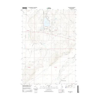
 2011 Black Creek2011 Print · USGSCovers Pemberthy Crossing, including Bear Lake Township, Oliver Township, and other nearby areas
 - 2014 Map of Black Creek, 2014 Print
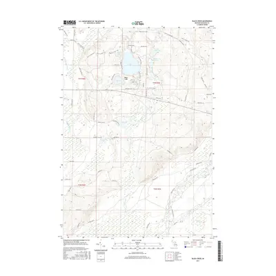
 2014 Black Creek2014 Print · USGSCovers Pemberthy Crossing, including Bear Lake Township, Oliver Township, and other nearby areas
 - 2017 Map of Black Creek, 2017 Print
 2017 Black Creek2017 Print · USGSCovers Pemberthy Crossing, including Bear Lake Township, Oliver Township, and other nearby areas
 - 2019 Map of Black Creek, 2019 Print
 2019 Black Creek2019 Print · USGSCovers Pemberthy Crossing, including Bear Lake Township, Oliver Township, and other nearby areas
 - 2023 Map of Black Creek, 2023 Print
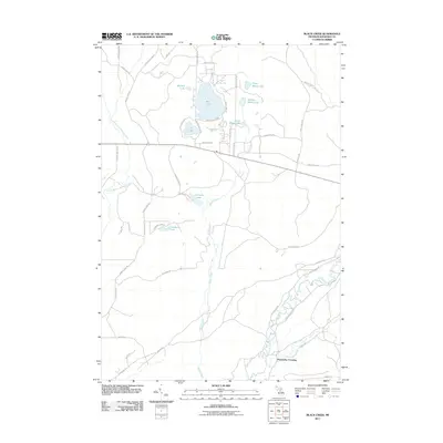
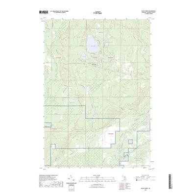 2023 Black Creek2023 Print · USGSKalkaska County's lake-rich landscape is captured here in the early 2020s, showing the intersection of residential lakeside life and military training grounds. You can trace the shorelines of Bear Lake and Cub Lake or explore the vast southern reaches of NG MTC-H Camp Grayling.
End of results
Showing maps 1-11 of 11
Top cities near Pemberthy Crossing
Frequently asked questions
- What are the different types of historical maps available for Pemberthy Crossing?
- What is the oldest map of Pemberthy Crossing?
- Where can I purchase historical maps of Pemberthy Crossing for my home or office?
- Where can I download high-res historical maps of Pemberthy Crossing?
- Are there historical topographic maps available for Pemberthy Crossing?
- Is there historical aerial imagery available for Pemberthy Crossing?
- Where are historical maps of Pemberthy Crossing sourced from?