2020s Maps of Eagle Harbor Township, Michigan
Explore 16 historic maps of Eagle Harbor Township from the 2020s. These maps offer a rare glimpse into what life looked like during the 2020s — showing old roads, neighborhoods, homes, and landmarks that have changed or disappeared over time.
Whether you're researching your family's past, planning a metal detecting trip, or studying how Eagle Harbor Township's landscape evolved across the 2020s, these high-resolution maps are a powerful tool for exploring the history of this region.
- Focus on a specific era: All maps on this page are from the 2020s, giving you a focused view of this time period.
- See what’s changed: Compare century-old streets, trails, and buildings to today's modern landscape using overlays and satellite layers.
- Research with precision: Use these maps for genealogy, historical research, land use analysis, or educational projects.
- View, download, or print: Maps are fully viewable online in high resolution, and can be downloaded or printed for your own records.
Start exploring Eagle Harbor Township's history through authentic maps from the 2020s. This is your window into the past.
Eagle Harbor Township, MI maps
(16)- 2023 Map of Bruneau Creek, 2023 Print
 2023 Bruneau Creek2023 Print · USGSThe Keweenaw Peninsula backcountry in the 2020s remains a terrain of high ridges and winding river systems. Genealogists and researchers can trace the roads around Mount Horace Greeley or follow the waters of Bruneau Creek to Lake Gratiot.
 - 2023 Map of Windigo OE W, 2023 Print
 2023 Windigo OE W2023 Print · USGSIsle Royale in Michigan's Keweenaw County is depicted here in recent years as its northern shoreline meets the international boundary. Genealogists and park enthusiasts can trace the limits of Isle Royale National Park against Lake Superior.
 - 2023 Map of Malone Bay, 2023 Print
 2023 Malone Bay2023 Print · USGSIsle Royale's southern coast is a complex world of rocky islands and deep harbors as it appeared in recent years. Researchers can trace the rugged shoreline from Malone Bay to remote outcrops like Menagerie Island and Stone House Island.
 - 2023 Map of Feldtmann Ridge, 2023 Print
 2023 Feldtmann Ridge2023 Print · USGSIsle Royale remains a pristine wilderness in this recent survey of its southwestern coast and ridges. Hikers and researchers can trace the Feldtmann Ridge Trl past Lake Halloran and identify coastal landmarks like Long Point and Attwood Beach.
 - 2023 Map of Feldtmann Lake, 2023 Print
 2023 Feldtmann Lake2023 Print · USGSIsle Royale's southwestern tip is documented here in the early twenty-first century, showing the intersection of coastal reefs and inland trails. Hikers and researchers can trace the paths between Grace Harbor, the high ground of Feldtmann Ridge, and the shores of Feldtmann Lake.
 - 2023 Map of Sugar Mountain, 2023 Print
 2023 Sugar Mountain2023 Print · USGSThe wilderness of Isle Royale is mapped here in the early twenty-first century, showing the island's high ridges and remote shoreline. Trace the paths of the Island Mine Trl or locate the Isle Royale Cem near the waters of Siskiwit Bay.
 - 2023 Map of Deer Lake, 2023 Print
 2023 Deer Lake2023 Print · USGSThe Keweenaw Peninsula shoreline meets the deep waters of the Great Lakes in this contemporary survey of northern Michigan. Trace the remote waterways of Lake Gratiot, Deer Lake, and Black Rock Point along the jagged coast of Betsy Bay.
 - 2023 Map of Todd Harbor, 2023 Print
 2023 Todd Harbor2023 Print · USGSIsle Royale's rugged northern coast and interior ridges are captured in this contemporary survey of the national park wilderness. Hikers and researchers can trace the paths of the Minong Ridge Trl and Hatchet Lake Trl past landmarks like Mt Siskiwit and Todd Harbor.
 - 2023 Map of Point Houghton, 2023 Print
 2023 Point Houghton2023 Print · USGSKeweenaw County's island wilderness is captured in the early 2020s, showing the intersection of dramatic ridges and the cold waters of Lake Superior. Researchers can trace the rugged shoreline from Fishermans Home Cove to the high vantage of Ishpeming Point.
 - 2023 Map of Little Todd Harbor, 2023 Print
 2023 Little Todd Harbor2023 Print · USGSThe northwestern shores of Isle Royale are captured in this modern survey of Keweenaw County's wilderness. Trace the remote coast from Thomsonite Beach to Little Todd Harbor, following the footpaths of the Minong Ridge Trl through the park.
 - 2023 Map of Windigo, 2023 Print
 2023 Windigo2023 Print · USGSIsle Royale's southwestern tip and the sheltered waters of Washington Harbor are shown here in the 2020s. Hikers and researchers can trace the intricate network of the Minong Ridge Trl and locate remote landmarks like Agate Beach and Windigo.
 - 2023 Map of Feldtmann Lake OE W, 2023 Print
 2023 Feldtmann Lake OE W2023 Print · USGSThe southwestern reaches of Isle Royale appear here in the early twenty-first century, showcasing a preserved wilderness environment. Researchers can locate remote island features like Washington Island, Bottle Island, and the navigational hazards of North Rock.
 - 2023 Map of Point Houghton OE S, 2023 Print
 2023 Point Houghton OE S2023 Print · USGSIsle Royale in the 2020s remains a landscape defined by preservation and Lake Superior isolation. Trace the northern shorelines and interior wetlands near Stickleback Lake and the Isle Royale Wilderness to see this primitive island territory.
 - 2023 Map of Eagle Harbor, 2023 Print
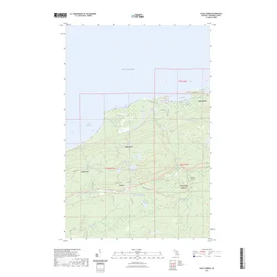 2023 Eagle Harbor2023 Print · USGSUpper Peninsula history comes alive along the Lake Superior coast in this modern survey of Keweenaw County. Researchers can trace the legacy of copper-era settlements and shoreline landmarks, from the streets of Eagle Harbor to the inland grounds of Central and the Pine Grove Cem.
 - 2023 Map of Delaware, 2023 Print
 2023 Delaware2023 Print · USGSKeweenaw Peninsula's rugged northern ridge is captured here in the early twenty-first century. Researchers can trace the legacy of copper mining and remote settlements at Delaware, Mandan, and the lakefront village of Lac La Belle.
 - 2023 Map of Lake Medora, 2023 Print
 2023 Lake Medora2023 Print · USGSThe northern tip of the Keweenaw Peninsula comes into focus in this recent survey of the Copper Harbor region. Local historians can trace mining-era legacies along Washington Mine Rd or explore the grounds of Fort Wilkins State Historic Park and Copper Harbor Cem.
End of results
Showing maps 1-16 of 16
Top neighborhoods of Eagle Harbor Township
- Nepco Camp Number 7 historical maps
- Copper Falls historical maps
- Gratiot Lake Beach historical maps
- Eagle Harbor historical maps
Frequently asked questions
- What are the different types of historical maps available for Eagle Harbor Township?
- What is the oldest map of Eagle Harbor Township?
- Where can I purchase historical maps of Eagle Harbor Township for my home or office?
- Where can I download high-res historical maps of Eagle Harbor Township?
- Are there historical topographic maps available for Eagle Harbor Township?
- Is there historical aerial imagery available for Eagle Harbor Township?
- Where are historical maps of Eagle Harbor Township sourced from?