2020s Maps of Sherman Township, Michigan
Explore 6 historic maps of Sherman Township from the 2020s. These maps offer a rare glimpse into what life looked like during the 2020s — showing old roads, neighborhoods, homes, and landmarks that have changed or disappeared over time.
Whether you're researching your family's past, planning a metal detecting trip, or studying how Sherman Township's landscape evolved across the 2020s, these high-resolution maps are a powerful tool for exploring the history of this region.
- Focus on a specific era: All maps on this page are from the 2020s, giving you a focused view of this time period.
- See what’s changed: Compare century-old streets, trails, and buildings to today's modern landscape using overlays and satellite layers.
- Research with precision: Use these maps for genealogy, historical research, land use analysis, or educational projects.
- View, download, or print: Maps are fully viewable online in high resolution, and can be downloaded or printed for your own records.
Start exploring Sherman Township's history through authentic maps from the 2020s. This is your window into the past.
Sherman Township, MI maps
(6)- 2023 Map of Bruneau Creek, 2023 Print
 2023 Bruneau Creek2023 Print · USGSThe Keweenaw Peninsula backcountry in the 2020s remains a terrain of high ridges and winding river systems. Genealogists and researchers can trace the roads around Mount Horace Greeley or follow the waters of Bruneau Creek to Lake Gratiot.
 - 2023 Map of Mohawk, 2023 Print
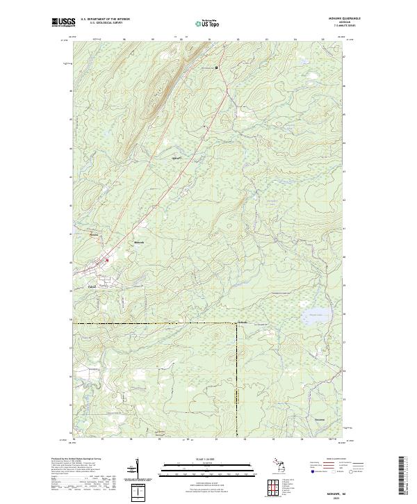 2023 Mohawk2023 Print · USGSThe northern Keweenaw Peninsula is captured here in the early twenty-first century, showing the enduring layout of historic mining communities. Researchers can trace local lineage through the Cliff Catholic Cem or explore the street grids of Mohawk and Fulton.
 - 2023 Map of Gay, 2023 Print
 2023 Gay2023 Print · USGSThe Keweenaw Peninsula coastline comes into focus in this recent survey of the Michigan lakefront. Researchers can trace the roads and waterways around Gay and Snowshoe, including Traverse Point and the winding course of the Tobacco River.
 - 2023 Map of Rice Lake, 2023 Print
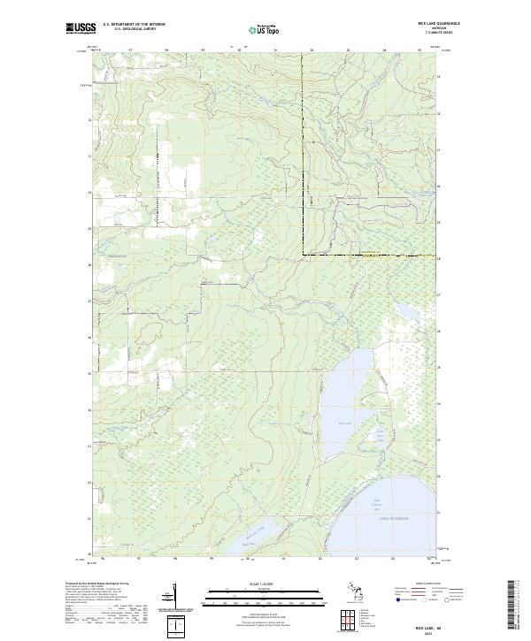 2023 Rice Lake2023 Print · USGSThe Keweenaw Peninsula shoreline meets the deep waters of Lake Superior in this modern survey of the Michigan coast. Researchers can trace the drainage of the Traverse River into Little Traverse Bay and locate landmarks like Rice Lake and Mud Lake.
 - 2023 Map of Deer Lake, 2023 Print
 2023 Deer Lake2023 Print · USGSThe Keweenaw Peninsula shoreline meets the deep waters of the Great Lakes in this contemporary survey of northern Michigan. Trace the remote waterways of Lake Gratiot, Deer Lake, and Black Rock Point along the jagged coast of Betsy Bay.
 - 2023 Map of Gay OE E, 2023 Print
 2023 Gay OE E2023 Print · USGSThe open expanse of Lake Superior defines this maritime survey of the Upper Peninsula at the start of the 2020s. Researchers can trace the unique aquatic boundary convergence of Keweenaw Co., Houghton Co., and Marquette Co. over the water.
End of results
Showing maps 1-6 of 6
Top cities near Sherman Township
- Laurium historical maps
- Allouez historical maps
- Lake Linden historical maps
- Eagle Harbor historical maps
- Copper City historical maps
- Ahmeek historical maps
Top neighborhoods of Sherman Township
Frequently asked questions
- What are the different types of historical maps available for Sherman Township?
- What is the oldest map of Sherman Township?
- Where can I purchase historical maps of Sherman Township for my home or office?
- Where can I download high-res historical maps of Sherman Township?
- Are there historical topographic maps available for Sherman Township?
- Is there historical aerial imagery available for Sherman Township?
- Where are historical maps of Sherman Township sourced from?