1900s (20th Century) Maps of Imlay City, Michigan
Explore 12 historic maps of Imlay City from the 1900s (20th Century). These maps offer a rare glimpse into what life looked like during the 1900s — showing old roads, neighborhoods, homes, and landmarks that have changed or disappeared over time.
Whether you're researching your family's past, planning a metal detecting trip, or studying how Imlay City's landscape evolved across the 1900s, these high-resolution maps are a powerful tool for exploring the history of this region.
- Focus on a specific era: All maps on this page are from the 1900s, giving you a focused view of this time period.
- See what’s changed: Compare century-old streets, trails, and buildings to today's modern landscape using overlays and satellite layers.
- Research with precision: Use these maps for genealogy, historical research, land use analysis, or educational projects.
- View, download, or print: Maps are fully viewable online in high resolution, and can be downloaded or printed for your own records.
Start exploring Imlay City's history through authentic maps from the 1900s. This is your window into the past.
Imlay City, MI maps
(12)- 1945 Map of Almont
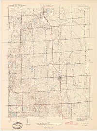 1945 Almont1945 Print · USGSAlmont and Dryden are the focal points of this mid-1940s survey of the Lapeer and Macomb county borders during a time of rural schoolhouses and family farms. Researchers can locate many local landmarks like Ferguson Cem, Rider Sch, and Neil Sch along the upper reaches of the Belle River.2 unique versions available
 - 1954 Map of Detroit
 1954 Detroit1954 Print · USGSThe Detroit metro and its Ontario neighbors are shown at the height of the mid-century industrial era, just as the suburbs were rapidly expanding. Researchers can trace the massive rail networks of the Wabash Railroad or locate landmarks like Grosse Ile and Selfridge Air Force Base.
 - 1954 Map of Flint, 1968 Print
 1954 Flint1968 Print · USGSThe industrial corridor and fertile Thumb region of Michigan come alive in this mid-century survey. Genealogists and historians can trace the rail networks of the Grand Trunk, locate established settlements like Bad Axe and Sandusky, or explore the 1950s shoreline along Saginaw Bay.4 unique versions available
 - 1958 Map of Flint
 1958 Flint1958 Print · USGSThe Michigan Thumb and the Saginaw Valley are captured here during the height of the post-war industrial era. Researchers can trace the complex rail networks of the Grand Trunk Western or locate mid-century landmarks like Lakeport State Park and the port at Bay City.2 unique versions available
 - 1961 Map of Detroit, 1973 Print
 1961 Detroit1973 Print · USGSThe international border between Michigan and Ontario was a bustling industrial corridor in the early sixties. Researchers can trace the transit networks and riverfront infrastructure connecting Detroit to Windsor via the Detroit-Windsor Tunnel and major air hubs like Willow Run Airport.2 unique versions available
 - 1963 Map of Imlay City, 1964 Print
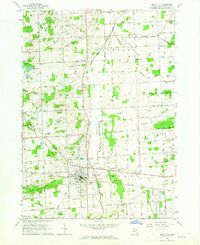 1963 Imlay City1964 Print · USGSImlay City and the surrounding Lapeer County farmlands are captured in the early sixties at a peak of rural development. Genealogists can locate family landmarks like Folsom Sch, Imlay Cem, and the Pentecostal Ch along the historic Grand Trunk Railroad route.2 unique versions available
 - 1965 Map of Detroit
 1965 Detroit1965 Print · USGSThe industrial corridor between Michigan and Ontario is captured here at mid-century, showing the dense rail and river networks of the Great Lakes. Local historians can trace the paths of the Grand Trunk Western RR and locate key landmarks like Selfridge Air Force Base and Grosse Ile.
 - 1968 Map of Almont, 1970 Print
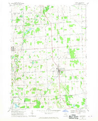 1968 Almont1970 Print · USGSLapeer County is captured in the late sixties as a traditional farming landscape beginning to modernize. Genealogists and historians can trace family-named sites like Hunters Cem and Hough Cem or follow the Grand Trunk Western rail line through Dryden.2 unique versions available
 - 1984 Map of Flint, 1985 Print
 1984 Flint1985 Print · USGSThe industrial corridor between Flint and Saginaw is captured here during the mid-1980s, showcasing a landscape of growing suburbs and preserved wildlands. Researchers can trace the Grand Trunk Western RR or locate local landmarks like St Johns Ch and Flint Memorial Park Cem.
 - 1985 Map of Pontiac
 1985 Pontiac1985 Print · USGSSoutheast Michigan in the mid-1980s shows a landscape of growing suburban corridors and expansive public parklands. Genealogists and local historians can trace the footprint of rail lines like the Grand Trunk Western or locate family sites near Oakwood Cem and White Chapel Cem.2 unique versions available
 - 1990 Map of Flint, 1991 Print
 1990 Flint1991 Print · USGSThe Flint and Saginaw corridors are captured here in the early nineties, showing a landscape defined by heavy industry and rural expanses. Genealogists and historians can trace the rail lines of the Penn Central RR, visit Flint Memorial Park Cem, or explore the limits of Zilwaukee.
 - 1991 Map of Almont
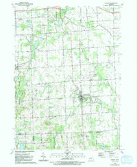 1991 Almont1991 Print · USGSAlmont and Dryden are captured in the early nineties at the junction of Lapeer, Macomb, and Oakland counties. Researchers can trace land use through numerous family burial sites like Hough Cem and community landmarks such as Gen Squier Mem Park.
End of results
Showing maps 1-12 of 12
Top cities near Imlay City
- Orion Charter Township historical maps
- Washington Charter Township historical maps
- Oxford Charter Township historical maps
- Oakland Charter Township historical maps
- Lapeer historical maps
- Addison Township historical maps
See more
Frequently asked questions
- What are the different types of historical maps available for Imlay City?
- What is the oldest map of Imlay City?
- Where can I purchase historical maps of Imlay City for my home or office?
- Where can I download high-res historical maps of Imlay City?
- Are there historical topographic maps available for Imlay City?
- Is there historical aerial imagery available for Imlay City?
- Where are historical maps of Imlay City sourced from?