Old Maps of Empire Township, Michigan for Genealogy
Trace your family roots with 22 historic maps of Empire Township. These high-res maps reveal old neighborhoods, homesites, landmarks, and streets — helping you uncover where your ancestors lived and how the area evolved over time.
- Explore historic neighborhoods: Identify where your relatives may have lived in the 1800s or 1900s.
- Compare maps over time: Trace the changes in streets, buildings, and landmarks for multi-generational research.
- Perfect for genealogy & ancestry research: Used by family historians and researchers to map out lineage and migration.
These maps are an incredible resource for exploring your personal connection to Empire Township's past.
Empire Township, MI maps
(22)- 1954 Map of Traverse City, 1965 Print
 1954 Traverse City1965 Print · USGSNorthern Michigan’s vast lakeshores and timberlands are captured here in the mid-fifties, showing the region before the modern interstate era. Genealogists and researchers can trace rail connections like the Detroit and Mackinac RR or find old communities such as Suttons Bay, Elk Rapids, and Prudenville.4 unique versions available
 - 1954 Map of Manitowoc, 1968 Print
 1954 Manitowoc1968 Print · USGSLake Michigan served as a vital transit corridor in the mid-fifties, with car and auto ferries linking the industrial ports of Wisconsin to the Michigan timberlands. Genealogists and maritime historians can trace active ferry routes like the Ann Arbor Railway Car and Auto Ferry and locate early settlements from Brussels to Algoma.2 unique versions available
 - 1957 Map of Empire, 1958 Print
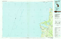
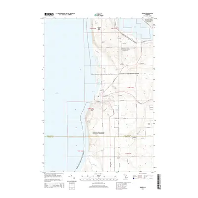
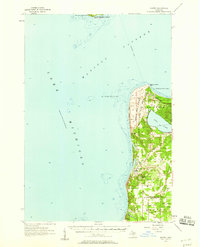 1957 Empire1958 Print · USGSThe Leelanau Peninsula coast in the mid-fifties shows a rugged landscape of shifting sands and Cold War defense. Genealogists and historians can locate Maple Grove Cem, the sprawling Sleeping Bear Dunes, and the Empire Air Force Station.2 unique versions available
 - 1957 Map of Maple City, 1958 Print
 1957 Maple City1958 Print · USGSLeelanau County's lake-studded landscape is captured here in the late fifties, showing the interplay between forest and settlement. Researchers can trace family sites at St Joseph Cem & Ch, the North Unity Sch, and Port Oneida.3 unique versions available
 - 1958 Map of Traverse City
 1958 Traverse City1958 Print · USGSNorthern Lower Michigan was a landscape of vast state forests and burgeoning lakeside retreats in the late fifties. Genealogists and historians can trace the rail corridors of the Ann Arbor RR and find established settlements from Elk Rapids to Houghton Lake.2 unique versions available
 - 1958 Map of Manitowoc
 1958 Manitowoc1958 Print · USGSLake Michigan and its shorelines are shown in the late fifties when maritime transport defined the region. Researchers can trace the routes of the Ann Arbor Railroad Ferry or locate old settlements like St. Nazianz, Rostock, and Two Creeks.
 - 1983 Map of Empire, 1984 Print
 1983 Empire1984 Print · USGSThe Leelanau shoreline comes into focus in the early eighties as the national lakeshore took its modern shape. Researchers can trace local landmarks like Maple Grove Cem and the Radar Station or follow the path of Otter Creek through the dunes.2 unique versions available
 - 1983 Map of Burdickville, 1984 Print
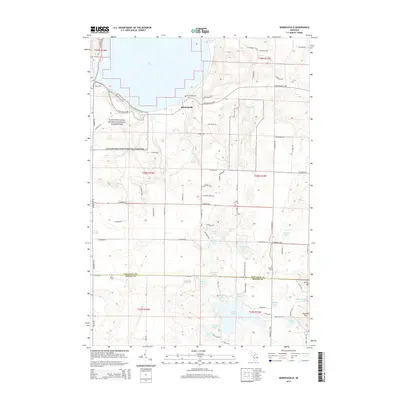
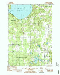 1983 Burdickville1984 Print · USGSLeelanau County's lake-rich landscape is captured here in the early eighties, centered on the community of Burdickville and the southern shores of Glen Lake. Researchers can trace rural cemeteries like Tobin Cem and Wilson Cem, alongside local landmarks like Glen Lake Sch.3 unique versions available
 - 1983 Map of Traverse City, 1984 Print
 1983 Traverse City1984 Print · USGSTraverse City and the surrounding bay country are captured in the early eighties as the region balanced its timber heritage with growing conservation. Genealogists and local historians can trace the rail lines of the Ann Arbor RR through settlements like Kingsley and Fife Lake.2 unique versions available
 - 1984 Map of Crystal Lake, 1985 Print
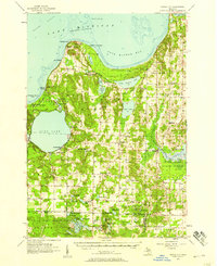
 1984 Crystal Lake1985 Print · USGSCoastal Benzie County in the mid-1980s reveals a landscape shaped by shifting dunes and deep glacial lakes. Researchers can trace the development of lakeside towns like Frankfort and Elberta, or locate landmarks such as the Point Betsie Lighthouse.2 unique versions available
 - 1989 Map of Traverse City, 1990 Print
 1989 Traverse City1990 Print · USGSNorthern Michigan’s lake-country and forest lands are captured in the late eighties as seasonal tourism and timber hubs expanded. Genealogists and historians can trace the routes of the Ann Arbor RR, the boundaries of Camp Grayling, and settlements like Elk Rapids and Manton.
 - 1998 Map of Empire, 2001 Print
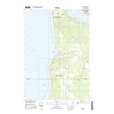
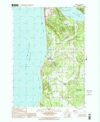 1998 Empire2001 Print · USGSCoastal Leelanau County is captured here at the close of the millennium, showing the established bounds of the Sleeping Bear Dunes National Lakeshore. Local historians can trace family sites near Maple Grove Cem, the village of Empire, and the high ridges of Shauger Hill.
 - 2011 Map of Empire, 2011 Print
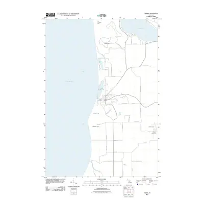 2011 Empire2011 Print · USGSCovers Empire Township, including Empire, Glen Arbor Township, and other nearby areas
 - 2011 Map of Burdickville, 2011 Print
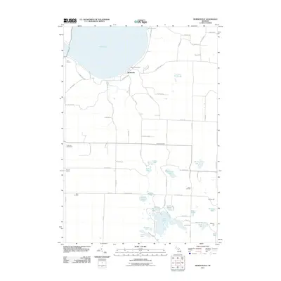 2011 Burdickville2011 Print · USGSCovers Empire Township, including Glen Arbor Township, Kasson Township, and other nearby areas
 - 2014 Map of Empire, 2014 Print
 2014 Empire2014 Print · USGSCovers Empire Township, including Empire, Glen Arbor Township, and other nearby areas
 - 2014 Map of Burdickville, 2014 Print
 2014 Burdickville2014 Print · USGSCovers Empire Township, including Glen Arbor Township, Kasson Township, and other nearby areas
 - 2017 Map of Empire, 2017 Print
 2017 Empire2017 Print · USGSCovers Empire Township, including Empire, Glen Arbor Township, and other nearby areas
 - 2017 Map of Burdickville, 2017 Print
 2017 Burdickville2017 Print · USGSCovers Empire Township, including Glen Arbor Township, Kasson Township, and other nearby areas
 - 2019 Map of Empire, 2019 Print
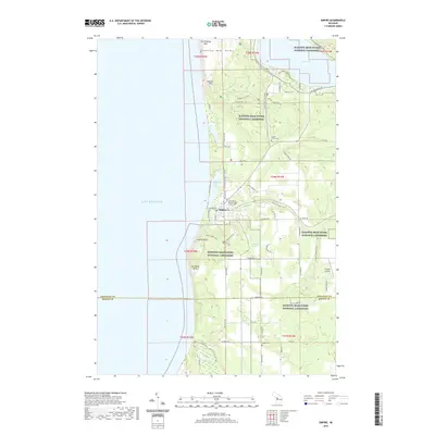 2019 Empire2019 Print · USGSCovers Empire Township, including Empire, Glen Arbor Township, and other nearby areas
 - 2019 Map of Burdickville, 2019 Print
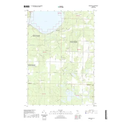 2019 Burdickville2019 Print · USGSCovers Empire Township, including Glen Arbor Township, Kasson Township, and other nearby areas
 - 2023 Map of Empire, 2023 Print
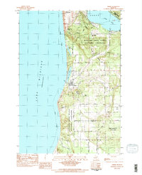
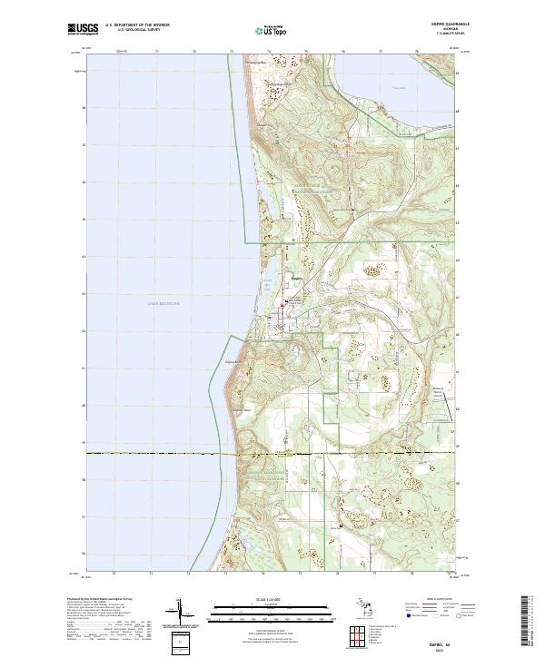 2023 Empire2023 Print · USGSThe Lake Michigan shoreline and the towering dunes of Leelanau County are captured here in the early twenty-first century. Genealogists and local historians can trace the community of Empire through sites like Saint Philip Neri Catholic Church, Maple Grove Cem, and Platte Cem.
 - 2023 Map of Burdickville, 2023 Print
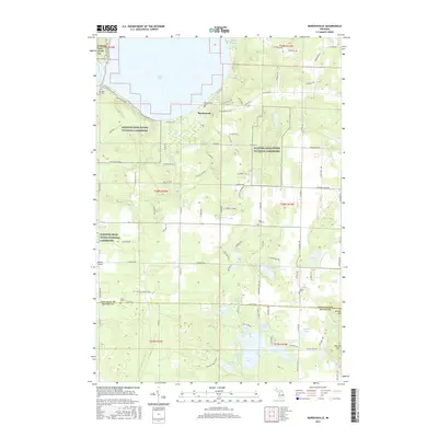
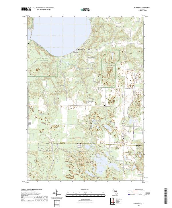 2023 Burdickville2023 Print · USGSLeelanau County in the early 2020s remains a landscape of inland waters and protected dunes centered on Burdickville. Researchers can trace local heritage through several burial grounds like Wilson Cem or locate aviation history at the William B Bolton Airport.
End of results
Showing maps 1-22 of 22
Top cities near Empire Township
- Long Lake Township historical maps
- Green Lake Township historical maps
- Frankfort historical maps
- Grant Township historical maps
- Benzonia historical maps
- Hardwood Acres historical maps
See more
Top neighborhoods of Empire Township
Frequently asked questions
- What are the different types of historical maps available for Empire Township?
- What is the oldest map of Empire Township?
- Where can I purchase historical maps of Empire Township for my home or office?
- Where can I download high-res historical maps of Empire Township?
- Are there historical topographic maps available for Empire Township?
- Is there historical aerial imagery available for Empire Township?
- Where are historical maps of Empire Township sourced from?