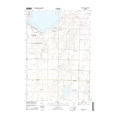
2014 Map of Burdickville
USGS Topo · Published 2014About this map
Glen Lake and the eastern reaches of Sleeping Bear Dunes National Lakeshore dominate the northwestern corner of this Michigan landscape. The small settlement of Burdickville serves as a hub near the southern shore of the lake, surrounded by a dense network of glacial water bodies including Pearl Lake, Lime Lake, and Armstrong Lake. The map reveals a high density of small family or community burial grounds, such as Tobin Cem, Rose Hill Cem, and Burdickville Cem, which are invaluable for genealogical research in this part of Leelanau County. The terrain transitions south into Benzie County, marked by the prominent elevations of Varney Hill and Warner Hill. This 2014 survey documents a region defined by its reliance on the water and the preservation of its natural dune-and-lake environment.
Find a feature on this map
86 named features on this map. Tap any name to fly to it.
Don’t see what you’re looking for? This feature index may not catch every label — zoom into the map to look around manually.
Map Details
Editions of this 2014 Burdickville Map
This is the sole edition of this map. No revisions or reprints were ever made.
Other maps of this area

1954 · Traverse City
USGS Topo · 1:250,000

1954 · Manitowoc
USGS Topo · 1:250,000

1956 · Thompsonville
USGS Topo · 1:62,500

1956 · Frankfort
USGS Topo · 1:62,500

1957 · Empire
USGS Topo · 1:62,500

1957 · Maple City
USGS Topo · 1:62,500

1958 · Traverse City
USGS Topo · 1:250,000

1958 · Manitowoc
USGS Topo · 1:250,000

1976 · Thompsonville NE
USGS Topo · 1:24,000

1976 · Thompsonville NW
USGS Topo · 1:24,000