Old Maps of Glen Arbor Township, Michigan
Explore 56 old maps of Glen Arbor Township, spanning from 1954 to today. These high-resolution historic maps reveal how streets, neighborhoods, landmarks, and natural features evolved over time — perfect for genealogy, metal detecting, research, and local history exploration.
What you can do with these maps:
- See how Glen Arbor Township changed over time: Compare historical maps to modern-day views to trace roads, homesites, rail lines & more.
- View detailed metadata: Each map includes creators, publishers, year, scale, and archive source.
- Overlay maps with satellite & LiDAR: Visualize the past alongside modern tools to explore terrain & human change.
- Trusted historical sources: Maps sourced from the USGS, Library of Congress, and other archives.
- Access maps your way: View online, download high-res files, or order prints for personal or research use.
Start exploring old maps of Glen Arbor Township to uncover forgotten places, hidden landmarks, and the deep history beneath your feet.
Glen Arbor Township, MI maps
(56)- 1954 Map of Traverse City, 1965 Print
 1954 Traverse City1965 Print · USGSNorthern Michigan’s vast lakeshores and timberlands are captured here in the mid-fifties, showing the region before the modern interstate era. Genealogists and researchers can trace rail connections like the Detroit and Mackinac RR or find old communities such as Suttons Bay, Elk Rapids, and Prudenville.4 unique versions available
 - 1954 Map of Escanaba, 1967 Print
 1954 Escanaba1967 Print · USGSThe Upper Peninsula and Door County shorelines meet here in the mid-fifties, showing the vital maritime and timber networks of the Great Lakes. Researchers can trace historic rail lines, old fire lookouts like the Stonington Fire Tower, and island settlements such as Washington Island.2 unique versions available
 - 1954 Map of Manitowoc, 1968 Print
 1954 Manitowoc1968 Print · USGSLake Michigan served as a vital transit corridor in the mid-fifties, with car and auto ferries linking the industrial ports of Wisconsin to the Michigan timberlands. Genealogists and maritime historians can trace active ferry routes like the Ann Arbor Railway Car and Auto Ferry and locate early settlements from Brussels to Algoma.2 unique versions available
 - 1956 Map of North Manitou, 1958 Print
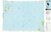
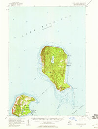 1956 North Manitou1958 Print · USGSNorth Manitou and South Manitou islands are captured here in the mid-fifties, showing a landscape of maritime navigation and quiet interior lakes. Researchers can locate the N Manitou I Sch (Abandoned), the S Manitou I Cem, and the vital Lifeboat Station.2 unique versions available
 - 1957 Map of Escanaba
 1957 Escanaba1957 Print · USGSThe Upper Peninsula and Door County shorelines meet in the mid-fifties, capturing a landscape of timber, iron, and maritime trade. Genealogists and local historians can trace the Chicago & North Western RR through settlements like Hermansville or locate St Vitals Church and the Potawatome Indian Reservation.
 - 1957 Map of Empire, 1958 Print
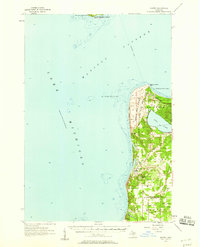 1957 Empire1958 Print · USGSThe Leelanau Peninsula coast in the mid-fifties shows a rugged landscape of shifting sands and Cold War defense. Genealogists and historians can locate Maple Grove Cem, the sprawling Sleeping Bear Dunes, and the Empire Air Force Station.2 unique versions available
 - 1957 Map of Maple City, 1958 Print
 1957 Maple City1958 Print · USGSLeelanau County's lake-studded landscape is captured here in the late fifties, showing the interplay between forest and settlement. Researchers can trace family sites at St Joseph Cem & Ch, the North Unity Sch, and Port Oneida.3 unique versions available
 - 1958 Map of Escanaba
 1958 Escanaba1958 Print · USGSNorthern Lake Michigan maritime commerce and timberlands are captured here in the mid-fifties. Genealogists and historians can trace rail networks like the Escanaba and Lake Superior or locate island settlements such as Detroit Harbor and Fish Creek.
 - 1958 Map of Traverse City
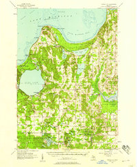
 1958 Traverse City1958 Print · USGSNorthern Lower Michigan was a landscape of vast state forests and burgeoning lakeside retreats in the late fifties. Genealogists and historians can trace the rail corridors of the Ann Arbor RR and find established settlements from Elk Rapids to Houghton Lake.2 unique versions available
 - 1958 Map of Manitowoc
 1958 Manitowoc1958 Print · USGSLake Michigan and its shorelines are shown in the late fifties when maritime transport defined the region. Researchers can trace the routes of the Ann Arbor Railroad Ferry or locate old settlements like St. Nazianz, Rostock, and Two Creeks.
 - 1983 Map of Empire, 1984 Print
 1983 Empire1984 Print · USGSThe Leelanau shoreline comes into focus in the early eighties as the national lakeshore took its modern shape. Researchers can trace local landmarks like Maple Grove Cem and the Radar Station or follow the path of Otter Creek through the dunes.2 unique versions available
 - 1983 Map of Burdickville, 1984 Print
 1983 Burdickville1984 Print · USGSLeelanau County's lake-rich landscape is captured here in the early eighties, centered on the community of Burdickville and the southern shores of Glen Lake. Researchers can trace rural cemeteries like Tobin Cem and Wilson Cem, alongside local landmarks like Glen Lake Sch.3 unique versions available
 - 1983 Map of Glen Haven, 1984 Print
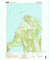
 1983 Glen Haven1984 Print · USGSThe Leelanau coastline comes into focus during the early eighties, showcasing the intersection of the maritime economy and protected parklands. Researchers can trace the layout of Glen Haven and the expansive reach of the Sleeping Bear Dunes National Lakeshore.
 - 1983 Map of Traverse City, 1984 Print
 1983 Traverse City1984 Print · USGSTraverse City and the surrounding bay country are captured in the early eighties as the region balanced its timber heritage with growing conservation. Genealogists and local historians can trace the rail lines of the Ann Arbor RR through settlements like Kingsley and Fife Lake.2 unique versions available
 - 1983 Map of Glen Arbor, 1984 Print
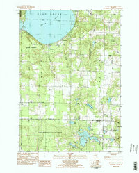
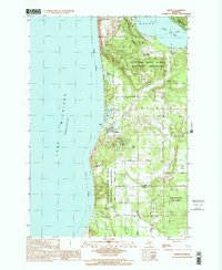
 1983 Glen Arbor1984 Print · USGSThe Leelanau Peninsula in the early eighties shows a landscape preserved by federal protection but still bearing the marks of early pioneer settlement. Trace the history of coastal homesteads at Port Oneida or locate family sites like Kelderhouse Cem and St Joseph Ch.
 - 1983 Map of South Manitou Island, 1984 Print
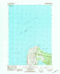
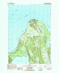
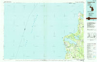
 1983 South Manitou Island1984 Print · USGSSouth Manitou Island is shown here during its transition into a protected national lakeshore in the early eighties. Researchers can locate the S Manitou Cem, the S Manitou Lighthouse, and a recorded Shipwreck along the coast.3 unique versions available
 - 1984 Map of Washington Island, 1985 Print
 1984 Washington Island1985 Print · USGSNorthern Door County and the Manitou Islands are mapped here in the mid-1980s, detailing a maritime landscape of remote archipelagoes. Researchers can trace the layout of Washington or locate Rock Island State Park and the rugged shores of North Manitou Island.2 unique versions available
 - 1984 Map of Crystal Lake, 1985 Print
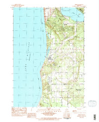
 1984 Crystal Lake1985 Print · USGSCoastal Benzie County in the mid-1980s reveals a landscape shaped by shifting dunes and deep glacial lakes. Researchers can trace the development of lakeside towns like Frankfort and Elberta, or locate landmarks such as the Point Betsie Lighthouse.2 unique versions available
 - 1989 Map of Traverse City, 1990 Print
 1989 Traverse City1990 Print · USGSNorthern Michigan’s lake-country and forest lands are captured in the late eighties as seasonal tourism and timber hubs expanded. Genealogists and historians can trace the routes of the Ann Arbor RR, the boundaries of Camp Grayling, and settlements like Elk Rapids and Manton.
 - 1997 Map of Glen Arbor, 2000 Print
 1997 Glen Arbor2000 Print · USGSThe Leelanau County coast is shown here in the late twentieth century, centered on the protected lands of Sleeping Bear Dunes. Genealogists and local historians can trace family ties at Kelderhouse Cem, explore the historic Port Oneida area, or follow the winding Crystal River.
 - 1998 Map of Empire, 2001 Print
 1998 Empire2001 Print · USGSCoastal Leelanau County is captured here at the close of the millennium, showing the established bounds of the Sleeping Bear Dunes National Lakeshore. Local historians can trace family sites near Maple Grove Cem, the village of Empire, and the high ridges of Shauger Hill.
 - 2011 Map of Empire, 2011 Print
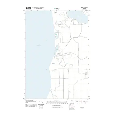 2011 Empire2011 Print · USGSCovers Glen Arbor Township, including Empire, Platte Township, and other nearby areas
 - 2011 Map of Glen Haven, 2011 Print
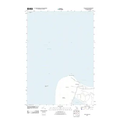 2011 Glen Haven2011 Print · USGSCovers Glen Arbor Township, including Glen Haven, Leelanau County, and other nearby areas
 - 2011 Map of South Manitou Island, 2011 Print
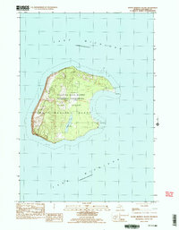
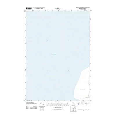 2011 South Manitou Island2011 Print · USGSCovers Glen Arbor Township, including Leelanau County, United States, and other nearby areas
 - 2011 Map of Glen Arbor, 2011 Print
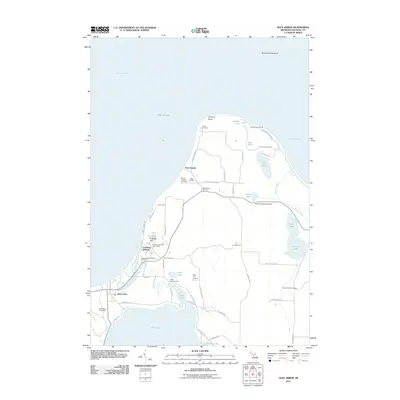 2011 Glen Arbor2011 Print · USGSCovers Glen Arbor Township, including Glen Arbor, Cleveland Township, and other nearby areas
Showing maps 1-25 of 56
Top cities near Glen Arbor Township
- Long Lake Township historical maps
- Empire historical maps
- Glen Arbor historical maps
- Maple City historical maps
Top neighborhoods of Glen Arbor Township
Frequently asked questions
- What are the different types of historical maps available for Glen Arbor Township?
- What is the oldest map of Glen Arbor Township?
- Where can I purchase historical maps of Glen Arbor Township for my home or office?
- Where can I download high-res historical maps of Glen Arbor Township?
- Are there historical topographic maps available for Glen Arbor Township?
- Is there historical aerial imagery available for Glen Arbor Township?
- Where are historical maps of Glen Arbor Township sourced from?