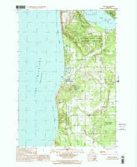
1998 Map of Empire
USGS Topo · Published 2001About this map
Sleeping Bear Dunes National Lakeshore dominates the shoreline of this Leelanau County landscape, where the dramatic elevation of The Sleeping Bear and Old Baldy Dune rise above the Lake Michigan coast. The village of Empire serves as a central hub, flanked by North Bar Lake and South Bar Lake. Further inland, the map captures a rural network of roads like Stormer Road and Valley Road, punctuated by local landmarks including Maple Grove Cem and the First Ch.
Find a feature on this map
43 named features on this map. Tap any name to fly to it.
Don’t see what you’re looking for? This feature index may not catch every label — zoom into the map to look around manually.
Map Details
Editions of this 1998 Empire Map
This is the sole edition of this map. No revisions or reprints were ever made.
Other maps of this area

1954 · Traverse City
USGS Topo · 1:250,000

1954 · Manitowoc
USGS Topo · 1:250,000

1956 · Thompsonville
USGS Topo · 1:62,500

1956 · Frankfort
USGS Topo · 1:62,500

1957 · Empire
USGS Topo · 1:62,500

1957 · Maple City
USGS Topo · 1:62,500

1958 · Traverse City
USGS Topo · 1:250,000

1958 · Manitowoc
USGS Topo · 1:250,000

1976 · Frankfort NW
USGS Topo · 1:24,000

1976 · Thompsonville NW
USGS Topo · 1:24,000