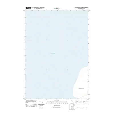
2011 Map of South Manitou Island
USGS Topo · Published 2011About this map
South Manitou Island sits prominently within the expanse of Lake Michigan in this 2011 survey of Leelanau County. The map focuses on the eastern shoreline of the island, where the land meets the deep waters of the lake. This specific edition provides a detailed look at the island's basic infrastructure and road network, identifying inland routes such as Cross Rd and Shefler Rd. These pathways serve as the primary terrestrial links across the southern portion of the island. The contrast between the vast open water and the confined terrestrial features highlights the isolation of this island landscape, which has long been a significant landmark for maritime navigation in the Great Lakes region. The data captured here reflects the modern footprint of the island, documenting its stable geography and the limited development characteristic of its preserved state.
Find a feature on this map
4 named features on this map. Tap any name to fly to it.
Don’t see what you’re looking for? This feature index may not catch every label — zoom into the map to look around manually.
Map Details
Editions of this 2011 South Manitou Island Map
This is the sole edition of this map. No revisions or reprints were ever made.
Other maps of this area

1954 · Escanaba
USGS Topo · 1:250,000

1954 · Manitowoc
USGS Topo · 1:250,000

1956 · North Manitou
USGS Topo · 1:62,500

1957 · Escanaba
USGS Topo · 1:250,000

1957 · Empire
USGS Topo · 1:62,500

1958 · Escanaba
USGS Topo · 1:250,000

1958 · Manitowoc
USGS Topo · 1:250,000
1983 · Glen Haven
USGS Topo · 1:25,000
1983 · South Manitou Island
USGS Topo · 1:24,000

1984 · Washington Island
USGS Topo · 1:100,000