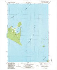
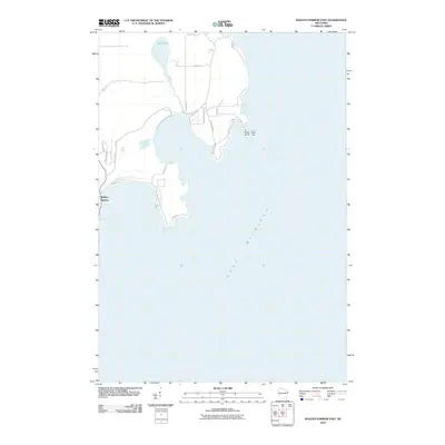
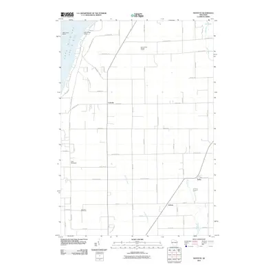
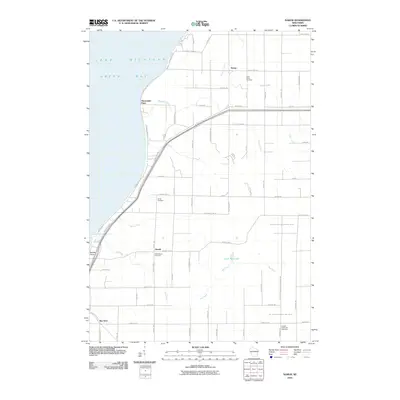
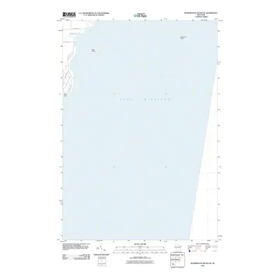
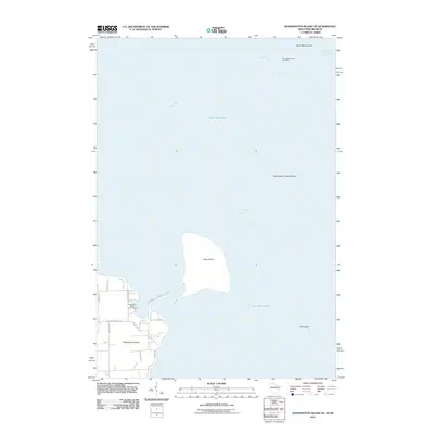
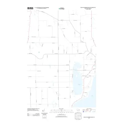
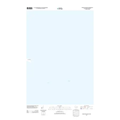
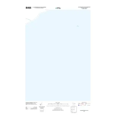
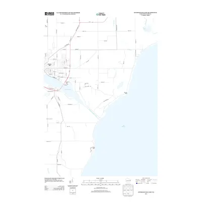
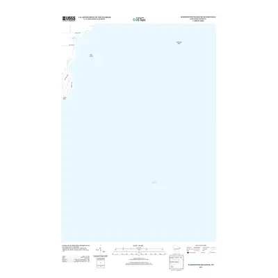
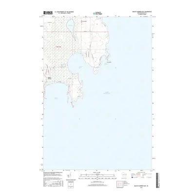
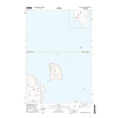
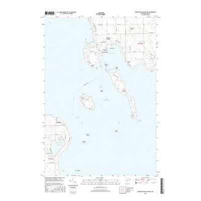
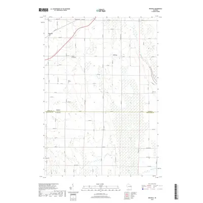
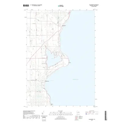
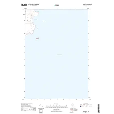
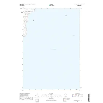
1984 Map of Washington Island
USGS Topo · Published 1985About this map
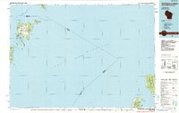
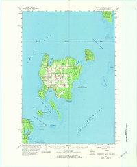
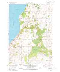
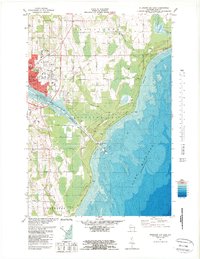
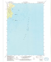
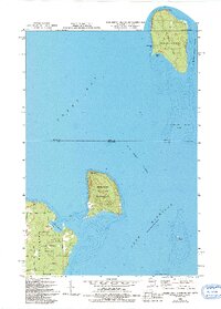
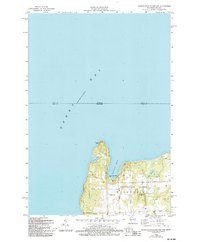
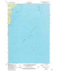
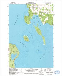
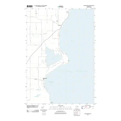
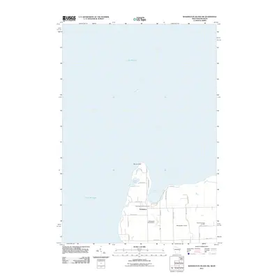
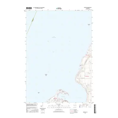
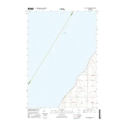
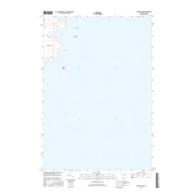
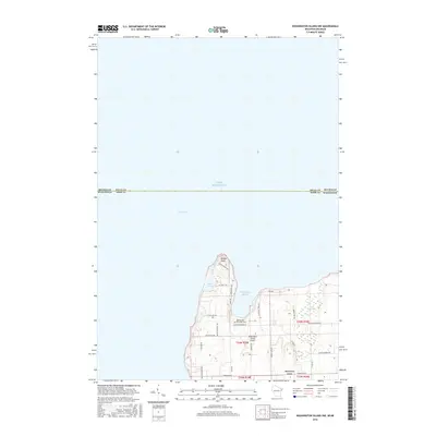
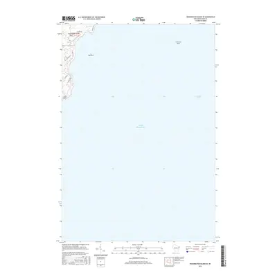
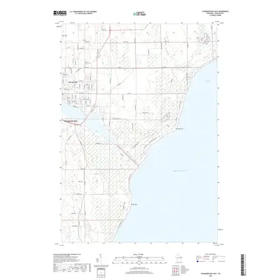
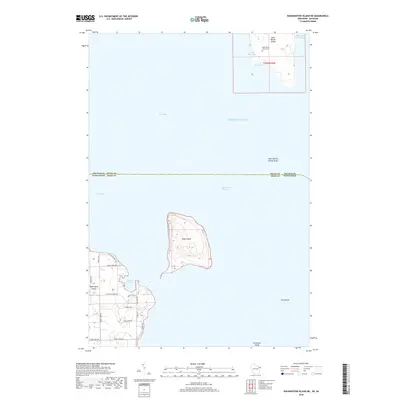
Washington Island dominates this mid-1980s chart of the northern Door County archipelago, where the waters of Green Bay meet Lake Michigan. The settlement of Washington and the Washington Island Landing Field serve as the hub for this maritime community, while the surrounding islands like Detroit Island and Plum Island create the complex channels of the Porte des Morts Passage. To the east across the open lake, the isolated wilderness of North Manitou Island and South Manitou Island appear as part of the Sleeping Bear Dunes National Lakeshore. These islands, including Rock Island State Park, represent a landscape defined by seasonal navigation and the preservation of coastal ecosystems. The map captures the transition from the developed Wisconsin peninsula near Northport to the remote, sand-dune-rimmed shores of the Michigan islands.
Find a feature on this map
52 named features on this map. Tap any name to fly to it.
Don’t see what you’re looking for? This feature index may not catch every label — zoom into the map to look around manually.
Map Details
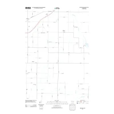
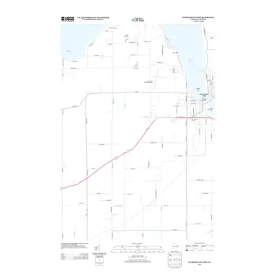
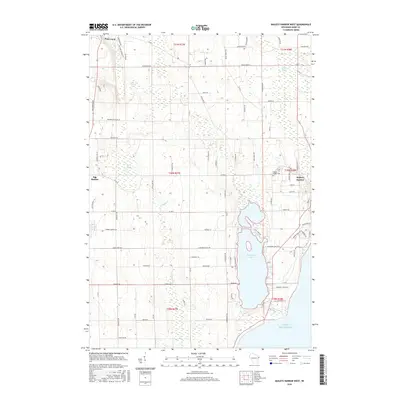
Editions of this 1984 Washington Island Map
2 editions found
Historical Maps of Washington Through Time
123 maps found

1960 Jacksonport
Door County, WI
1960 Washington Island
Door County, WI

1961 Chambers Island
Door County, WI

1978 Brussels
Door County, WI
1978 Namur
Door County, WI

1981 Idlewild
Door County, WI

1981 Institute
Door County, WI
1981 Sturgeon Bay East
Door County, WI

1981 Sturgeon Bay West
Door County, WI

1982 Algoma NE
Door County, WI

1982 Baileys Harbor East
Door County, WI

1982 Baileys Harbor West
Door County, WI
1982 Chambers Island
Door County, WI

1982 Green Island
Door County, WI

1982 Jacksonport
Door County, WI

1982 Jacksonport SW
Door County, WI

1982 Little Sturgeon SW
Door County, WI
1982 Spider Island
Door County, WI
1982 Washington Island NE
Door County, WI
1982 Washington Island NW
Door County, WI
1982 Washington Island SE
Door County, WI
1982 Washington Island SW
Door County, WI
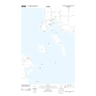
1984 Washington Island
Door County, WI
2010 Algoma NE
Door County, WI
2010 Baileys Harbor East
Door County, WI
2010 Baileys Harbor West
Door County, WI
2010 Brussels
Door County, WI
2010 Idlewild
Door County, WI
2010 Institute
Door County, WI
2010 Jacksonport
Door County, WI
2010 Jacksonport SW
Door County, WI
2010 Little Sturgeon SW
Door County, WI
2010 Namur
Door County, WI
2010 Spider Island
Door County, WI
2010 Sturgeon Bay East
Door County, WI
2010 Sturgeon Bay West
Door County, WI
2010 Washington Island SE
Door County, WI
2010 Washington Island SW
Door County, WI

2011 Chambers Island
Door County, WI
2011 Chambers Island NW
Door County, WI
2011 Green Island
Door County, WI
2011 Washington Island NE
Door County, WI
2011 Washington Island NW
Door County, WI
2013 Algoma NE
Door County, WI
2013 Baileys Harbor East
Door County, WI
2013 Baileys Harbor West
Door County, WI
2013 Brussels
Door County, WI
2013 Chambers Island
Door County, WI
2013 Chambers Island NW
Door County, WI
2013 Green Island
Door County, WI
2013 Idlewild
Door County, WI
2013 Institute
Door County, WI
2013 Jacksonport
Door County, WI
2013 Jacksonport SW
Door County, WI
2013 Little Sturgeon SW
Door County, WI
2013 Namur
Door County, WI
2013 Spider Island
Door County, WI
2013 Sturgeon Bay East
Door County, WI
2013 Sturgeon Bay West
Door County, WI
2013 Washington Island NE
Door County, WI
2013 Washington Island NW
Door County, WI
2013 Washington Island SE
Door County, WI
2013 Washington Island SW
Door County, WI
2015 Algoma NE
Door County, WI
2015 Brussels
Door County, WI
2015 Idlewild
Door County, WI
2015 Institute
Door County, WI
2015 Jacksonport
Door County, WI
2015 Jacksonport SW
Door County, WI
2015 Little Sturgeon SW
Door County, WI
2015 Namur
Door County, WI
2015 Sturgeon Bay East
Door County, WI
2015 Sturgeon Bay West
Door County, WI
2016 Baileys Harbor East
Door County, WI
2016 Baileys Harbor West
Door County, WI

2016 Chambers Island
Door County, WI
2016 Chambers Island NW
Door County, WI
2016 Green Island
Door County, WI
2016 Spider Island
Door County, WI
2016 Washington Island NE
Door County, WI
2016 Washington Island NW
Door County, WI
2016 Washington Island SE
Door County, WI
2016 Washington Island SW
Door County, WI
2018 Algoma NE
Door County, WI
2018 Baileys Harbor East
Door County, WI
2018 Baileys Harbor West
Door County, WI
2018 Brussels
Door County, WI

2018 Chambers Island
Door County, WI
2018 Chambers Island NW
Door County, WI
2018 Green Island
Door County, WI

2018 Idlewild
Door County, WI
2018 Institute
Door County, WI
2018 Jacksonport
Door County, WI
2018 Jacksonport SW
Door County, WI
2018 Little Sturgeon SW
Door County, WI
2018 Namur
Door County, WI
2018 Spider Island
Door County, WI
2018 Sturgeon Bay East
Door County, WI
2018 Sturgeon Bay West
Door County, WI
2018 Washington Island NE
Door County, WI

2018 Washington Island NW
Door County, WI
2018 Washington Island SE
Door County, WI

2018 Washington Island SW
Door County, WI

2022 Algoma NE
Door County, WI

2022 Baileys Harbor East
Door County, WI

2022 Baileys Harbor West
Door County, WI

2022 Brussels
Door County, WI

2022 Chambers Island
Door County, WI

2022 Chambers Island NW
Door County, WI

2022 Green Island
Door County, WI

2022 Idlewild
Door County, WI

2022 Institute
Door County, WI

2022 Jacksonport
Door County, WI

2022 Jacksonport SW
Door County, WI

2022 Little Sturgeon SW
Door County, WI

2022 Namur
Door County, WI
2022 Spider Island
Door County, WI

2022 Sturgeon Bay East
Door County, WI

2022 Sturgeon Bay West
Door County, WI

2022 Washington Island NE
Door County, WI

2022 Washington Island NW
Door County, WI

2022 Washington Island SE
Door County, WI

2022 Washington Island SW
Door County, WI
Featured Locations
- Fairbanks Township, MI
- Glen Arbor Township, MI
- Leland Township, MI
- Washington, WI
- Northport, Liberty Grove