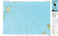
1984 Map of Washington Island
USGS Topo · Published 1991About this map
Washington Island and its surrounding archipelago anchor the northern reaches of the Door Peninsula in this mid-1980s look at the waters where Green Bay meets Lake Michigan. The map details the intricate maritime geography of the region, from the treacherous Porte des Morts Passage to the sheltered waters of Detroit Harbor. On the island itself, settlement patterns are visible near the Washington Island Landing Field and the inland waters of Coffee Swamp. Across the open lake to the southeast, the remote wilderness of North Manitou Island and South Manitou Island appears as part of the Sleeping Bear Dunes National Lakeshore. These islands, along with protected areas like Rock Island State Park, represent a landscape defined by seasonal isolation and a long history of Great Lakes navigation, marked by numerous lights and lookouts guarding the shipping lanes.
Find a feature on this map
54 named features on this map. Tap any name to fly to it.
Don’t see what you’re looking for? This feature index may not catch every label — zoom into the map to look around manually.
Map Details
Editions of this 1984 Washington Island Map
2 editions found

Other maps of this area

1932 · Burnt Bluff SW
USGS Topo · 1:31,680

1954 · Traverse City
USGS Topo · 1:250,000

1954 · Escanaba
USGS Topo · 1:250,000

1954 · Manitowoc
USGS Topo · 1:250,000

1955 · Gull Island
USGS Topo · 1:62,500

1955 · Cheboygan
USGS Topo · 1:250,000

1956 · North Manitou
USGS Topo · 1:62,500

1956 · South Fox Island
USGS Topo · 1:62,500

1957 · Escanaba
USGS Topo · 1:250,000

1957 · Empire
USGS Topo · 1:62,500